


Altitude and Weather Tracker


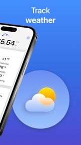
Altitude and Weather Tracker is a GPS-based utility for hikers and travelers that provides real-time elevation data and visual landmark comparisons on iOS.
The App DNA
What makes this app unique?
The app removes the cognitive friction of interpreting raw altitude numbers by mapping them to familiar physical landmarks, serving users who document their outdoor adventures.
For Outdoor enthusiasts, hikers, and travelers requiring basic altitude tracking and visual documentation of their location.
What does it look like?
Key features
Real-time altitude data acquisition using device GPS hardware
Calculates relative height against known landmarks like Mount Everest or the Eiffel Tower
Captures images with an embedded altitude overlay directly within the app interface
How much does it cost?
The app is currently offered as a free utility with no visible subscription or IAP gates.
Velocity
Dormant developmentperformanceShow more...
With only one release in the observed window and no updates for 289 days, the app has entered a state of inactivity. The development momentum is effectively non-existent, as the last update occurred over nine months ago. There is no evidence of ongoing maintenance or feature development, categorizing the app as a zombie project.
Who built it?
Aliaksei Buyasau
2 apps tracked · Travel
 Pro Block – Safari Ad Blocker
User Sentiment
What do users think recently?
How are ratings & reviews evolving?
Not enough recent reviews to extract reliable themes yet.
Read the full review analysisCompetition
Competitive landscape for Altitude and Weather Tracker
How's the Travel market?
Altitude and Weather Tracker operates as a free utility in the Travel category, currently lacking the monetization or update cadence seen in active competitors.
Read the market outlookThe rivals identified
Unlock the deeper market read.
Access the full report for freeThe Analyst's Read
Key takeaways for Altitude and Weather Tracker
Where is it heading?
The travel utility market is consolidating around apps with high-frequency updates and social integration, leaving static tools like Altitude and Weather Tracker exposed. Without a clear roadmap or recent development activity, the app faces a high risk of being displaced by native OS features.
- The nine-month update silence indicates a lack of active development, which erodes user trust and risks incompatibility with future iOS updates.
- The absence of a monetization model or recent feature expansion suggests the product is in a sunset phase rather than a growth trajectory.
The SWOT
- Landmark comparison mechanism provides a unique visual hook for casual documentation
- Integrating social sharing APIs for altitude-stamped photos could drive organic acquisition
Next best moves
Audit codebase stability because the app has been dormant for nine months → determine if the project is viable for a feature-led pivot
The counter-intuitive read
The lack of monetization is not a weakness but a survival strategy…
Read the full takeSince the last report: The app's outlook has transitioned from mixed to declining, as the extended development silence is now categorized as a sunset phase rather than a maintenance-only state. This shift is compounded by the emergence of platform-native altimeter tools as a direct threat to the app's core utility.
Bottom line
Altitude and Weather Tracker relies on a niche visual comparison mechanism, but the lack of development cadence since late 2025 leaves the product vulnerable to platform-native feature expansion; the PM should prioritize a stability audit to determine if the codebase remains viable.
Unlock 1 critical friction, 1 market threat and the analyst’s take.
Access the full report for freeFAQ
Is Altitude and Weather Tracker free to use?
Does Altitude and Weather Tracker work without internet?
What makes Altitude and Weather Tracker different from other altitude apps?
Sources
- [1] App Store
Report last updated