


Altitude : My Elevation & GPS
By Tech Atlas


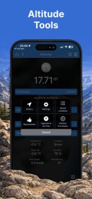

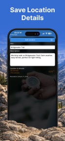

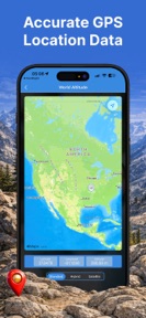

Altitude : My Elevation & GPS is a travel utility for hikers and cyclists that provides offline-capable altitude tracking via GPS and barometer sensors on iOS.
The App DNA
What makes this app unique?
The app removes the dependency on cellular data for elevation tracking, allowing users to maintain accurate altitude records in remote environments where connectivity is unreliable.
For Outdoor enthusiasts including hikers and road cyclists who require altitude tracking and offline sensor data.
What does it look like?
Key features
Combines GPS, barometer, and online elevation maps to determine altitude readings.
Enables GPS and barometer-based altitude tracking without internet connectivity.
Applies altitude, location, and sensor data as visual layers on captured images.
How much does it cost?
The app is currently offered as a free utility with no visible subscription or IAP gates.
Velocity
Dormant developmentopaqueShow more...
Altitude : My Elevation & GPS has entered a zombie state, with no updates or feature releases in the last 230 days. The development momentum has effectively ceased, as the app has not seen a new build in over seven months. Given the lack of activity, there is no evidence of ongoing maintenance or support for the platform.
Who built it?
Tech Atlas
5 apps tracked · Travel
 Prayers Times - Qibla & Quran
 prayer times - اتجاه القبلة
 Loop Habit Tracker - Streaks
 Prayer time | مواقيت الصلاة
User Sentiment
What do users think recently?
How are ratings & reviews evolving?
Not enough recent reviews to extract reliable themes yet.
Read the full review analysisCompetition
Competitive landscape for Altitude : My Elevation & GPS
How's the Travel market?
Altitude : My Elevation & GPS occupies a niche in the Travel category as a specialized sensor-utility, maintaining a 4.75 rating across its initial user base.
Read the market outlookThe rivals identified
Unlock the deeper market read.
Access the full report for freeThe Analyst's Read
Key takeaways for Altitude : My Elevation & GPS
Where is it heading?
The outdoor utility market is consolidating around apps that offer integrated trail-mapping and social sharing, which creates a risk for Altitude : My Elevation & GPS as a standalone sensor tool. Without a return to active feature development, the app will likely remain a static utility, vulnerable to rivals that offer more comprehensive outdoor ecosystems.
- The 230-day update gap indicates a maintenance-only posture, which limits the ability to respond to emerging competitor features.
The SWOT
- Offline-first sensor integration provides a functional barrier against cloud-dependent rivals in remote terrain
- Localized UI or trail-specific data overlays could capture the segment currently using general-purpose GPS tools
Next best moves
Audit sensor-calibration logic because the seven-month update gap risks user trust in data accuracy → maintain rating baseline
The counter-intuitive read
The app's lack of monetization is its primary competitive advantage…
Read the full takeSince the last report: Development remains in a maintenance-only state, with no functional updates or shifts in the core product. The primary change is a refinement of the competitive narrative and SWOT analysis to emphasize the app's niche as a standalone sensor utility rather than a general-purpose navigation tool.
Bottom line
Altitude : My Elevation & GPS relies on its offline sensor-fusion mechanism to retain its niche user base, but the seven-month development gap risks ceding ground to more active competitors.
Unlock 1 critical friction, 1 market threat and the analyst’s take.
Access the full report for freeFAQ
Does Altitude : My Elevation & GPS work without an internet connection?
Is there a paid version of this app?
What sensors does the app use for altitude?
Sources
- [1] App Store
- [2] Developer website, source
Report last updated