




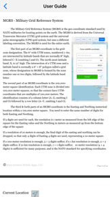

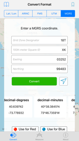


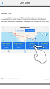
GPS Coordinate Converter is a navigation utility designed for converting between multiple geographic coordinate formats, including UTM, MGRS, and ARINC 424. It provides distance and bearing measurements using geodesic calculations and includes an offline database of aviation-specific navigation aids like airports and VORs.
Overview · Full Intel report in progress
The App DNA
What makes this app unique?
For Aviation professionals and field navigators requiring precise coordinate conversion and distance measurement tools.
What does it look like?
Key features
Supports conversion between decimal degrees, degrees-minutes-seconds, UTM, MGRS, ARINC 424, and FMS formats.
Calculates distance and bearing between two points on a map, accounting for Earth's curvature, with results in multiple unit types.
Includes an onboard database for locating airports, heliports, and radio navigation aids such as VORs.
Displays time zone and postal address information for coordinates when an internet connection is active.
How much does it cost?
Velocity
Intense developmentShow more...
5 versions in history. Development pace: intense.
Who built it?
Aviation Mobile Apps
7 apps tracked · Navigation
 METARs Aviation Weather
 FAR AIM
 E6B Aviation Calculator
 Holding Pattern Computer
 Nautical Calculator
 Time Calculator For Pilots
User Sentiment
What do users think recently?
How are ratings & reviews evolving?
Not enough recent reviews to extract reliable themes yet.
Read the full review analysisCompetition
Competitive landscape for GPS Coordinate Converter
How's the Navigation market?
The rivals identified
The Analyst's Read
Key takeaways for GPS Coordinate Converter
Where is it heading?
Bottom line
This is a specialized navigation tool that combines multi-format coordinate conversion with an aviation-focused reference database.
Report last updated