




Hunting Points is a navigation and scouting tool designed for hunters and outdoorsmen to track locations and analyze terrain. It distinguishes itself by integrating parcel data, including property lines and landowner information, alongside essential field navigation tools.
Overview · Full Intel report in progress
The App DNA
What makes this app unique?
For Hunters, outdoorsmen, and land professionals requiring precise GPS tracking and property boundary identification.
What does it look like?
Key features
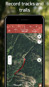
Allows users to record tracks, trails, and mark specific points like tree stands or trail camera zones.
Provides access to US land boundaries, including private and public property lines with associated landowner information.
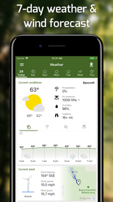
Delivers 7-day detailed weather forecasts, including hourly temperature, precipitation, wind, and pressure changes.
Enables users to download map areas for offline use to maintain orientation and GPS accuracy in remote locations.
How much does it cost?
Velocity
Steady developmentShow more...
5 versions in history. Development pace: steady.
Who built it?
Fishing Points d.o.o.
4 apps tracked · Navigation
 Fishing Points: Map & Forecast
 Hunting Points: GPS Hunt Map
 Fishing Points - Fishing App
User Sentiment
What do users think recently?
How are ratings & reviews evolving?
Not enough recent reviews to extract reliable themes yet.
Read the full review analysisCompetition
Competitive landscape for Hunting Points: GPS & Hunt App
How's the Navigation market?
The rivals identified
The Analyst's Read
Key takeaways for Hunting Points: GPS & Hunt App
Where is it heading?
Bottom line
This app serves as a comprehensive field utility that combines precise GPS navigation with critical land ownership data for hunters and rural professionals.
Report last updated