


Cuspart: Altimeter is a navigation utility for hikers and outdoor adventurers that provides offline-capable altitude, weather, and GPS tracking on Android and iOS.
The App DNA
What makes this app unique?
The app removes the need for multiple single-purpose tools by consolidating environmental sensors and navigation into one interface, serving users who prioritize offline reliability during remote excursions.
For Outdoor enthusiasts including hikers, skiers, and mountain bikers who require precise elevation and environmental data.
Key features
Calculates elevation using GPS, barometric pressure, or network location services.
Triggers SMS with coordinates and activates flashlight/siren.
Embeds location and altitude data into images.
How much does it cost?
The freemium model monetizes via ad-inventory on the free tier and a paid-gate for advanced data management.
Velocity
Maintenance developmentUX improvementsinternationalizationmonetizationShow more...
The development cadence is currently in the maintenance tier, with only two releases recorded over the last 12 months. The latest release occurred on April 22, 2026, following a significant gap since the previous update in August 2025. Development is focused on functional improvements and platform-specific bug fixes rather than a regular feature release cycle. There is no evidence of live-ops activity or a high-frequency update schedule.
Who built it?
Mustafa Tolga DALBUDAK
13+ apps tracked · Navigation
 Cuspart: Acil
 Rehber: Antik Kentler, Müzeler
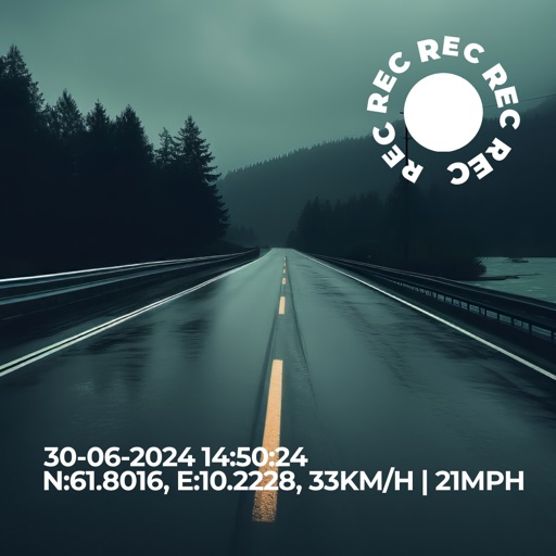 Cuspart: Dash Cam
 Cuspart: GPS
 Cuspart: Earthquake
 Cuspart: Ez Tabuu+
 Cuspart: Soru Cevap+
 Cuspart: Altimeter+
 Percent Calculator App
 Cuspart: Calculator
 Cuspart: Soru Cevap
 Cuspart: Blood Sugar
User Sentiment
What do users think recently?
Recent user voice shows an excited sentiment. Users appreciate high precision sensors provide reliable altitude and location data even when offline or without cellular signal and simple interface design allows users to access core navigation tools without navigating complex or cluttered menus, but report intrusive full-screen advertisements block critical navigation data and force users to restart the application.
How are ratings & reviews evolving?
What users say, by theme
- High precision sensors provide reliable altitude and location data even when offline or without cellular signal
- Simple interface design allows users to access core navigation tools without navigating complex or cluttered menus
- Integrated camera functionality allows users to capture photos with embedded location and altitude data overlays
- Intrusive full-screen advertisements block critical navigation data and force users to restart the application
50 of 50 recent reviews analyzed · high confidence · Excited overall
Read the full review analysisUnlock 2 more frustration themes and 1 user request, each backed by review evidence.
Access the full report for freeCompetition
Competitive landscape for Cuspart: Altimeter
How's the Navigation market?
Cuspart holds a 4.46 rating on Android, reflecting strong sensor reliability. The recent entry into the #92 Grossing category rank signals potential for monetization if the ad-friction is resolved.
Read the market outlookThe rivals identified
Unlock the deeper market read.
Access the full report for freeThe Analyst's Read
Key takeaways for Cuspart: Altimeter
Where is it heading?
Users report: The outdoor navigation market is shifting toward privacy-centric and utility-focused tools, leaving ad-heavy apps vulnerable to churn. Cuspart's recent move to offer a premium trial is a necessary step to stabilize retention, but the underlying trust issues from deceptive notifications must be addressed to prevent long-term user attrition.
- The latest release introduced a 7-day premium trial, providing a clear path to ad-free usage that addresses top user requests.
- Users report: Aggressive promotional notifications and deceptive alerts continue to degrade user trust, which compounds the churn pressure from intrusive ad placements.
The SWOT
- Offline-first sensor architecture ensures utility in remote environments
- Emergency SOS suite establishes category authority for serious mountaineers
- Localized premium pricing could convert users frustrated by current ad-heavy experience
Next best moves
Deprecate full-screen interstitial ads during navigation sessions because they force app restarts and drive churn → improve session retention.
+ 1 more prioritized moveThe counter-intuitive read
The app's reliance on aggressive ad-monetization is a…
Read the full takeFeature gaps
Global datum support for professional surveyors (available in Tomstrails GPS UTM but absent here) +1
Since the last report: The app is undergoing a transition from an ad-heavy, maintenance-mode utility to a more focused navigation tool, driven by user demand for ad-free experiences and professional-grade features like negative altitude tracking.
Bottom line
Transitioning from intrusive ad-monetization to a value-based premium model would resolve the primary churn driver identified in reviews. Prioritizing core navigation stability over disruptive promotional alerts will protect the app's reputation for precision, which is its primary retention anchor.
Unlock 3 critical frictions, 1 market threat, 1 more prioritized move and the analyst’s take.
Access the full report for freeFAQ
Is Cuspart: Altimeter accurate without an internet connection?
Does Cuspart: Altimeter have intrusive advertisements?
How does Cuspart compare to other hiking apps?
What is a good alternative for professional surveying?
Sources
Report last updated