


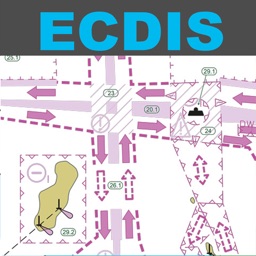
ELECTRONIC NAUTICAL CHART SYMBOLS & ABBREVIATIONS
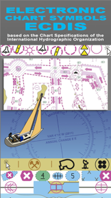
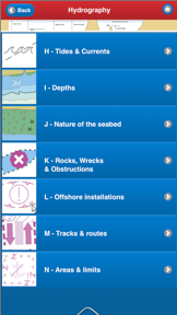

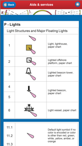

Electronic Nautical Chart Symbols & Abbreviations is a mobile reference guide for IHO-specified INT 1 symbols used in ECDIS navigation. It provides a structured, offline-accessible library of maritime symbols, including high-resolution graphics and a searchable index for quick identification.
Overview · Full Intel report in progress
The App DNA
What makes this app unique?
For Maritime professionals, students, and recreational sailors requiring quick access to standardized nautical chart symbology.
What does it look like?
Key features
Provides a comprehensive catalog of symbols and abbreviations as specified by the International Hydrographic Organization.
Includes hi-res graphics with a Tap & Enlarge feature to ensure clarity of complex chart symbols.
Features a fully searchable database organized into five main categories, including General, Topography, and Hydrography.
Designed for mobile use without requiring an active internet connection.
How much does it cost?
Velocity
Who built it?
The Other Hat
13+ apps tracked · Navigation
 U.S. Inland Navigational Rules
 NAUTICAL CHART SYMBOLS & ABBREVIATIONS
 Boating First Aid at Sea
 Safe Skipper - tips and advice
 ColRegs: Nav Lights & Shapes
 ColRegs: Rules of the Road
 IALA Buoyage & Lights
 VHF DSC Radio
 Knot Bible - the 50 best boating knots
 Start Sailing: Yachts
 International Certificate of Competence (ICC)
 Sunsail Sailing School
User Sentiment
What do users think recently?
How are ratings & reviews evolving?
Not enough recent reviews to extract reliable themes yet.
Read the full review analysisCompetition
Competitive landscape for ELECTRONIC NAUTICAL CHART SYMBOLS & ABBREVIATIONS
How's the Navigation market?
The rivals identified

By Oguz Uncu
Both apps target the maritime professional and recreational sailor demographic, competing for limited screen time and utility during nautical operations.
- AnchorSafe provides real-time AIS vessel tracking and remote drift alerts, while the source app focuses on static reference material.
- AnchorSafe operates as a free, sensor-driven monitoring tool, whereas the source app is a paid, offline-only reference library.

Unlock the head-to-head verdict: where this rival wins, and where it loses.
Access the full report for freeThe Analyst's Read
Key takeaways for ELECTRONIC NAUTICAL CHART SYMBOLS & ABBREVIATIONS
Where is it heading?
Bottom line
This app serves as a specialized, offline-capable digital field guide for interpreting standardized electronic nautical chart symbols.
Report last updated