




GPS Area Calculator for Land is a utility app for digital land, area, and distance measurement on iOS.
The App DNA
What makes this app unique?
Users hire this app to perform precise land surveying tasks via map-based coordinate inputs, replacing manual paper-based calculations.
For Land surveyors, property managers, and individuals requiring precise digital land measurement tools.
What does it look like?
Key features
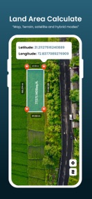
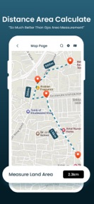
Calculates land area, distance, and length using map-based manual input.
Allows manual entry of coordinates or degrees to define land boundaries.
Saves and organizes measurements into custom groups for future retrieval.
How much does it cost?
Subscription model anchored at $49.99/year, utilizing usage caps to drive conversion to premium.
Velocity
Dormant developmentopaqueShow more...
GPS Area Calculator for Land has been inactive for over 495 days, placing it firmly in the zombie category. The only recorded update in the provided history was a minor bug fix, and there has been no development activity or feature iteration since early 2025. The lack of updates over this extended period indicates that the app is no longer receiving active maintenance or support.
Who built it?
E-PEPPLO ENTERPRISE
5 apps tracked · Utilities
 AI Noise Reducer Audio Enhance
 LED Light Controller Smart LED
 Live Earth Camera Street View
 Smart Printer: Printer App
User Sentiment
What do users think recently?
How are ratings & reviews evolving?
Not enough recent reviews to extract reliable themes yet.
Read the full review analysisCompetition
Competitive landscape for GPS Area Calculator for Land
How's the Utilities market?
The app operates in the Utilities category with a premium-focused subscription model. The 16-month update gap suggests a static market position that risks losing share to more frequently updated competitors.
Read the market outlookThe rivals identified
Unlock the deeper market read.
Access the full report for freeThe Analyst's Read
Key takeaways for GPS Area Calculator for Land
Where is it heading?
The market for digital land measurement is consolidating around tools that offer frequent feature updates, leaving this app exposed to churn. The lack of recent development suggests the current revenue strategy relies on legacy traffic rather than active growth, which will compress the user base as competitors iterate on UX and pricing.
- The 16-month update silence suggests the app is in maintenance mode, which will likely accelerate churn as competitors iterate on measurement accuracy.
The SWOT
- Coordinate-based input mechanism provides professional-grade precision for land boundary definition
- Integration of wearable-based GPS tracking could differentiate the tool for field-based surveyors
Next best moves
Audit competitor pricing because the $49.99/year tier exceeds category norms → reduce churn risk
+ 1 more prioritized moveThe counter-intuitive read
The app's 16-month maintenance-mode status is a greater…
Read the full takeSince the last report: The product remains in maintenance mode with no feature updates, but the intelligence focus has shifted to address the high annual subscription price as a primary driver of churn.
Bottom line
The app offers specialized coordinate-based measurement tools, but the 16-month update gap and high annual price signal a lack of competitive urgency, so the PM should prioritize a feature-parity audit against active rivals to justify the premium tier.
Unlock 2 critical frictions, 1 market threat, 1 more prioritized move and the analyst’s take.
Access the full report for freeSources
- [1] App Store, source
Report last updated