


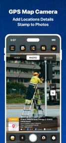
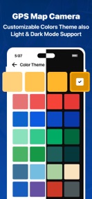
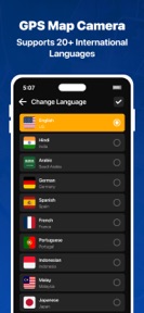


GPS Map Camera - Geotag Photo is a camera utility for iOS that embeds real-time location, date, and coordinate metadata onto photos and videos.
The App DNA
What makes this app unique?
The app removes the manual friction of tracking photo locations for travelers and field workers by automating the metadata capture process at the moment of shooting.
For Travelers, real estate professionals, and field workers who require precise location and time metadata for photo documentation.
What does it look like?
Key features
Automatically overlays real-time address, latitude, longitude, and altitude onto photos and videos.
Embeds interactive map views including satellite, terrain, and hybrid modes directly onto images.
Specialized camera setting for continuous recording with location metadata.
How much does it cost?
The app is currently offered as a free service, with the developer reserving the right to introduce charges for services in future updates.
Velocity
Maintenance developmentopaqueperformanceShow more...
The app has shipped only one release in the last 136 days, indicating a maintenance-level development cadence. The latest release provided no specific feature information, relying on generic language regarding general improvements. There is no evidence of active feature development or live operations, and the current release frequency suggests a lack of ongoing investment in new functionality.
Who built it?
Sejalben Nimeshkumar Savaliya
3 apps tracked · Photo & Video
 WAM - Recover Deleted Messages
 Auto Clicker - Automatic Taps
User Sentiment
What do users think recently?
How are ratings & reviews evolving?
Not enough recent reviews to extract reliable themes yet.
Read the full review analysisCompetition
Competitive landscape for GPS Map Camera - Geotag Photo
How's the Photo & Video market?
GPS Map Camera - Geotag Photo serves the photo utility segment with a focus on metadata precision. The free-to-use model positions it as an accessible tool for field workers, though the lack of recent feature updates limits its competitive standing against more active rivals.
Read the market outlookThe rivals identified
Unlock the deeper market read.
Access the full report for freeThe Analyst's Read
Key takeaways for GPS Map Camera - Geotag Photo
Where is it heading?
The photo utility market is consolidating around apps that offer integrated cloud-sync and professional-grade documentation workflows. GPS Map Camera - Geotag Photo remains in a maintenance state, which leaves it exposed to rivals that ship frequent updates and premium tiers, potentially leading to a decline in market share over the next two quarters.
- The four-month gap in feature releases indicates a shift to maintenance mode, which reduces the app's ability to compete for new users.
- The current free-only pricing model provides no recurring revenue, which limits the developer's capacity to respond to market changes or rival feature sets.
The SWOT
- Real-time metadata stamping provides immediate verification for field documentation
- Dashcam mode targets specific professional use cases like real estate
- Live map overlay acts as a visual hook for social sharing
- Introducing a subscription tier for high-volume professional users could fund active development
- Developing a cloud-sync integration would address primary data-management friction
Next best moves
Ship cloud-sync integration because it is the primary friction point for professional field documentation → increase long-term retention
+ 1 more prioritized moveThe counter-intuitive read
The app's current maintenance-only state is a strategic…
Read the full takeBottom line
GPS Map Camera - Geotag Photo provides essential location-stamping utilities, but the lack of active development risks obsolescence against more agile competitors. Prioritizing a cloud-sync feature would secure the professional user base and unlock a clear path for premium monetization.
Unlock 3 critical frictions, 2 market threats, 1 more prioritized move and the analyst’s take.
Access the full report for freeFAQ
Is GPS Map Camera - Geotag Photo free to use?
Does GPS Map Camera - Geotag Photo support cloud storage for photos?
Who is GPS Map Camera - Geotag Photo best suited for?
Sources
- [1] App Store, source
Report last updated