


Wasatch Backcountry Skiing Map
By Iterum
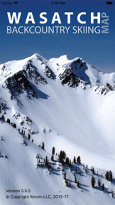


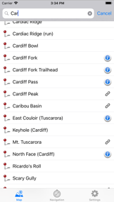
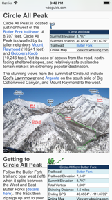
The Wasatch Backcountry Skiing Map is a navigation tool for iOS that provides high-resolution topographic maps of Utah’s Central Wasatch mountains. It integrates GPS location tracking with a database of over 1,000 backcountry locations and links to detailed online guide information.
Overview · Full Intel report in progress
The App DNA
What makes this app unique?
For Backcountry skiers, hikers, and outdoor travelers navigating the Central Wasatch mountain range.
What does it look like?
Key features
Displays the user's real-time location on high-resolution topo maps using device GPS.
Features an integrated compass with a destination arrow to guide users toward specific backcountry ski locations.
Provides one-tap access to the Wasatch Backcountry Skiing Guide website for photographs and detailed location data.
Displays current elevation and coordinates, with the ability to share location data via email.
How much does it cost?
Velocity
Dormant developmentShow more...
5 versions in history. Development pace: zombie.
Who built it?


User Sentiment
What do users think recently?
How are ratings & reviews evolving?
Not enough recent reviews to extract reliable themes yet.
Read the full review analysisCompetition
Competitive landscape for Wasatch Backcountry Skiing Map
How's the Navigation market?
The rivals identified
The Analyst's Read
Key takeaways for Wasatch Backcountry Skiing Map
Where is it heading?
Bottom line
While the app offers a specialized database for Wasatch navigation, user feedback highlights a need for modern UI updates and expanded geographic coverage.
Report last updated