


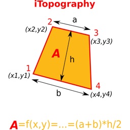


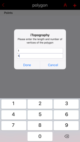

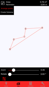

iTopography is a mobile utility for calculating polygon areas and perimeters for civil engineers and DIY builders on iOS.
The App DNA
What makes this app unique?
The app removes the need for specialized surveying hardware by approximating surface areas via GPS or manual coordinate entry.
For Civil engineers, topographers, students, and DIY builders requiring basic land measurement and coordinate mapping tools.
What does it look like?
Key features
Computes area and perimeter for polygons with up to 5 vertices using GPS or manual coordinate entry.
Reads and writes DXF files to exchange project data with CAD software, enabling professional workflows.
Supports creation and storage of an infinite number of projects with cloning and renaming capabilities.
How much does it cost?
The app is distributed as a free utility without visible subscription or IAP gates, limiting its commercial sustainability.
Velocity
Dormant developmentUX improvementsShow more...
The app has reached a state of inactivity, with no new feature builds or updates released in the last 539 days. Development has effectively ceased, as the last recorded update occurred over 18 months ago. There is no evidence of ongoing maintenance or operational support for the platform.
Who built it?
i-SmartSolutions
6 apps tracked · Utilities
 iTavli-Best backgammon game
 iTavli-All Backgammon games
 iPinPoint - Measurement tool
 Card Games: Solitaire and more
 Rainbow-Best cloud storage app
User Sentiment
What do users think recently?
Fresh user feedback skews upset. Users appreciate calculating the area of specific sub-regions provides utility for users managing land measurements.
How are ratings & reviews evolving?
What users say, by theme
- Calculating the area of specific sub-regions provides utility for users managing land measurements
- Inaccurate area calculations lead to significant discrepancies between reported results and actual field measurements
6 of 6 recent reviews analyzed · limited sample · Upset overall
Read the full review analysisUnlock 2 more frustration themes, each backed by review evidence.
Access the full report for freeCompetition
Competitive landscape for iTopography - Area Calculator
How's the Utilities market?
iTopography occupies a niche in the Utilities category for basic land measurement, but the 18-month update gap and lack of monetization prevent it from competing with professional-grade GIS tools.
Read the market outlookThe rivals identified
Unlock the deeper market read.
Access the full report for freeThe Analyst's Read
Key takeaways for iTopography - Area Calculator
Where is it heading?
The land-measurement utility market is consolidating around tools with active update cadences and professional-grade accuracy. iTopography's current maintenance-only posture leaves it exposed to churn, as users migrate to competitors that provide reliable, updated mapping features.
- The 18-month release gap indicates a maintenance-only posture, which prevents the app from addressing core calculation errors.
- Persistent reports of inaccurate acreage calculations drive user churn, as the primary utility fails to deliver reliable data for field projects.
The SWOT
- DXF file compatibility enables integration into professional CAD workflows
- Localized pricing or a Pro tier could fund the maintenance required to fix core mapping regressions
Next best moves
Audit core calculation logic because users report large errors in acreage results -> restore basic utility.
+ 1 more prioritized moveThe counter-intuitive read
The lack of monetization is the primary threat to iTopography…
Read the full takeSince the last report: The report shifts from a maintenance-focused outlook to a sunset-phase assessment, driven by the 18-month update drought and persistent functional failures. The competitive positioning now explicitly highlights the displacement risk from professional GIS alternatives.
Bottom line
The lack of updates for over 500 days suggests iTopography is in a sunset phase, as the core calculation errors remain unaddressed. The PM should prioritize a pivot to a paid maintenance model or sunset the project to avoid further brand erosion.
Unlock 2 critical frictions, 1 market threat, 1 more prioritized move and the analyst’s take.
Access the full report for freeFAQ
Is iTopography suitable for professional land surveying?
How does iTopography compare to professional GIS apps?
Does iTopography work offline for field mapping?
What are some free alternatives for land area calculation?
Sources
Report last updated