


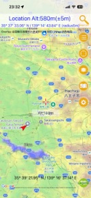
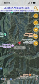

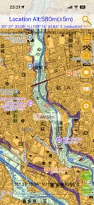

国土マップR is a navigation tool for iOS that provides offline access to over 160 types of GSI topographic maps for hikers and outdoor enthusiasts.
The App DNA
What makes this app unique?
Users hire this app to access specialized, high-fidelity topographic data in remote areas without cellular signal, serving a job-to-be-done in remote navigation and disaster preparedness.
For Mountaineers, hikers, and outdoor enthusiasts who require offline navigation tools and topographic map data.
What does it look like?
Key features
Saves up to 200 MB of map tiles for offline use.
Overlays base maps, aerial photos, and Google Maps with transparency control.
Records movement paths and supports external log imports.
How much does it cost?
Currently free-to-use with ad-supported inventory, with a clear roadmap for a paid-gate to remove ads.
Velocity
Maintenance developmentinternationalizationUX improvementsShow more...
The app ships at a maintenance cadence of approximately 0.17 releases per week, with only one version released in the last 42 days. Development is currently focused on internationalization and UX improvements, specifically enhancing map display and search functionality. There is no evidence of a live-ops strategy or frequent feature iteration. Future updates are expected to follow this slow, feature-driven release pattern.
Who built it?
keiji matsumoto
6 apps tracked · Navigation
 ジオグライト
 Here.info | GPS情報表示
 ただのロガー
 Geographica | offline map
 會下雨嗎?
會下雨嗎?User Sentiment
What do users think recently?
How are ratings & reviews evolving?
Not enough recent reviews to extract reliable themes yet.
Read the full review analysisCompetition
Competitive landscape for 国土マップR
How's the Navigation market?
国土マップR serves a specialized niche in the Navigation category, providing GSI map access that general-purpose apps lack. The app maintains a 5.0 rating on the App Store, though the single-rating count indicates a limited user base.
Read the market outlookThe rivals identified
Unlock the deeper market read.
Access the full report for freeThe Analyst's Read
Key takeaways for 国土マップR
Where is it heading?
The market for specialized, offline-capable topographic tools remains stable, but the app's current maintenance-only posture leaves it exposed to disruption from more frequently updated, cross-platform outdoor navigation apps. The lack of active feature investment suggests a risk of technical debt accumulation that will eventually erode the current user base if OS-level compatibility issues arise.
- The latest release introduced internationalization and search improvements, but the app remains in a maintenance cadence with only one update in the last six weeks.
The SWOT
- 160+ GSI map types provide a deep data library that acts as a barrier to entry.
- Expanding into B2B disaster-preparedness partnerships could leverage the GSI data authority.
Next best moves
Pivot to a subscription model because the current ad-supported inventory is insufficient to fund active development → increase feature velocity
The counter-intuitive read
The app's maintenance-only state is a feature, not a bug…
Read the full takeSince the last report: The intelligence report shifted focus from monetization friction to long-term operational risks associated with a single-developer, maintenance-only development cycle.
Bottom line
国土マップR provides high-value access to specialized topographic data for hikers, but the maintenance-only update cadence threatens its long-term viability as a reliable navigation tool, so the developer should prioritize a transition to a sustainable subscription model to fund active development.
Unlock 1 critical friction, 1 market threat and the analyst’s take.
Access the full report for freeSources
- [1] App Store, source
Report last updated