


Public transport map Budapest
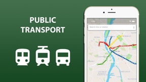


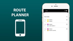

Public transport map Budapest is a navigation tool for tourists that provides static transit maps and route planning on iOS and Android.
The App DNA
What makes this app unique?
The app removes the need for constant data connectivity while navigating a foreign city, serving users who lack local roaming or reliable Wi-Fi access.
For Tourists and city visitors requiring reliable, offline-capable public transport navigation in Budapest.
What does it look like?
Key features
Access maps and schedules without internet.
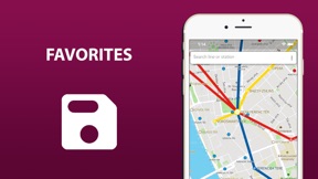
Save routes for repeated access.
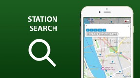
Identify nearby stations via device location.
How much does it cost?
The freemium model gates offline functionality and schedule data behind an extended version purchase, which reviewers describe as aggressive.
Velocity
Maintenance developmentplatform expansionUX improvementsperformanceShow more...
Development momentum is currently in a maintenance state, with only two releases identified across the last 13 months. The latest release, which occurred 137 days ago, focused on a platform migration to MAUI and a design refresh. Given the significant gap between the most recent update and the previous one, the app lacks a consistent release cadence. Future updates appear to be limited to occasional technical maintenance rather than active feature development.
Who built it?
Khrystyna Skliarova
13+ apps tracked · Navigation
 Public transport map Barcelona
 Public transport map Valencia
 Public transport map Istanbul
 Barcelona travel map guide
 Public transport map Paris
 Public transport map Berlin
 City Transport Map Paphos
 Public transport map Lisbon
 Public transport map Vienna
 Public transport map Bangkok
 Krakow travel map guide 2020
 Crowd sourcing traffic lights
User Sentiment
What do users think recently?
Fresh user feedback skews upset.
How are ratings & reviews evolving?
What users say, by theme
- Geographic coverage limitations prevent users from navigating outside the primary city center boundaries
3 of 3 recent reviews analyzed · limited sample
Read the full review analysisUnlock 1 more frustration theme and 1 user request, each backed by review evidence.
Access the full report for freeCompetition
Competitive landscape for Public transport map Budapest
How's the Navigation market?
Public transport map Budapest occupies a niche in the Navigation category, relying on offline-first utility to differentiate from data-dependent mapping rivals.
Read the market outlookThe rivals identified
Unlock the deeper market read.
Access the full report for freeThe Analyst's Read
Key takeaways for Public transport map Budapest
Where is it heading?
Users report: The navigation category is consolidating around comprehensive, real-time transit data providers, leaving static map tools like Public transport map Budapest increasingly exposed. Without a shift toward regional data expansion, the app will continue to lose relevance to rivals that offer broader geographic coverage.
- The maintenance-only release cadence prevents the app from addressing geographic coverage gaps, which accelerates churn as users seek more comprehensive transit alternatives.
The SWOT
- Offline map access removes the connectivity dependency rivals require
- Expand geographic coverage to include suburban transit lines to address top user request
Next best moves
Pivot monetization by un-gating basic zoom functionality because current paywall placement is the #1 driver of negative reviews → improve rating baseline
+ 1 more prioritized moveThe counter-intuitive read
The app's offline-first design is a retention lever…
Read the full takeSince the last report: The app's competitive positioning has shifted from a broad transit tool to a niche offline-first utility, while the SWOT analysis now explicitly links the maintenance-only development cycle to increased market vulnerability.
Bottom line
Un-gating basic map interaction would address the primary driver of negative sentiment, allowing the product to compete on its offline-first utility rather than its paywall.
Unlock 1 critical friction, 1 market threat, 1 more prioritized move and the analyst’s take.
Access the full report for freeFAQ
Is Public transport map Budapest worth paying for?
Does Public transport map Budapest work without internet?
What is the main limitation of Public transport map Budapest?
Sources
- [1] App Store
Report last updated