


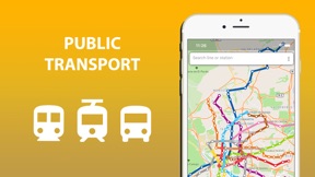





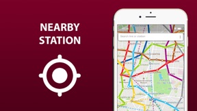
Public transport map Madrid is a navigation utility for metro, tram, and bus routes in Madrid, available on iOS and Android.
The App DNA
What makes this app unique?
The app removes the reliance on consistent cellular connectivity for transit planning, serving users who prioritize offline access over real-time data.
For Tourists and city residents navigating Madrid public transport who require reliable, offline-capable transit maps.
What does it look like?
Key features
Downloads transport infrastructure maps for use without internet connectivity.
Visualizes metro, tram, and bus routes with grouped transfer stations on a single interface.
Provides short schedules for public transport routes.
How much does it cost?
Freemium model gates offline functionality and schedule data behind an extended version upgrade.
Velocity
Maintenance developmentplatform expansionUX improvementsShow more...
The app has shipped only two releases in the observed window, with the latest version arriving 139 days ago. Development is currently in a maintenance phase, characterized by infrequent updates that focus on platform migration and database improvements rather than new user-facing content. With an average cadence of approximately one release every 4.5 months, the development momentum is low and lacks a consistent update cycle.
Who built it?
Khrystyna Skliarova
13+ apps tracked · Navigation
 Public transport map Barcelona
 Public transport map Valencia
 Public transport map Istanbul
 Barcelona travel map guide
 Public transport map Paris
 Public transport map Berlin
 City Transport Map Paphos
 Public transport map Lisbon
 Public transport map Vienna
 Public transport map Bangkok
 Krakow travel map guide 2020
 Crowd sourcing traffic lights
User Sentiment
What do users think recently?
How are ratings & reviews evolving?
Not enough recent reviews to extract reliable themes yet.
Read the full review analysisCompetition
Competitive landscape for Public transport map Madrid
How's the Navigation market?
Public transport map Madrid occupies a niche in the navigation category by focusing on static, offline transit visualization. The lack of recent feature expansion, with only two major updates in the last six months, signals a maintenance-mode posture that limits its ability to compete with real-time navigation rivals.
Read the market outlookThe rivals identified
Unlock the deeper market read.
Access the full report for freeThe Analyst's Read
Key takeaways for Public transport map Madrid
Where is it heading?
The navigation market is consolidating around real-time, data-rich tools that provide live service alerts and traffic updates. Public transport map Madrid remains in a maintenance-only posture, which leaves it exposed to feature-parity gaps against competitors that provide dynamic, rather than static, transit information.
- The maintenance-only update cadence indicates a focus on stability over feature expansion, which preserves the current user base but limits new acquisition.
- The lack of real-time transit data integration forces users to switch to broader navigation apps, accelerating churn pressure on the core user base.
The SWOT
- Offline map packs remove the connectivity dependency rivals require
- Localized transit schedule integration could capture users relying on real-time navigation
Next best moves
Audit transit schedule data sources because current schedules are static → increase user retention
The counter-intuitive read
The offline-first design is a retention lever in…
Read the full takeSince the last report: The report reflects a shift from a neutral maintenance-focused outlook to an active recognition of competitive churn risks caused by the absence of real-time transit data. This change in perspective highlights the growing pressure from cloud-integrated navigation rivals.
Bottom line
Public transport map Madrid relies on offline utility to defend its position, but the lack of real-time data limits its long-term viability against major navigation platforms. Integrating live service alerts would address the primary utility gap driving users toward real-time alternatives.
Unlock 2 critical frictions, 1 market threat and the analyst’s take.
Access the full report for freeFAQ
Does Public transport map Madrid work without internet?
How does Public transport map Madrid compare to Google Maps?
Is Public transport map Madrid free to use?
Sources
- [1] App Store listing, source
Report last updated