


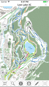

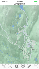
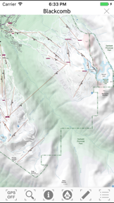
Whistler Area Ski Maps is a topographic navigation tool for Whistler ski areas, providing trail data and location tracking on iOS.
The App DNA
What makes this app unique?
The app removes the need for physical paper maps by providing digital elevation profiles and location-enabled terrain tracking for cross-country enthusiasts.
For Skiers and cross country enthusiasts visiting the Whistler area who require offline-accessible terrain navigation.
What does it look like?
Key features
Detailed terrain maps for Whistler Blackcomb and Whistler Olympic Park.
Real-time user positioning on the map interface, providing utility during active ski sessions.
Elevation profiles and written descriptions for cross country ski trails.
How much does it cost?
The app is provided at no cost with no visible in-app purchase or subscription gates.
Velocity
Dormant developmentopaqueShow more...
Whistler Area Ski Maps has been inactive for 2,151 days, indicating the project is no longer receiving development support. There have been no feature updates, bug fixes, or operational changes in over five years. The development momentum is non-existent, and the app remains in a state of total stagnation.
Who built it?
Ryan Robertson
7 apps tracked · Reference
 TrailMapps: Rotorua
 Waitangi MTB Park
 Whitehorse Trail Guide
 TrailMapps: Sunshine Coast
 TrailMapps: Squamish
 Sea to Sky Gondola Maps
User Sentiment
What do users think recently?
Review voice lately leans excited.
How are ratings & reviews evolving?
What users say, by theme
- Outdated mountain map data prevents users from accessing current trail information for major resort locations
1 of 1 recent reviews analyzed · limited sample
Read the full review analysisUnlock 1 user request, each backed by review evidence.
Access the full report for freeCompetition
Competitive landscape for Whistler Area Ski Maps
How's the Reference market?
Whistler Area Ski Maps occupies a niche reference category with a 4.5-star rating from 2 total reviews. The lack of updates since 2020 signals a stagnant market position relative to general-purpose mapping tools.
The rivals identified
The Analyst's Read
Key takeaways for Whistler Area Ski Maps
Where is it heading?
The market for specialized ski maps is consolidating around platforms that provide live, crowdsourced data updates. Whistler Area Ski Maps remains in maintenance mode, which will lead to continued churn as users migrate to more reliable, frequently updated navigation tools.
- The lack of updates since 2020 means the map data is increasingly inaccurate, which erodes user trust and utility over time.
The SWOT
- Location-enabled topographic mapping provides immediate utility during active ski sessions
- Elevation profiles for cross-country trails offer specialized data
- Implementing a crowdsourced trail-update loop could mitigate the lack of manual data maintenance
Next best moves
Sunset the app because the data is over 5 years old and cannot be maintained → prevent further negative sentiment
The counter-intuitive read
The app's lack of monetization is its greatest weakness: without a revenue stream…
Read the full takeSince the last report: The product strategy shifted from a maintenance-focused audit to a formal recommendation to sunset the application. This pivot reflects the realization that the lack of a revenue model prevents the necessary data updates for current resort navigation.
Bottom line
Whistler Area Ski Maps provides high-utility topographic data for the Whistler region, but the lack of updates since 2020 leaves the navigation data increasingly unreliable for current resort infrastructure.
Unlock 2 critical frictions, 1 market threat and the analyst’s take.
Access the full report for freeFAQ
Is Whistler Area Ski Maps still accurate for the current Whistler resort layout?
Does Whistler Area Ski Maps work offline?
What is a better alternative for navigating Whistler Blackcomb?
Sources
- [1] App Store, source
Report last updated