


GeoPOI
For outdoor enthusiasts, hikers, and foragers seeking detailed, activity-specific mapping for US federal and state lands.
 BLM Public Lands Map Guide USA
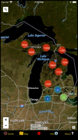

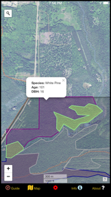


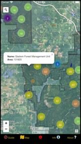


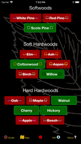




Snapshot
Who is GeoPOI?
Providing specialized digital cartography and navigation tools for outdoor enthusiasts to explore US public lands and natural resources.
Target audience


Portfolio
Last updated

BLM Public Lands Map Guide USA
v3.0.0
2.6y ago
Publisher DNA
What defines GeoPOI?
Publisher DNA
Primary focus
Specialized US public land navigation tools
Scale
indie
Target audience
Outdoor enthusiasts, hikers, and foragers seeking detailed, activity-specific mapping for US federal and state lands.
Signature Patterns
- •Exclusive use of a paid-upfront monetization model across the entire catalog
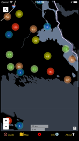
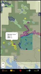
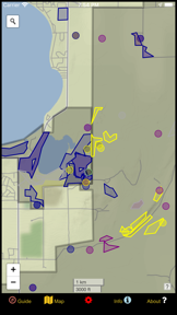
- •Heavy reliance on color-coded icon systems and polygon mapping for data visualization
- •Niche-specific data sets, such as mushroom host tree correlations, not found in general navigation apps
- •Uniform focus on the Navigation category with no diversification into other sectors
Portfolio momentum
The publisher has released zero updates across the portfolio in the last six months, with 80% of the catalog currently classified as abandoned.
Portfolio
What does GeoPOI ship?
Apps
6 apps analysed
Your guide to the recreational opportunities of the Bureau of Land Management!


Analysis in progress

Take the guesswork away from wild mushroom hunting. Let the trees be your guide!


Your guide to the recreational opportunities of the National Forest Service!


Offline-first architecture serves remote wilderness segments where streaming competitors fail
- Extensive geographic coverage provides users with detailed information for navigating national forests across the country

Your key to discovering all the wonders and beauty in the National Park System!


Single-market publisher, every app ships only to United States.
Based on 3 of 6 apps with localized market data, more coverage rolling in as scans complete · last scanned .
Americas (1)
- United States3 / 3
Core markets (3/3 apps)
User Sentiment
How do users feel about their apps?
1
Positive apps
0
Neutral / mixed
0
Negative apps
90/100
Avg sentiment score
Rivals
Who does GeoPOI compete with?
The rivals identified
Nemeses(2)

Avenza Maps targets field workers and outdoor users needing offline maps, competing for the same remote-access utility.


Both apps target outdoor enthusiasts navigating public lands in the Western United States, creating direct competition for users seeking reliable offline map data.
Contenders(6)


Gaia GPS serves the same outdoor navigation user base but focuses on professional-grade GIS tools rather than simple recreational site discovery.


Both apps target outdoor enthusiasts navigating public lands, with Eastern Sierra Camping providing localized offline map utility that overlaps with the broader Western US coverage of BLM Public Lands Map Guide USA.


Provides a highly intuitive path-drawing interface that directly challenges the target app's utility for recreational planning.


Both apps target outdoor enthusiasts seeking geographic data for land exploration. They compete for the same user time and wallet share in the outdoor navigation category.


Both apps target outdoor enthusiasts seeking federal land recreational sites, creating direct competition for users planning trips on public lands.


Both apps target outdoor enthusiasts navigating remote areas, with overlapping utility in identifying public recreational sites and dispersed camping locations.
Same space(16)


National Park Trail Guide targets the same outdoor recreation audience with a focus on National Park trail navigation.


Walmart Overnight Parking serves the same road-trip and camping audience with specialized parking permissions data.


TopoRec provides a similar map-viewing utility for historical and modern topographic data.


Adjacent recreational navigation app that gamifies the forest experience, competing for the same leisure-time user base.


KOMPASS offers professional outdoor navigation for hikers and cyclists, overlapping with the source app's recreational focus.


Hot & Thermal Springs provides a specialized database for outdoor travelers, similar to the source app's recreational point database.


UK Map targets the same outdoor navigation market with high-detail topographic maps for rural areas.


onX Backcountry offers similar land-layer utility for backcountry users but adds 3D terrain data for safety.


OS Maps shares the recreational trail-planning focus but emphasizes community-rated content over static point databases.


LandGlide provides parcel-level land data for professionals, serving a similar need for boundary verification.


RockHoundR targets the same land-access-conscious user base with specialized geological site mapping.


Track N Trail targets the same land-access-conscious user base but adds specialized game recovery tools.


US Public Lands provides a similar federal land boundary reference for outdoor users needing to identify public property.


HiiKER provides professional-grade topographic maps for hikers, overlapping with the navigation utility of the source app.


Focuses on community-sourced trail sharing, providing a social alternative to the target app's static guide.


Boondocking addresses the same camping-discovery need but focuses on free, crowdsourced locations.
New entrants(1)

known for MapXplorer: Map Radar Navigate
A recent entrant with high release velocity that is aggressively targeting the general navigation and map-utility space.
The Analyst's Read
The bottom line on GeoPOI
Bottom line
GeoPOI is a specialized utility publisher that has carved out a niche in US public land data visualization. While their products offer high specificity for outdoor recreation, the lack of recent development activity suggests a portfolio in a terminal maintenance phase.
Frequently asked questions
How many apps does GeoPOI publish?
What kind of apps does GeoPOI make?
What is GeoPOI's top app?
In how many countries are GeoPOI's apps available?
What fed this analysis
- Apps analyzed:
- 5
- With full intel:
- 0
- With overview:
- 5
- Website scraped:
- yes
- Social presence:
- no