

Richard Vijgen
For tech-curious users, digital sociology enthusiasts, and individuals interested in off-grid exploration and digital infrastructure.
 Architecture of Radio




Snapshot
Who is Richard Vijgen?
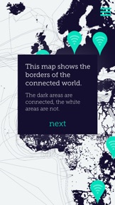
Visualizing the invisible digital infrastructure of our world. Providing tools to map and understand wireless networks and connectivity gaps.
Target audience


Portfolio
Free 1Last updated

Architecture of Radio
v1.1
6mo ago
Publisher DNA
What defines Richard Vijgen?
Publisher DNA
Primary focus
Educational data visualization and network mapping
Scale
indie
Target audience
Tech-curious users, digital sociology enthusiasts, and individuals interested in off-grid exploration and digital infrastructure.
Origin
Created by Richard Vijgen, a designer focused on visualizing the invisible technological landscape.
Signature Patterns
- •Focus on augmented reality and 360-degree data visualization
- •Educational content centered on digital infrastructure and connectivity
- •Integration of VR-style exploration features
- •Mixed monetization strategy utilizing both paid and free models
Portfolio momentum
With only one release in the last six months and one of two apps categorized as abandoned, the publisher maintains a low-frequency development cycle.
Portfolio
What does Richard Vijgen ship?
Apps
2 apps analysed

Rivals
Who does Richard Vijgen compete with?
The rivals identified
Same space(20)

Maps cellular towers to help users optimize mobile connections, aligning with the source app's interest in wireless infrastructure.


Uses camera-based image recognition to trigger animations, sharing the augmented reality interaction model of the source app.


Tracks orbital mechanics using augmented reality, sharing the educational and immersive visualization approach of the source app.


Provides educational simulations of electromagnetic waves, directly mirroring the educational intent of the source app.


Offers Wi-Fi signal strength detection in dBm, serving as a diagnostic tool for network connectivity similar to the radio signal focus of the source app.


Analyzes connection stability and signal strength, providing diagnostic data for the same wireless environment.


Provides technical calculations for radio hobbyists, serving as a specialized utility for the same audience interested in radio frequency infrastructure.


Provides a database of 50 million cell towers for network optimization, targeting users in remote or poor-coverage areas.


Maps antenna sites and tests connection speeds, providing a diagnostic utility for the same radio infrastructure visualized by the source app.


Maps cellular networks and tests speeds, serving as a utility for understanding wireless infrastructure.


Visualizes subsurface data in real space, sharing the augmented reality data visualization approach of the source app.


Monitors radio frequency signals in real-time, providing a professional-grade analysis tool for the same wireless environment rendered by the source app.


Maps global cellular infrastructure to help users identify antenna proximity, similar to the source app's visualization of wireless signals.


Maps Wi-Fi coverage and identifies dead zones, providing a spatial visualization of wireless signals similar to the source app.


Visualizes celestial bodies and environmental data, sharing the educational visualization focus on the physical world.


Alerts users to astrophysical events, sharing the educational focus on invisible phenomena found in the source app.


Maps cellular infrastructure to assist users in troubleshooting connectivity, overlapping with the source app's goal of visualizing wireless signals.


Analyzes local signals and network information, serving as a diagnostic utility for the same wireless environment.


Maps cellular infrastructure for signal optimization, targeting the same users interested in visualizing wireless network coverage.


Shares the augmented reality educational visualization approach for invisible phenomena, though focused on celestial bodies rather than radio infrastructure.
New entrants(2)


Measures and documents Wi-Fi quality on a map, serving as a diagnostic tool for wireless signal coverage.


Maps Wi-Fi signal strength onto a 3D model of a home, providing a spatial visualization of wireless signals.
The Analyst's Read
The bottom line on Richard Vijgen
Bottom line
Richard Vijgen maintains a specialized, concept-driven portfolio that serves a niche educational market. The publisher's value lies in unique data-visualization IP rather than high-frequency mobile growth.
Frequently asked questions
How many apps does Richard Vijgen publish?
What kind of apps does Richard Vijgen make?
What is Richard Vijgen's top app?
What fed this analysis
- Apps analyzed:
- 2
- With full intel:
- 0
- With overview:
- 2
- Website scraped:
- yes
- Social presence:
- yes
