


Busan Metro Map
By SY KHANH HO

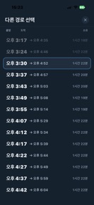


Busan Metro Map is a transit navigation tool for Busan's metro and light rail lines, providing offline routing and timetables on iOS and Android.
The App DNA
What makes this app unique?
The app removes the connectivity dependency that breaks transit tools in underground stations, serving users who lack consistent data access while traveling.
For Commuters, tourists, and residents in Busan requiring reliable transit navigation across the city's six metro and light rail lines.
What does it look like?
Key features
Full map and station data stored locally to maintain utility in underground signal-dead zones.
Interface and station names in 17 languages, with separate Hangul settings for platform sign matching.
Switchable schematic and geographic map views for quick interchange reading or spatial context.
How much does it cost?
The app is entirely free, monetizing through ad inventory rather than gated premium features.
Velocity
Maintenance developmentUX improvementsShow more...
With only one release in the observed window and a last update occurring 35 days ago, the app operates at a maintenance cadence. Development is currently focused on UX improvements, specifically providing users with alternative map visualization styles and customizable text sizing. The current release pattern suggests a stable, low-frequency update cycle rather than an active or live-service model. Future updates are expected to follow this infrequent, feature-focused release schedule.
Who built it?
SY KHANH HO
3 apps tracked · Navigation
 DIYables Bluetooth STEM
 Seoul Subway Map
User Sentiment
What do users think recently?
How are ratings & reviews evolving?
Not enough recent reviews to extract reliable themes yet.
Read the full review analysisCompetition
Competitive landscape for Busan Metro Map
How's the Navigation market?
Busan Metro Map occupies the offline-utility segment of the Busan transit market, focusing on reliability over real-time tracking.
Read the market outlookThe rivals identified
Unlock the deeper market read.
Access the full report for freeThe Analyst's Read
Key takeaways for Busan Metro Map
Where is it heading?
Users report: The transit utility market in Busan is consolidating around tools that offer reliable offline access. Busan Metro Map is well-positioned to capture the tourist segment, provided it maintains data accuracy against operator retiming.
- The latest release added a schematic map view, demonstrating active feature investment rather than maintenance-only status.
The SWOT
- Offline-first architecture removes connectivity dependency
- Localized marketing in tourist hubs like Haeundae
Next best moves
Implement a 'Data Last Updated' timestamp because timetable drift is a primary accuracy risk → maintain user trust
The counter-intuitive read
The lack of real-time train positions is not…
Read the full takeBottom line
Busan Metro Map secures a niche by solving the offline-navigation problem for Busan transit users, but the reliance on ad-inventory monetization requires maintaining high session frequency to offset the lack of a premium tier.
Unlock 1 critical friction, 1 market threat and the analyst’s take.
Access the full report for freeFAQ
Does Busan Metro Map work without an internet connection?
Does Busan Metro Map show live train positions?
Is Busan Metro Map free to use?
Sources
- [1] App Store
Report last updated