


Photo Measures
By Cubent
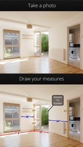
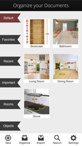
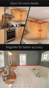

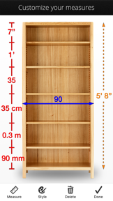
Photo Measures is a productivity tool that allows users to annotate photos with dimensions and notes to document layouts and object sizes. It is designed for professionals and homeowners to simplify project planning and communication with contractors. The app has gained recognition for its utility in managing complex spatial measurements.
Overview · Full Intel report in progress
The App DNA
What makes this app unique?
For Homeowners, contractors, engineers, and DIY enthusiasts involved in construction, renovation, or space planning.
What does it look like?
Key features
Allows users to draw lines and write specific dimensions directly onto captured photos.
Enables users to save and reference exact layouts and object sizes for future project planning.
Optimized for use on both iPhone and iPad to facilitate measurement documentation in the field.
How much does it cost?
Velocity
Dormant developmentShow more...
5 versions in history. Development pace: zombie.
Who built it?

User Sentiment
What do users think recently?
How are ratings & reviews evolving?
Not enough recent reviews to extract reliable themes yet.
Read the full review analysisCompetition
Competitive landscape for Photo Measures
How's the Productivity market?
The rivals identified

By TOP APP d.o.o.
Both apps target the same professional and DIY demographic for spatial documentation and photo annotation, competing directly for users seeking to document object dimensions.
- My Measures PRO offers a freemium model, while Photo Measures requires an upfront payment of 4.99.
- My Measures PRO includes integrated cloud synchronization for project management, which is not listed for Photo Measures.
- My Measures PRO incorporates AR measurement capabilities, whereas Photo Measures focuses on manual photo annotation.


Unlock the head-to-head verdict: where this rival wins, and where it loses.
Access the full report for freeThe Analyst's Read
Key takeaways for Photo Measures
Where is it heading?
Bottom line
The app functions as a visual annotation tool for spatial documentation rather than an automated measurement utility.
Report last updated