


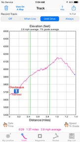


iHikeGPS is a navigation tool for iOS that provides offline access to USGS, US Forest Service, and Canadian topographic maps. It is designed for outdoor enthusiasts who require reliable backcountry navigation without relying on cellular signals or recurring subscription fees.
Overview · Full Intel report in progress
The App DNA
What makes this app unique?
For Outdoor enthusiasts such as hikers, backpackers, and hunters who require offline topographic mapping.
What does it look like?
Key features
Provides access to USGS, US Forest Service, and Canadian topo maps for use in remote areas without cell service.
Includes track recording, route navigation, and estimated time of arrival calculations.
Allows users to manage tracks, waypoints, and routes for backcountry excursions.
Operates as a one-time purchase app with no ads, sign-ups, or in-app purchases.
How much does it cost?
Velocity
Steady developmentShow more...
5 versions in history. Development pace: steady.
Who built it?
James Associates
4 apps tracked · Navigation
 iSailGPS : NOAA USA RNC Charts
 iHikeGPS NZ : LINZ Topo Maps
 iSailGPS NZ : Nautical Charts
User Sentiment
What do users think recently?
How are ratings & reviews evolving?
Not enough recent reviews to extract reliable themes yet.
Read the full review analysisCompetition
Competitive landscape for iHikeGPS : Classic Topo Maps
How's the Navigation market?
The rivals identified
The Analyst's Read
Key takeaways for iHikeGPS : Classic Topo Maps
Where is it heading?
Bottom line
While the app offers robust offline mapping for backcountry use, users report a steep learning curve regarding its interface and file management.
Report last updated