


James Associates
For outdoor enthusiasts, hikers, and recreational sailors requiring reliable mapping in areas without cellular connectivity.
 iSailGPS : NOAA USA RNC Charts










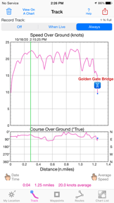


Snapshot
Who is James Associates?
Providing specialized offline navigation tools for outdoor and marine enthusiasts through high-resolution topographic and nautical mapping.
Target audience


Portfolio
Last updated

iSailGPS : NOAA USA RNC Charts
v9.6.6
11mo ago
Publisher DNA
What defines James Associates?
Publisher DNA
Primary focus
Offline navigation for marine and backcountry use
Scale
indie
Target audience
Outdoor enthusiasts, hikers, and recreational sailors requiring reliable mapping in areas without cellular connectivity.
Origin
The publisher appears to be an extension of the MacGPS Pro software line, with mobile releases dating back to 2010.
Signature Patterns
- •One-time purchase pricing model with no recurring subscriptions or in-app ads
- •Heavy reliance on official government mapping data including NOAA, USGS, and USFS
- •Offline-first functionality designed for use without cellular signals
- •Niche utility focus targeting specific outdoor activities like sailing and hiking
Portfolio momentum
Maintained a consistent update schedule with 2 releases across their 2-app portfolio in the last 6 months, ensuring both titles remain active.
Portfolio
What does James Associates ship?
Apps
4 apps analysed


Analysis in progress
Single-market publisher, every app ships only to United States.
Based on 2 of 4 apps with localized market data, more coverage rolling in as scans complete · last scanned .
Americas (1)
- United States2 / 2
Core markets (2/2 apps)
Rivals
Who does James Associates compete with?
The rivals identified
Nemeses(2)


Both apps target outdoor enthusiasts needing navigation tools, competing for the same user base of hikers and backcountry travelers.


Both apps target coastal sailors and boaters with offline-first marine navigation, creating direct competition for users seeking reliable chart access without cellular dependency.
Contenders(20)

Both apps target outdoor recreationalists and hikers requiring offline navigation, but Avenza Maps captures a broader professional segment through its map store and custom import capabilities.


Both apps target outdoor enthusiasts requiring offline navigation in remote areas, creating direct competition for users who prioritize reliable topographic mapping.


Both apps target outdoor navigation for hikers and off-roaders, competing directly on offline map utility and GPS tracking functionality. Guru Maps provides a free global alternative to the specialized New Zealand topographic focus of iHikeGPS NZ.


Both apps target outdoor enthusiasts with offline mapping and activity tracking, creating direct competition for users seeking reliable backcountry navigation tools.


Both applications target outdoor enthusiasts requiring offline navigation, but they diverge on map source accuracy and pricing models for backcountry travel.


Both apps target outdoor enthusiasts and backcountry travelers requiring offline topographic map access for navigation in New Zealand.


Both applications target recreational boaters requiring GPS-based navigation and route management tools for marine environments.


Both applications provide offline navigation using official LINZ topographic data for backcountry travel in New Zealand. They compete directly for the same audience of hikers and outdoor enthusiasts requiring reliable map access without cellular connectivity.


Both apps target recreational sailors and boaters with marine navigation tools, creating direct competition for users seeking reliable chart access.


Both apps target outdoor navigation and backcountry exploration, creating direct competition for users seeking reliable offline tracking and route planning tools.


Both apps target New Zealand outdoor enthusiasts requiring offline navigation tools, creating a shared utility space for backcountry and coastal exploration.


Both apps target recreational boaters with one-time purchase models for offline NOAA chart access, creating direct competition for users avoiding subscription-based navigation tools.


Both apps target recreational boaters and sailors with NOAA chart-based navigation, creating direct competition for users seeking mobile marine plotting tools.


Both applications target recreational sailors with marine navigation and chart plotting, creating direct competition for users seeking reliable maritime situational awareness.


Both apps target recreational sailors requiring mobile marine navigation tools. iNavX competes by offering worldwide chart coverage and professional-grade weather data, contrasting with the USA-specific focus of iSailGPS.


Both apps target recreational sailors and boaters, competing for the same user base requiring route management and chart access on mobile devices.


Both apps target recreational mariners, but they solve different problems: iSailGPS provides offline chart navigation, while Boat Beacon focuses on internet-based AIS vessel tracking and collision avoidance.


Both apps target New Zealand backcountry users with paid, offline-first topographic map solutions that remove the need for cellular data.


Both apps target recreational sailors requiring marine navigation and chart plotting, with SEAiq offering broader chart format support while iSailGPS focuses on a simplified, one-time purchase model.


Both applications target recreational sailors requiring marine navigation, competing directly through distinct chart formats and monetization models.
Same space(22)


Topo GPS offers a broader international scope for topographic maps compared to the New Zealand-specific focus of iHikeGPS.


Argo Navigation provides a social-first marine navigation experience for recreational boaters in North America.


bergfex targets the Alpine outdoor market, offering a similar navigation experience but with a focus on regional trail databases.


Tachometer GPS provides multi-modal speed monitoring for boaters and travelers needing real-time trip data.


Tide Graph Pro utilizes official NOAA data to provide tide and current predictions for marine planning.


CalTopo serves the professional backcountry segment with a focus on cross-platform synchronization and advanced analytical tools.


AV Assistant provides USCG Light List data for users needing to identify navigation aids in U.S. waters.


KiwiCamping serves the same New Zealand outdoor audience but focuses on campsite discovery and itinerary planning rather than general navigation.


Te Araroa is a direct regional competitor, providing a free, offline-first navigation tool specifically for the 3,000 km New Zealand trail.


Topo Maps+ addresses the same backcountry navigation need but adds professional-grade planning and team coordination features.


AyeTides provides specialized tide and current forecasting for maritime professionals in an offline-first format.


Iphigénie offers a vast library of international base maps and overlays, serving a broader geographic audience than the New Zealand-focused iHikeGPS.


KOMPASS provides a similar outdoor navigation experience but differentiates through editorially reviewed and certified hiking tours.


Orienteering Companion targets a niche athletic segment, offering manual map calibration tools that differ from the pre-loaded LINZ maps of iHikeGPS.


Maps 3D Neo assists outdoor route planning by visualizing terrain elevation and topography in 3D.


TrackLink NauticEd functions as a digital logbook for sailors to record and authenticate their sailing ventures.


onX Backcountry targets the same backcountry navigation segment but utilizes proprietary LiDAR data and land-ownership layers to justify a subscription model.


Tractor GPS provides agricultural field guidance for farmers who need offline navigation without dedicated hardware.


Trailforks serves the same outdoor navigation audience but shifts the focus from general topographic maps to a massive, community-driven database of 780,000 specific trails.


This app provides a simplified alternative for route recording and GPX export without the specialized topographic map focus of iHikeGPS.


Savvy Navvy integrates environmental variables like weather and tides into marine route planning for recreational boaters.


Wavve Boating simplifies marine navigation by allowing users to customize charts based on specific boat draft.
The Analyst's Read
The bottom line on James Associates
Bottom line
James Associates Inc. is a disciplined niche publisher that has successfully sustained a paid-upfront model in a category dominated by SaaS. Their value proposition rests on reliability and data integrity for users operating in high-stakes offline environments.
Frequently asked questions
How many apps does James Associates publish?
What kind of apps does James Associates make?
What is James Associates's top app?
In how many countries are James Associates's apps available?
What fed this analysis
- Apps analyzed:
- 2
- With full intel:
- 0
- With overview:
- 2
- Website scraped:
- yes
- Social presence:
- no