


Glacier Peak Studios
For serious outdoor adventurers, hunters, and wildland firefighters requiring offline-capable terrain analysis and team coordination.
 Topo Maps+: Topographic Maps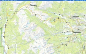

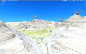


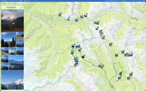


Snapshot
Who is Glacier Peak Studios?
Providing high-precision topographic mapping and offline navigation tools for backcountry enthusiasts and emergency response teams.
Target audience


Portfolio
Free 3Last updated

Topo Maps+: Topographic Maps
v9.6.7
6mo ago
Publisher DNA
What defines Glacier Peak Studios?
Publisher DNA
Primary focus
Backcountry navigation and professional GIS tools
Scale
indie
Target audience
Serious outdoor adventurers, hunters, and wildland firefighters requiring offline-capable terrain analysis and team coordination.
Signature Patterns
- •Heavy emphasis on offline-first functionality for remote, backcountry environments.
- •Freemium monetization model for consumer titles with free access for emergency services.
- •Integration of professional-grade GIS data and specialized overlays like land boundaries.
- •Consistent focus on cross-device data synchronization for trip planning and field use.
Portfolio momentum
The publisher maintains an intense development cadence with 14 updates across their portfolio in the last 6 months, including a major release within the last 48 hours.
Portfolio
What does Glacier Peak Studios ship?
Apps
3 apps analysed


Rivals
Who does Glacier Peak Studios compete with?
The rivals identified
Nemeses(1)


Both apps target serious outdoor adventurers requiring offline navigation and land ownership data, creating direct competition for the high-intent backcountry user segment.
Contenders(9)


Both applications target outdoor enthusiasts requiring offline navigation for backcountry and long-distance travel, creating direct competition for the same user base.


Both apps target outdoor enthusiasts with land ownership data and offline navigation, creating direct competition for users prioritizing remote terrain analysis.


Both apps target outdoor enthusiasts with route planning and GPS navigation, competing for the same user base of hikers and backcountry explorers.


Both apps target backcountry enthusiasts with offline navigation, forcing a direct choice between specialized land boundary data and professional-grade web-to-mobile synchronization.


Both apps compete for the same outdoor navigation audience by providing offline GPS and land boundary data for backcountry and hunting use.


Both apps target outdoor users requiring offline navigation and terrain analysis, though Detector Maps focuses on the specific niche of gold prospecting.


Both applications target outdoor navigation and backcountry exploration, competing for the same user base of hikers and trekkers who require offline map access.


Both apps target outdoor enthusiasts with offline navigation and route-planning features, creating direct competition for users seeking reliable backcountry guidance.


Both applications target outdoor enthusiasts by providing offline topographic map navigation and GPS functionality on mobile devices, directly competing for users seeking alternatives to dedicated hardware.
Same space(18)


Provides specialized sensor-based navigation tools for survival and remote wilderness use.


Serves the same professional field-work audience but focuses on custom map imports rather than pre-built trail databases.


Offers 3D mountain navigation for specialized activities like paragliding and mountaineering.


Targets vehicle-specific navigation needs, integrating trail maps with hardware displays for BRP owners.


Targets the same professional field-research audience with a focus on precise waypoint logging and offline reliability.


Provides an alternative offline navigation experience with a focus on OpenStreetMap data and multi-stop route planning.


Complements Topo Maps+ by providing an intuitive route-tracing interface for planning before heading into the backcountry.

known for Compass 55. Map & GPS kit.
Serves as a technical navigation utility for coordinate management and waypoint tracking in remote areas.


Focuses on 3D terrain rendering to assist with topographical route planning for hikers and cyclists.


Niche navigation tool for anglers that adds environmental data and property boundaries to standard mapping.


Provides a similar trail-planning utility for outdoor recreation with a focus on community-rated routes.


Appeals to privacy-conscious users who want offline navigation without the data collection or subscription costs found in Topo Maps+.


Appeals to power users needing granular offline map control and privacy-first data management.


Provides localized navigation utility for France by integrating official IGN topographic maps.


Offers a basic offline navigation solution with global 3D map access for remote travel.


Targets the same professional-grade backcountry navigation segment but uses a subscription-based bundle to capture revenue.


Targets serious hikers with professional-grade topographic maps and multi-day planning tools.


Offers a massive community-verified trail database that provides discovery features missing from Topo Maps+.
The Analyst's Read
The bottom line on Glacier Peak Studios
Bottom line
Glacier Peak Studios is a highly disciplined developer dominating the high-end backcountry navigation niche. Their transition from consumer travel tools to specialized emergency response utilities demonstrates a successful vertical expansion strategy backed by exceptional user sentiment.
Frequently asked questions
How many apps does Glacier Peak Studios publish?
What kind of apps does Glacier Peak Studios make?
What is Glacier Peak Studios's top app?
What fed this analysis
- Apps analyzed:
- 3
- With full intel:
- 0
- With overview:
- 3
- Website scraped:
- yes
- Social presence:
- no
