


Kalimex-Consulting s.r.o. @Blocoware & Stanislav Dvoychenko
For field professionals, surveyors, and outdoor enthusiasts who require precise spatial data, coordinate tracking, and geolocated documentation.
 GPS Camera 55. Field Survey
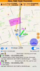


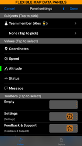
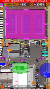


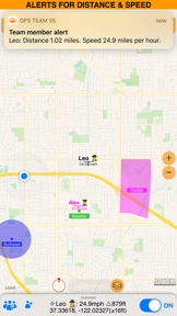


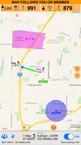
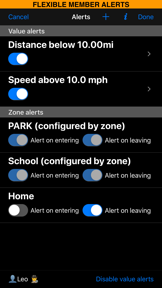
Snapshot
Who is Kalimex-Consulting s.r.o. @Blocoware & Stanislav Dvoychenko?
Providing specialized navigation and field-survey utilities for professionals requiring precise coordinate management and data logging. Enabling efficient site documentation and mapping through mobile-first, registration-free tools.
Target audience


Portfolio
Free 5Last updated

GPS Camera 55. Field Survey
v5.0.1
7mo ago
Publisher DNA
What defines Kalimex-Consulting s.r.o. @Blocoware & Stanislav Dvoychenko?
Publisher DNA
Primary focus
Professional navigation and field-survey utilities
Scale
indie
Target audience
Field professionals, surveyors, and outdoor enthusiasts who require precise spatial data, coordinate tracking, and geolocated documentation.
Signature Patterns
- •Focus on professional-grade navigation and spatial measurement tools
- •Consistent use of free-to-use pricing models across the portfolio
- •Emphasis on offline functionality and registration-free access
- •Integration of advanced data formats like UTM, MGRS, and metadata overlays
Portfolio momentum
Released 11 updates across 5 apps in the last 6 months with consistent maintenance across the entire portfolio.
Portfolio
What does Kalimex-Consulting s.r.o. @Blocoware & Stanislav Dvoychenko ship?
Apps
5 apps analysed


Distributed across 9 markets, strongest in Europe.
Based on 1 of 5 apps with localized market data, more coverage rolling in as scans complete · last scanned .
Americas (3)
- Brazil1 / 1
- Mexico1 / 1
- United States1 / 1
Europe (4)
- France1 / 1
- Germany1 / 1
- Portugal1 / 1
- Spain1 / 1
Asia-Pacific (2)
- Japan1 / 1
- South Korea1 / 1
Core markets (1/1 apps)
Rivals
Who does Kalimex-Consulting s.r.o. @Blocoware & Stanislav Dvoychenko compete with?
The rivals identified
Nemeses(1)


Both apps target field professionals requiring geolocated photographic evidence, creating direct competition for users prioritizing site documentation over standard mobile photography.
Contenders(9)


Both apps target field professionals requiring geolocated photographic evidence for site documentation, creating direct competition for the same professional user base.


Both applications provide GPS-based metadata embedding for visual media, competing for users who require location-stamped documentation for their files.


Both applications target professionals requiring geolocated photographic evidence for site documentation, creating direct competition for field survey workflows.


Both applications target users requiring geotagged photography, competing for the same utility-focused audience through free, ad-supported models.


Both applications target field professionals requiring geolocated photo documentation, creating direct competition for real estate and construction workflows.


Both apps target users requiring geotagged photographic evidence, competing for the same professional and field-documentation user base through free, metadata-focused camera utilities.


Both applications target professionals requiring geolocated photographic evidence, competing directly for the same utility-focused user base through metadata-embedded image capture.


Both apps target field workers requiring geolocated photo documentation, creating direct competition for users seeking reliable site-survey tools.


Both applications target users requiring geolocated photographic evidence for site documentation and field tracking. They compete directly through shared functionality in metadata stamping and location-based photo management.
Same space(38)


Offers map-based navigation tools for field documentation with multiple map styles.


Extends documentation to video for site progress and delivery proof.


Offers specific stamp templates for professional reporting and insurance claims.


Provides a user-friendly interface for adding scrollable geo-map timestamps to photos.


Enables professional-grade offline mapping for field workers, acting as a high-utility tool for remote environments.


Embeds location data into images for official records and travel documentation.


Focuses on land-ownership and parcel data for outdoor enthusiasts, acting as a specialized layer for field navigation.


Focuses on speed and trip tracking, providing a specialized subset of the telemetry tools found in Compass 55.


Provides detailed environmental metadata including magnetic field and compass data for field documentation.


Adds religious orientation features to standard compass navigation, serving a specific user segment within the navigation category.


Provides professional-grade waypoint logging and offline tracking for field researchers, aligning with the core utility of Compass 55.


Provides multi-modal navigation and local search, serving as a comprehensive urban utility for commuters.


Combines GPS tracking with property boundary data for rural professionals, mirroring the field-utility focus of Compass 55.


Serves as a specialized marine navigation tool for users requiring nautical charts beyond standard GPS coordinate tracking.

known for MapXplorer: Map Radar Navigate
Offers integrated safety alerts and GPS camera tools for drivers, expanding on the navigation capabilities of Compass 55.


Offers multi-modal routing and professional driver tools that complement the coordinate-based navigation of Compass 55.


Organizes field work through hierarchical project structures for building and asset inspections.


Targets outdoor enthusiasts by adding altitude and magnitude data to photo metadata.


Enables custom branding and hashtagging for traceable photo stories.


Serves photographers using non-GPS cameras by syncing background-recorded GPS logs with photo timestamps.


Targets professional inspections and delivery proof by embedding metadata into photos and videos.


Focuses on personal memory discovery rather than professional site documentation.


Provides millisecond-accurate documentation for workforce management, though users report local time manipulation risks.


Addresses logistics and warehouse audit needs by embedding weather and address data into images.


Provides a privacy-focused, offline-first navigation alternative for users who value data sovereignty over commercial features.


Focuses on map-based review of photo locations for field documentation.


Users report: Captures environmental data like weather and magnetic field for real-time documentation.


Provides specialized land-access overlays for geological field work, acting as a niche utility for prospectors.


Provides advanced AI-driven scouting tools for hunters, representing a high-tech evolution of field-navigation utilities.


Delivers professional-grade offline mapping and AR navigation for users who require higher technical fidelity than Compass 55.


Provides commercial-vehicle routing that complements the coordinate-based tracking needs of Compass 55 users.


Offers a minimalist speed reference that overlaps with the integrated speedometer feature in Compass 55.


Targets professional GIS users with high-fidelity topographic maps, serving as a technical upgrade for backcountry navigation.


Targets heavy-duty operators with vehicle-specific routing, serving as a professional-grade alternative for long-haul navigation.


Provides specialized POI databases and weigh station status for professional drivers, expanding on the field-utility focus of Compass 55.


Targets professional drivers with specialized routing and parking data, serving as a high-utility alternative for field-based navigation.


Offers collage creation tools alongside location tagging for travel memories.


Matches GPS route logs with photo timestamps for photographers using non-GPS hardware.
New entrants(3)

Combines location tools with interactive 3D Earth exploration for travel planning.


Users report: Integrates global exploration tools with location-tagged photo capture.


Focuses on speed camera detection and smart routing, serving as a driver-specific navigation assistant.
The Analyst's Read
The bottom line on Kalimex-Consulting s.r.o. @Blocoware & Stanislav Dvoychenko
Bottom line
This publisher has successfully carved out a defensible niche by providing high-utility, technical navigation tools that outperform generic map apps for professional use cases. Their disciplined maintenance and high user ratings suggest a stable, product-led growth model.
Frequently asked questions
How many apps does Kalimex-Consulting s.r.o. @Blocoware & Stanislav Dvoychenko publish?
What kind of apps does Kalimex-Consulting s.r.o. @Blocoware & Stanislav Dvoychenko make?
What is Kalimex-Consulting s.r.o. @Blocoware & Stanislav Dvoychenko's top app?
In how many countries are Kalimex-Consulting s.r.o. @Blocoware & Stanislav Dvoychenko's apps available?
What fed this analysis
- Apps analyzed:
- 5
- With full intel:
- 0
- With overview:
- 5
- Website scraped:
- yes
- Social presence:
- no
