


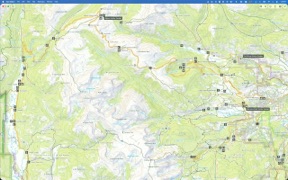
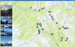


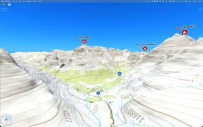

Topo Maps+ is a cross-platform navigation tool designed for backcountry planning and offline use. It enables users to build routes, manage unlimited waypoints, and sync data between Mac and iOS devices using a variety of professional-grade map sources.
Overview · Full Intel report in progress
The App DNA
What makes this app unique?
For Outdoor enthusiasts and backpackers requiring reliable, offline-capable navigation and trip planning tools.
What does it look like?
Key features
Provides tools for creating custom paths and managing unlimited waypoints for backcountry trips.
Offers access to diverse map types including USGS, US Forest Service, NOAA Marine, and ESRI ArcGIS.
Allows users to plan trips on a Mac and sync detailed route information to iOS devices for field use.
Enables users to compare maps and combine overlays to create personalized views for specific terrain.
How much does it cost?
Velocity
Intense developmentShow more...
5 versions in history. Development pace: intense.
Who built it?
Glacier Peak Studios
3 apps tracked · Travel
 Topo Maps+: Topographic Maps
 Topo Fire
User Sentiment
What do users think recently?
How are ratings & reviews evolving?
Not enough recent reviews to extract reliable themes yet.
Read the full review analysisCompetition
Competitive landscape for Topo Maps+
How's the Travel market?
The rivals identified
The Analyst's Read
Key takeaways for Topo Maps+
Where is it heading?
Bottom line
While the app offers robust planning and mapping features, users report that core topographical functionality is gated behind a subscription.
Report last updated