

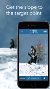
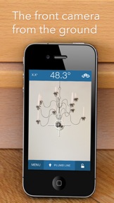


SeeLevel is a multi-functional utility app that transforms mobile devices into precision measurement tools, including a clinometer, bubble level, laser level, and protractor. It is designed for users requiring accurate slope, angle, and inclination measurements, offering features like relative angle mode and magnetic field computation. The app is notable for its high precision, supporting up to three decimal places of accuracy.
Overview · Full Intel report in progress
The App DNA
What makes this app unique?
For Outdoor enthusiasts, hobbyists, and professionals in fields like trail building or forestry who require portable, cost-effective slope and angle measurement tools.
What does it look like?
Key features
Provides versatile tools including a clinometer, bubble level, laser level, and protractor for various inclination tasks.
Allows users to measure slopes and angles on surfaces that are not parallel to the ground.
Includes a compass with magnetic field computation and provides detailed information about device sensors.
Enables users to capture images with overlaid measurement values and save results for later reference.
How much does it cost?
Velocity
Dormant developmentShow more...
5 versions in history. Development pace: zombie.
Who built it?
Sten Kaiser
10 apps tracked · Utilities
 RacquetTune - String Tension
 SprintTimer Pro
 SprintTimer - Photo Finish
 LapTracker - Auto Timer
 SpeedClock - Video Radar
 FitnessMeter - Test & Measure
 SprintStart - Reaction Time
 JumpPower
 SwingTool - Swing Weight
User Sentiment
What do users think recently?
How are ratings & reviews evolving?
Not enough recent reviews to extract reliable themes yet.
Read the full review analysisCompetition
Competitive landscape for SeeLevel - visual clinometer
How's the Utilities market?
The rivals identified
The Analyst's Read
Key takeaways for SeeLevel - visual clinometer
Where is it heading?
Bottom line
While the app offers high-precision measurement capabilities that rival dedicated hardware, users report that the interface has a learning curve and requires a tripod for optimal accuracy.
Report last updated