

Aviation Data Systems
For casual users seeking quick weather snapshots and professional pilots requiring high-fidelity radar and aviation metrics.
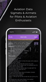
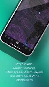
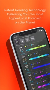
 MyRadar Accurate Weather Radar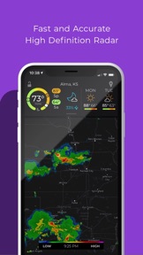




Snapshot
Who is Aviation Data Systems?
Providing high-fidelity meteorological data and hyper-local alerts to casual users and professional aviators.
Target audience


Portfolio
Free 2Last updated

MyRadar Accurate Weather Radar
v7.120.1
6mo ago
Publisher DNA
What defines Aviation Data Systems?
Publisher DNA
Primary focus
High-performance weather and aviation tools
Scale
indie
Target audience
Casual users seeking quick weather snapshots and professional pilots requiring high-fidelity radar and aviation metrics.
Origin
Rooted in aviation data systems, the publisher has expanded from flight-related weather into space-based AI and satellite technology.
Signature Patterns
- •Focus on high-fidelity, animated radar visualizations as the core UI
- •Monetization via a mix of ad-supported free versions and one-time Pro purchases
- •High-margin upsells through specialized aviation data subscriptions
- •Extremely high release frequency to maintain data accuracy and performance
- •Dual-market targeting of both mass-market consumers and niche professionals
Portfolio momentum
Maintaining an intense development pace with 24 updates across 2 apps in the last 6 months, with the most recent major release occurring 13 days ago.
Portfolio
What does Aviation Data Systems ship?
Apps
2 apps analysed
Professional radar pack creates high-value enthusiast barrier
- High-fidelity radar imagery provides critical situational awareness during severe weather events for outdoor users
- Aggressive advertising frequency interrupts critical weather monitoring during time-sensitive severe storm tracking sessions

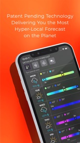
Hyperlocal rain alerts by MyRadar using patent-pending technology, radar & more

Radar-first, ad-free interface reduces cognitive load for power users
- High-resolution radar imagery provides accurate storm tracking that users rely on for daily safety decisions
- Recent updates cause the radar map to load as a blank screen on multiple devices
Distributed across 19 markets, strongest in Europe.
Based on 1 of 2 apps with localized market data, more coverage rolling in as scans complete · last scanned .
Americas (4)
- Brazil1 / 1
- Canada1 / 1
- Mexico1 / 1
- United States1 / 1
Europe (8)
- France1 / 1
- Germany1 / 1
- Italy1 / 1
- Netherlands1 / 1
- Portugal1 / 1
›+3 more europe markets
- Spain1 / 1
- Turkey1 / 1
- United Kingdom1 / 1
Asia-Pacific (7)
- Australia1 / 1
- India1 / 1
- Indonesia1 / 1
- Japan1 / 1
- Singapore1 / 1
›+2 more asia-pacific markets
- South Korea1 / 1
- Vietnam1 / 1
Core markets (1/1 apps)
User Sentiment
How do users feel about their apps?
1
Positive apps
1
Neutral / mixed
0
Negative apps
65/100
Avg sentiment score
Unlock the app dragging this portfolio down.
Access the full report for freeRivals
Who does Aviation Data Systems compete with?
The rivals identified
Nemeses(2)


Both apps target the weather forecasting market with radar-based visualization and severe weather alerts, creating direct competition for users seeking real-time situational awareness.


Both apps target casual weather observers and outdoor enthusiasts, competing directly for daily radar usage and severe weather alert attention.
Contenders(18)


This app targets the same outdoor enthusiast demographic as MyRadar but focuses on specialized geomagnetic events instead of general meteorology.


Both apps target weather enthusiasts and storm trackers with radar and satellite-first interfaces, creating direct competition for users seeking detailed environmental monitoring.


Windy.com serves outdoor professionals through multi-model data visualization, acting as a high-utility alternative for users requiring more granular meteorological analysis than MyRadar.


Both apps compete for the same audience of weather-conscious users by offering radar-first interfaces and hyperlocal forecasting, with both currently suffering from radar-loading technical regressions.


Both apps compete for the same general weather-tracking audience by offering radar-first interfaces and real-time severe weather notifications as their primary utility.


Both apps target users needing immediate, location-specific precipitation tracking, creating a direct overlap in the hyper-local weather alert segment.


Both apps target users seeking real-time radar and precipitation tracking, competing directly for the same utility-focused audience in the US weather market.


Both apps compete for the same casual weather observer audience by offering high-accuracy radar and forecasting tools within the US weather category.


Both apps compete for the same weather-tracking audience by providing live radar maps and severe weather alerts as their core utility.


Both apps compete for the same weather-tracking audience by offering freemium radar and forecasting tools, forcing a choice between MyRadar's professional aviation-grade data and Meteored's ECMWF model-driven accuracy.


Both apps compete for the same safety-conscious, radar-focused user base, with Clime holding the #2 Grossing rank while MyRadar holds #7. They overlap directly in radar-first utility and freemium monetization models.


Both apps compete for the same mass-market audience seeking real-time weather tracking and radar visualization, with both relying on freemium models that gate advanced features behind subscriptions.


Both apps compete for the same weather-tracking audience by offering radar-centric features and free-to-use models, creating direct competition for daily active users.


Both apps target the same weather-tracking audience and offer live radar capabilities, creating direct competition for daily active users.


Both apps compete for the casual weather observer segment by offering radar-based forecasting, though they diverge on UI tone and monetization strategy.


Both apps target the same user base seeking real-time precipitation tracking and hyper-local weather alerts, competing directly for daily active usage in the weather utility category.


Both apps compete for the same commuter and outdoor enthusiast audience by offering hyper-local radar and severe weather alerts as their primary utility.


Both apps compete for the same Android user base by providing live radar maps and severe weather alerts.
Same space(18)


Lightning Tracker & Radar Map focuses on safety timers for storm zones, providing a recurring safety habit for outdoor professionals similar to MyRadar's rain alerts.


QuakeFeed provides disaster monitoring for seismic events, serving as a specialized utility for users who also monitor severe weather via MyRadar.


NOAA Weather Radio offers digital emergency audio streaming, serving users who prioritize immediate safety alerts over the visual radar focus of MyRadar.


This app targets the same utility-focused user base by embedding radar and alerts directly into the device homescreen.


This app competes for the same daily-habit weather user by offering model comparison and meteorologist-verified forecasts.


NOAA Weather Radar Live Map provides hurricane and lightning tracking with an integrated barometer, serving general users who need severe weather monitoring.


Marine Weather Forecast Pro aggregates maritime data for professional navigation, serving the same high-fidelity user base as MyRadar's aviation subscription.


Mountain-Forecast.com provides elevation-specific data for summits, catering to outdoor enthusiasts who require more precise altitude-based weather than MyRadar.


Earthquake - alerts and map provides global seismic monitoring, competing for the attention of users who rely on MyRadar for real-time environmental data.


Weather Hi-Def Radar provides a radar-centric interface for severe weather tracking, mirroring the core utility of MyRadar for casual observers.


NOAA Radar & Weather Forecast offers specialized meteorological layers for travel planning, competing with MyRadar's professional radar pack.


MyShake provides seismic early warning alerts, acting as a critical safety utility for users in earthquake-prone regions alongside MyRadar.


Ventusky offers a 3D interactive globe for professional meteorological analysis, targeting the same power-user segment that utilizes MyRadar's aviation data layers.


WeatherBug provides hyper-local safety alerts through a proprietary sensor network, competing with MyRadar for users who prioritize precise lightning and air quality data.


WindAlert utilizes a proprietary station network for wind monitoring, providing more localized wind data than standard weather services like MyRadar.


ZoneWatch offers professional-grade parameters like CAPE and helicity, targeting power users who find MyRadar's standard radar layers insufficient.


Windfinder focuses on maritime safety through wind and wave data, attracting the same outdoor sports audience that relies on MyRadar for aviation-grade meteorological insights.


Windy.app focuses on wind sports forecasting, providing granular meteorological data for enthusiasts who require specific wave and wind reports.
New entrants(1)


Weather forecast provides minute-by-minute precipitation tracking, offering a streamlined alternative for users who find MyRadar's interface too complex.
The Analyst's Read
The bottom line on Aviation Data Systems
Bottom line
Aviation Data Systems is a technically sophisticated publisher that has successfully defended a top-tier position in the weather category through proprietary data and professional-grade features. Their expansion into AI-driven nowcasting and space technology signals a move toward high-barrier-to-entry government and enterprise contracts.
Frequently asked questions
How many apps does Aviation Data Systems publish?
What kind of apps does Aviation Data Systems make?
What is Aviation Data Systems's top app?
In how many countries are Aviation Data Systems's apps available?
What fed this analysis
- Apps analyzed:
- 2
- With full intel:
- 1
- With overview:
- 2
- Website scraped:
- yes
- Social presence:
- yes