


Bad Rhino ApS
For outdoor enthusiasts planning specific European treks and casual gamers interested in arithmetic and trivia challenges.
 Calculuz: Learning Math Game


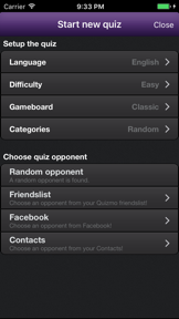
Snapshot
Who is Bad Rhino ApS?
Providing specialized navigation tools for long-distance hikers and educational math puzzles for casual learners. Bridging the gap between niche outdoor exploration and supplemental skill-building.
Target audience


Portfolio
Free 3Last updated

Calculuz: Learning Math Game
v1.0.5
3.6y ago
Publisher DNA
What defines Bad Rhino ApS?
Publisher DNA
Primary focus
Travel navigation guides and educational puzzle games
Scale
indie
Target audience
Outdoor enthusiasts planning specific European treks and casual gamers interested in arithmetic and trivia challenges.
Signature Patterns
- •High degree of specialization in regional European hiking routes
- •Paid, one-time purchase model for travel utility apps
- •Freemium model for trivia and educational gaming titles
- •Focus on functional, task-oriented app design
Portfolio momentum
Released 1 update in the last 6 months with a mix of active travel guides and legacy gaming titles.
Portfolio
What does Bad Rhino ApS ship?
Apps
7 apps analysed


Single-market publisher, every app ships only to United States.
Based on 1 of 7 apps with localized market data, more coverage rolling in as scans complete · last scanned .
Americas (1)
- United States1 / 1
Core markets (1/1 apps)
Rivals
Who does Bad Rhino ApS compete with?
The rivals identified
Nemeses(3)

DiscoverTrail provides a similar offline-capable hiking guide experience, competing for the same user base looking for trail navigation in remote areas.


Visorando acts as a global route discovery platform, offering a wider variety of activities and locations compared to the specific regional focus of Bornholm Rundt.


Both apps target travelers in Denmark seeking navigation tools, though Bornholm Rundt focuses on specific hiking trails while the rival provides general offline mapping.
Contenders(14)


Acts as a general travel guide for the Balearic Islands, offering broader island information than the GR 221 trail-specific tool.


Both apps target outdoor enthusiasts with offline navigation tools, creating a direct conflict for users seeking trail-specific guidance.


Both apps compete for the attention of travelers planning trips to Denmark, specifically targeting users who require navigation and location-based information for their itinerary.


Mallorca Map competes for the same tourist audience by offering location-based discovery and trip planning tools that overlap with the initial planning phase of a hiker's journey.


Both applications serve long-distance hikers requiring offline navigation and trail-specific planning tools for specific European trekking routes.


Both apps target long-distance hikers seeking offline navigation and trail-specific planning tools. They compete for the same user base of outdoor enthusiasts planning multi-day treks.


Both apps target the same geographic market in Mallorca, competing for the limited attention of tourists seeking specialized outdoor navigation and safety information.


Both apps function as paid, offline-first navigation utilities for specific long-distance European hiking trails. They compete for the same niche audience of independent hikers seeking reliable route guidance without connectivity.


Both apps serve the niche hiking trail guide market by providing offline navigation and route-specific planning for long-distance paths.


Both apps target visitors to Mallorca, creating competition for limited storage space on a traveler's device.


Both apps target hikers requiring offline navigation for specific long-distance trails, creating direct overlap in utility for outdoor enthusiasts.


Both applications target tourists visiting Bornholm, Denmark, creating direct competition between a specialized, paid hiking guide and a free, general-purpose travel utility.


Both apps provide navigation and planning tools for hikers, though they serve distinct geographic regions and trail scopes.


Both apps compete for the attention of tourists visiting Mallorca, targeting the same geographic market for travel and navigation utility.
Same space(32)


MAPS.ME serves as a broad-market alternative for offline navigation, using OpenStreetMap data to provide global coverage that exceeds the two-trail focus of Bornholm Rundt.


Provides a curated, expert-led guide for a specific long-distance route, mirroring the specialized focus of the GR 221 app.


WeTrek provides a broader route-sharing platform that includes multiple map layers and emergency network coverage, serving as a more feature-dense alternative to Bornholm Rundt.


Provides a specialized guide for the Portuguese Way, serving as a similar route-specific tool for a different long-distance path.


bergfex provides a regional Alpine focus that mirrors the island-specific strategy of Bornholm Rundt but scales it across a much larger trail database.


Offers a paid, open-data-based navigation tool for hiking on Bornholm, similar to the GR 221's specialized trail focus.


Supplies audio tours and beach guides for Mallorca, acting as a general travel companion for island tourists.


TrekSpots focuses on camping-specific discovery, providing a utility that hikers using Bornholm Rundt might require for multi-day trips.


Mapply serves as a general-purpose map viewer, offering a broader set of tile-based layers than the dedicated trail guides found in Bornholm Rundt.


Terra Map offers a more technically robust navigation experience for off-road explorers, contrasting with the simpler, route-specific utility of Bornholm Rundt.


Hike Maker focuses on automated route generation, providing a dynamic planning experience that contrasts with the fixed trail data in Bornholm Rundt.


Point Reyes Audio Tour Guide provides an immersive, narrative-driven experience that complements the visual navigation provided by Bornholm Rundt.


Assists with public transport planning in Mallorca, helping hikers reach trailheads for routes like the GR 221.


Functions as a direct, paid competitor for offline mapping in Mallorca, though it lacks the specific trail-planning focus of the GR 221.


Snowdonia Outdoor Map is a specialized regional navigation tool, mirroring the niche, location-specific strategy of Bornholm Rundt.


Just Draw It! offers a lightweight, gesture-based planning tool that provides a faster alternative to the pre-defined routes found in Bornholm Rundt.


Ondago digitizes official tourist maps, providing a similar offline-first experience to Bornholm Rundt but focused on curated destination management.


Offers a general travel guide for Mallorca with augmented reality features, serving as a broader companion for island visitors.


Norgeskart provides a highly detailed, country-specific mapping experience that serves as a regional benchmark for the type of navigation Bornholm Rundt attempts for Bornholm.


Focuses on local community discovery and social planning for Mallorca visitors rather than specific trail navigation.


Supplies land-ownership and safety data that provides a higher level of backcountry detail than the GR 221 trail guide.


OpenRunner serves as a comprehensive planning and tracking platform, offering more advanced route-creation tools than the static guides in Bornholm Rundt.


Combines community-rated trails with offline mapping, providing a broader discovery layer for hikers exploring Mallorca.


Organic Maps targets the same privacy-conscious hikers as Bornholm Rundt but differentiates through a completely free, ad-free model built on community-maintained data.


Provides a privacy-focused, open-source alternative for hikers who require granular offline map control beyond the GR 221 trail.


Adds audio-guided tours and CarPlay support for National Park visitors, offering a different modality for exploring Mallorca.


Obriy emphasizes custom route building over pre-defined paths, offering a more flexible planning tool for experienced hikers than Bornholm Rundt.


Macs Adventure focuses on the logistical side of self-guided travel, providing a digital itinerary that complements the navigation-only focus of Bornholm Rundt.


Unifies public transport schedules in Mallorca, helping hikers navigate to and from trailheads for the GR 221.


Targets professional-grade backcountry navigation needs with GIS tools that exceed the basic trail mapping of the GR 221 app.


Hiking Slovakia provides a regional trail database similar to Bornholm Rundt, focusing on a specific geographic area with high-detail topographic data.


Integrates professional-grade topographic maps and multi-day planning tools that cater to the same serious hiker demographic as the GR 221.
New entrants(3)


Traileasy combines logistical gear-tracking with navigation, serving as a more comprehensive planning tool for the same long-distance hiking audience as Bornholm Rundt.


Focuses on RV trip planning and camping, providing a different outdoor logistical tool for travelers visiting Mallorca.


WANDOO offers a similar mix of route planning and offline mapping, competing directly for the attention of hikers seeking reliable trail guidance.
The Analyst's Read
The bottom line on Bad Rhino ApS
Bottom line
Bad Rhino ApS functions as a niche utility publisher, successfully monetizing specific outdoor interests through paid guides while maintaining a secondary, lower-engagement presence in casual gaming. Their future viability depends on whether they can scale their travel guide model to more regions or if they will continue to operate as a collection of disparate, low-volume assets.
Frequently asked questions
How many apps does Bad Rhino ApS publish?
What kind of apps does Bad Rhino ApS make?
What is Bad Rhino ApS's top app?
In how many countries are Bad Rhino ApS's apps available?
What fed this analysis
- Apps analyzed:
- 6
- With full intel:
- 0
- With overview:
- 6
- Website scraped:
- yes
- Social presence:
- no
