


Inside Outside Studios
For hunters and outdoor enthusiasts in Canada who require precise boundary data for wildlife management units and offline map access.
 iHunter


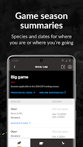


Snapshot
Who is Inside Outside Studios?
Providing hunters with precise, offline-capable mapping tools for navigating provincial wildlife management boundaries across Canada.
Target audience


Portfolio
Free 10Last updated

iHunter
v5.0.57
6mo ago
Publisher DNA
What defines Inside Outside Studios?
Publisher DNA
Primary focus
Regional hunting navigation and regulatory utility apps
Scale
indie
Target audience
Hunters and outdoor enthusiasts in Canada who require precise boundary data for wildlife management units and offline map access.
Signature Patterns
- •Focus on overlaying regional wildlife management boundaries onto base maps
- •Strong emphasis on offline map caching and functionality
- •Freemium monetization model across regional variants
- •Consistent feature set including waypoint management and seasonal data
Portfolio momentum
Released 19 updates across 10 apps in the last 6 months, indicating a high-frequency maintenance and feature-update cycle.
Portfolio
What does Inside Outside Studios ship?
Apps
10 apps analysed


Americas-centric footprint across 2 markets.
Based on 4 of 10 apps with localized market data, more coverage rolling in as scans complete · last scanned .
Americas (1)
- United States4 / 4
Europe (1)
- France1 / 4
Core markets (4/4 apps)
Rivals
Who does Inside Outside Studios compete with?
The rivals identified
Nemeses(1)


Hunting Log Ontario targets the same Ontario hunting demographic by offering a focused, offline-first personal record-keeping tool that avoids the account requirements and regulatory features found in iHunter Ontario.
Same space(20)


This app targets the same outdoor recreation audience as iHunter but shifts the focus from hunting regulations to multi-sport trail navigation.


Avenza Maps serves as a high-utility alternative for users who require professional-grade offline mapping and custom data imports.


Users report: BaseMap offers a similar mapping utility to iHunter Ontario but adds specialized research tools like harvest data and draw odds.


i-Hunting provides a similar mapping experience to iHunter Ontario but emphasizes PLSS mapping and vector topo data for US-based users.


ZEISS Hunting complements iHunter Ontario by offering specialized ballistic calculations and hardware-linked management for optics users.


GPS Tracks provides a professional-grade alternative for users who prioritize offline reliability and precise waypoint logging over hunting-specific regulatory data.


Topo Maps Canada provides a focused topographic viewing experience that serves as a lightweight alternative for Canadian outdoor enthusiasts.


Hunting Points functions as a direct utility peer by combining GPS tracking with land parcel data for rural professionals and hunters.


Topo Maps+ serves as a robust navigation alternative for backcountry users who need advanced planning and on-trail monitoring.


GOHUNT targets the same hunting demographic by integrating research platforms with GPS mapping for specific hunting units.


HuntStand competes for the same user base by offering environmental forecasting and property data, though it currently struggles with technical stability.


Hunt'n Buddy acts as an all-in-one field utility, overlapping with iHunter Ontario's core navigation and data logging features.


MyHunt serves as a direct peer for hunting area management, focusing on collaborative boundary definition and task assignment for hunting groups.


HuntScout offers a similar mapping experience to iHunter Ontario, focusing on public land access and GMU boundary overlays.


iHUNT Calls provides a specialized audio utility that hunters use alongside navigation apps to improve success in the field.


Lenzmark Hunt focuses on game tracking and terrain assessment, serving as a specialized companion to general navigation tools.


WeHunt provides a platform for coordinated hunting, focusing on group safety and dog tracking alongside mapping.


onX Hunt serves as a primary navigation rival by leveraging proprietary land ownership data that creates high switching costs for serious hunters.


HuntWise differentiates itself from iHunter Ontario by focusing on predictive data analysis rather than just regulatory zone mapping.


Track N Trail offers a specialized recovery utility that complements navigation apps by using machine vision for blood tracking.
New entrants(1)


This app serves the pre-hunting phase by providing educational prep for Ontario hunting licenses, acting as a funnel for new hunters.
The Analyst's Read
The bottom line on Inside Outside Studios
Bottom line
Inside Outside Studios is a disciplined niche publisher that has successfully scaled a regionalized utility model across Canada. Their high update frequency and strong user ratings demonstrate a clear product-market fit for specialized outdoor navigation.
Frequently asked questions
How many apps does Inside Outside Studios publish?
What kind of apps does Inside Outside Studios make?
What is Inside Outside Studios's top app?
In how many countries are Inside Outside Studios's apps available?
What fed this analysis
- Apps analyzed:
- 10
- With full intel:
- 0
- With overview:
- 10
- Website scraped:
- yes
- Social presence:
- yes
