Mike Irving
For outdoor enthusiasts, hikers, and field professionals requiring precise, region-specific geographic coordinate data.
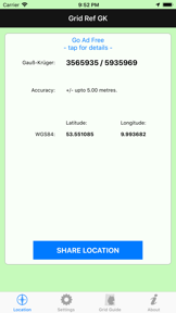
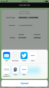
 Grid Ref UTM

















Snapshot
Who is Mike Irving?
Providing precise geographic coordinate tools for outdoor enthusiasts. Enabling accurate location tracking across multiple global grid systems.
Target audience


Portfolio
Free 8Last updated

Grid Ref UTM
v2.3.4
5.7y ago
Publisher DNA
What defines Mike Irving?
Publisher DNA
Primary focus
Navigation and coordinate conversion utilities
Scale
indie
Target audience
Outdoor enthusiasts, hikers, and field professionals requiring precise, region-specific geographic coordinate data.
Signature Patterns
- •Heavy reliance on niche, region-specific navigation utilities
- •Core functionality centers on coordinate conversion and accuracy monitoring
- •Monetization split between free ad-supported tools and paid utility apps
- •Minimalist UI focused on data display rather than social or gamified features
Portfolio momentum
With zero releases in the last 6 months and all 11 apps categorized as abandoned, the portfolio is in a state of long-term maintenance.
Portfolio
What does Mike Irving ship?
Apps
11 apps analysed


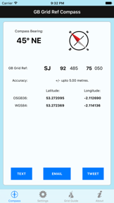
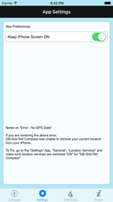
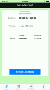
Never get lost. Find out your current location in GB Grid Reference Format.




Rivals
Who does Mike Irving compete with?
The rivals identified
Nemeses(2)

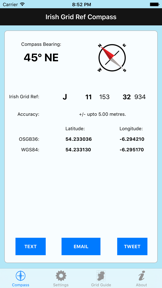
Both apps target outdoor enthusiasts requiring precise location tracking, though Irish Grid Ref Compass focuses on localized Irish grid references while GPS Tracks provides broader offline mapping and professional-grade tracking.


It provides coordinate conversion and management, serving as a technical utility for users needing precise location data.
Contenders(9)


Both apps target outdoor enthusiasts requiring navigation tools, creating a direct overlap in the utility category for hikers.


Both apps target outdoor navigation and precise location identification, forcing users to choose between specialized Irish National Grid references and a global three-word addressing system.


Both apps target outdoor enthusiasts requiring specialized navigation tools, though they serve distinct geographic regions: Ireland versus France.


Both apps target users seeking orientation and navigation tools, with the rival focusing on custom map creation while the source app provides standardized coordinate tracking.


Both apps target field professionals and outdoor users requiring precise GPS-based location data for documentation or navigation. They share a $0.99 entry price point, forcing a choice between specialized Irish grid navigation and GPS-stamped field photography.


Both apps serve UK-based field professionals requiring precise location data, though they diverge between coordinate-based orientation and rural address pinpointing.


Both apps target outdoor navigation and geographic precision at an identical 0.99 dollar price point, forcing users to choose between grid-based positioning and magnetic data.


Both applications target outdoor enthusiasts and hikers who require precise geographic coordinate data for navigation in remote environments.


Both apps target outdoor enthusiasts requiring geographic coordinate data for navigation, creating direct competition for users seeking reliable location tools.
Same space(28)

known for Qibla Finder 100% اتجاه القبلة
It uses GPS and compass technology to provide directional guidance, similar to the source app's core navigation function.

known for MapXplorer: Map Radar Navigate
It targets commuters and travelers with real-time route guidance, overlapping with the navigation utility of the source app.


It competes for the same outdoor enthusiast audience by gamifying exploration through community-hidden caches.


It provides field-specific navigation and tracking, targeting agricultural users who require precise location data without hardware.


It offers a privacy-focused alternative for outdoor navigation that relies on offline data, appealing to the same user base.


It transforms mobile devices into GPS units for outdoor activities, directly overlapping with the source app's utility.


It serves the same professional-grade backcountry navigation niche by offering high-fidelity topographic maps.


It offers specialized mapping layers for hunters, providing a similar navigation experience for outdoor environments.


Offers extensive trail databases and route planning for Alpine outdoor enthusiasts, overlapping with the source app's orientation utility.


It integrates compass navigation with environmental data, appealing to the same outdoor enthusiast audience as the source app.


It offers precise orientation and coordinate tracking for outdoor users, directly competing with the source app's navigation features.


It provides directional orientation using a compass interface, serving as a specialized navigation tool for a specific user group.


Provides professional topographic maps and tour planning for outdoor activities, acting as a comprehensive navigation alternative.


Offers specialized marine navigation data, serving a subset of the outdoor navigation market with bathymetry.


It provides high-fidelity terrain data for outdoor enthusiasts, serving as a professional-grade alternative for backcountry navigation.


It functions as a field utility for solar tracking, appealing to the same professional demographic requiring precise location data.


Provides real-time location tracking for family and friends, overlapping with the GPS monitoring functionality of the source app.


Focuses on personal safety and coordination between friends, serving a different navigation intent than the source app.


Tracks speed and altitude for outdoor activities, sharing the GPS-based monitoring utility of the source app.


A digital compass with a rustic aesthetic serves as a simple navigation tool similar to the source app.


It provides compass-based navigation and directional guidance, overlapping with the core utility of the source app.


Combines GPS navigation with land ownership data, serving the same outdoor navigation needs as the source app.


It serves as a benchmark mapping application for various outdoor activities, offering extensive map coverage similar to the source app.


It provides turn-by-turn navigation for drivers, competing for the same user segment seeking reliable location-based guidance.


Tracks marine vessels using GPS and AIS feeds, serving a specialized navigation niche distinct from land-based orientation.


It provides marine-specific navigation that shares the coordinate-based utility found in the source app.


Military-focused coordinate system support provides specialized navigation utility for outdoor activities.


Provides professional-grade topographic maps for hikers, serving as a high-fidelity alternative to the source app.
New entrants(2)


Offers global 3D mapping and flight tracking, serving a broader navigation and exploration audience than the source app.


It focuses on location sharing for friends and family, providing a social navigation utility that complements the source app.
The Analyst's Read
The bottom line on Mike Irving
Bottom line
The publisher maintains a stable of functional, single-purpose navigation tools that serve specific geographic niches. While the lack of recent development limits growth, the portfolio provides consistent, low-maintenance utility for a specialized user base.
Frequently asked questions
How many apps does Mike Irving publish?
What kind of apps does Mike Irving make?
What is Mike Irving's top app?
What fed this analysis
- Apps analyzed:
- 11
- With full intel:
- 0
- With overview:
- 11
- Website scraped:
- yes
- Social presence:
- no