p swagath
For professionals and hobbyists requiring offline access to Google Earth-compatible data, including land surveyors and field researchers.
 Kmz Viewer-Kmz Converter app


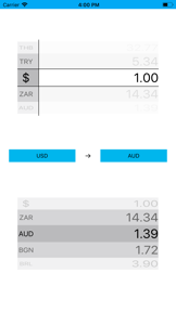





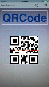
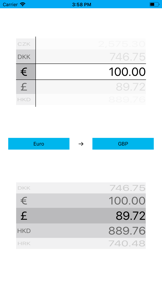






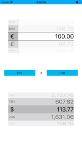

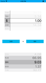


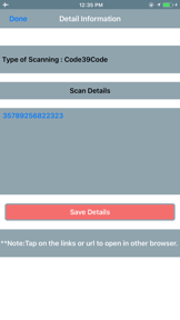
Snapshot
Who is p swagath?
Providing specialized navigation and geospatial utility tools for users managing KML and KMZ data files on mobile devices.
Target audience


Portfolio
Last updated

Kmz Viewer-Kmz Converter app
v2.0.3
1.1y ago
Publisher DNA
What defines p swagath?
Publisher DNA
Primary focus
Geospatial navigation and file conversion utilities
Scale
studio
Target audience
Professionals and hobbyists requiring offline access to Google Earth-compatible data, including land surveyors and field researchers.
Signature Patterns
- •Heavy reliance on paid pricing models for niche utility apps
- •Strong focus on offline-capable geospatial data management
- •Recurring development of file conversion and map visualization tools
- •Minimalist UI/UX design focused on functional utility over engagement
Portfolio momentum
With zero releases in the last six months and four of eleven apps identified as abandoned, the publisher is currently in a maintenance-only state.
Portfolio
What does p swagath ship?


Rivals
Who does p swagath compete with?
The rivals identified
Nemeses(5)


Both applications target outdoor enthusiasts needing to visualize location-based files on mobile maps, competing for the same utility-focused user base at a similar price point.


Both apps target outdoor enthusiasts needing to import and visualize GPX files for hiking and cycling, creating direct competition for the same user base.


Both apps target users seeking street-level imagery and navigation, but the rival offers a free, multi-provider model that directly challenges the paid utility model of the target app.


Both apps target users needing location tracking, but they diverge on utility: one focuses on technical GPS coordinate precision while the other prioritizes social tracking between contacts.


Both apps target land surveyors and outdoor professionals needing spatial measurement tools on satellite imagery.
Contenders(11)


Both apps provide interfaces for Google Street View imagery, competing for users seeking location exploration tools on mobile devices.


Both apps compete for users seeking location-tracking utilities, though they diverge between technical coordinate discovery and social-focused family monitoring.


Both apps target users seeking street-level navigation and location exploration, competing for the same user base through shared Google Street View functionality.


Both applications target users seeking street-level navigation and map exploration. The rival competes directly by offering a free, higher-rated alternative with integrated GPS and traffic features.


Both apps target users seeking virtual exploration of global landmarks via Street View, creating direct competition for the same travel-enthusiast audience.


Both apps target users seeking street-level navigation and location discovery via Google Maps, creating direct competition for the same user base.


Both apps target users seeking street-level imagery and location exploration, competing directly for the same utility-focused user base.


Both applications utilize KMZ files as a primary data format, creating a functional overlap for users who need to manage or visualize geographic location data.


Both apps target users seeking virtual exploration of global locations via Google Maps and Street View interfaces.


Both apps target users seeking street-level exploration and location discovery, competing for the same audience through overlapping map-based functionality.


Both applications target users needing to manage and view KMZ files offline, creating direct competition for the same utility-focused user base.
Same space(79)

Facilitates file format compatibility by converting KML files into various GPS-compatible formats like GPX and GeoJSON.


This app targets the same outdoor navigation audience but captures power users through subscription-gated offline mapping and professional-grade tracking.


GPX viewer 2 offers a similar utility-focused experience but differentiates through a subscription-free, ad-free model.


Targets the same navigation utility space by focusing on manual management of GPS exchange format files.


This app focuses on the same route planning and distance measurement needs as the source app.

known for Mipatek KML Viewer
Provides a legacy reference tool for GIS professionals needing to visualize KML/KMZ files against CAD drawings.


Serves as an all-in-one route management tool for outdoor enthusiasts requiring advanced analytics and format conversion.


Acts as a point-of-interest management tool for users who need to import and display various GPS file formats.


It targets the same outdoor navigation market by offering unlimited offline storage and 3D mapping for remote travel.


Bridges compatibility gaps between hardware devices and mapping software by converting between standard GPS formats.


Targets outdoor and professional users needing a low-cost tool for visualizing custom map data and image overlays.


Focuses on map management by allowing users to import and edit KML/KMZ files created via desktop browser tools.


It provides a similar lightweight utility for coordinate retrieval, focusing on simplicity for travel and field work.


This app provides similar land measurement and organization tools for farmers and property managers.


Panorama 360 focuses on the creation and stitching of user-generated content, offering a creative toolset that complements the consumption-focused nature of the source app.


This app targets the same professional and hobbyist demographic by emphasizing precision in distance and area calculation.


This app targets the same professional and educational audience by offering reverse geocoding and multi-map provider support.


Street View Maps provides a free alternative that emphasizes specific location categories like museums and hospitals, appealing to users seeking specialized exploration.


This app competes for the same professional and traveler audience by offering a broad range of coordinate formats.


This app introduces AI-powered insights and guided tours, shifting the value proposition from simple navigation to an educational travel guide.


Marea competes for the same professional contractor and farmer audience by offering integrated project cost estimation.


Avenza Maps targets professional field workers who require specialized offline map imports, contrasting with the manual GPX file management focus of the source app.


This app provides a similar suite of GPS measurement tools for land management and construction surveying.


This app competes for the same hiking and climbing audience by offering specialized session analytics and battery-optimized recording.


Planimeter targets the same professional surveying audience but utilizes a different monetization strategy.


Targets a more specialized professional audience within the same geospatial utility space.


It serves the same outdoor enthusiast segment as the source app but adds environmental sensor data and photo-stamping capabilities.


This app acts as a multi-functional travel planner, including niche tools like area calculators and translators alongside standard navigation features.


Addresses the need for quick route visualization for hikers and cyclists without requiring account sign-ups.


Live Satellite View Earth Maps focuses on voice-guided navigation to help commuters avoid traffic, positioning itself as a practical tool for daily travel.


It serves the same coordinate-identification audience but creates friction by gating core search features behind a paywall.


Guru Maps provides an alternative for users seeking broader offline navigation and turn-by-turn guidance rather than just GPX file visualization.


This app serves the same outdoor activity tracking audience by integrating barometer sensors for elevation precision.


It competes for the same outdoor adventure market by offering visual trip recording and 3D flyover capabilities.


It serves a similar navigation-utility role but expands into local discovery and speed monitoring for road-trippers.


Street Navigation focuses on walking-specific utility, linking map and street views to assist users in checking the appearance of their walking routes.


This app expands the measurement utility beyond maps to include AR-based surface calculation for indoor and outdoor spaces.


It serves the same minimalist coordinate-tracking audience but struggles with functional reliability compared to the source app.


Earth Map provides a freemium navigation experience that includes 3D city rendering, though it suffers from a lack of recent updates compared to active competitors.


This app leverages embedded HD video from webcams to offer a dynamic, real-time view of global locations that static street view cannot match.


GPX-Viewer provides a direct alternative for file management but struggles with the same stability issues as the source app.


This app provides a similar set of GPS-based measurement tools for land and route management.


This app provides a similar GPS-based measurement utility for land and property lines, acting as a direct functional peer.


This app is a direct competitor in the land surveying space, offering extensive coordinate system support.


It provides a similar basic location utility focused on one-touch address and coordinate determination.


This app provides similar coordinate tracking for travelers but differentiates through photo-centric documentation features.


Globe 3D uses Apple MapKit to provide a high-fidelity 3D globe experience, offering a more polished visual interface than standard Google-based street view apps.


This app targets the same coordinate-capture audience by offering iCloud synchronization for history management.


This app focuses on neighborhood previewing, helping users understand building entrances and surroundings before visiting, which serves a practical utility niche.


Tractor GPS targets the same agricultural segment but focuses on active field guidance rather than static measurement.


OS Maps integrates community-sourced trail data, offering a broader discovery experience than the source app's manual file management.


This app targets the same address-lookup audience by integrating traffic overlays and 3D terrain views.


FieldCalc serves the same agricultural and surveying audience as the source app but operates as a free, ad-supported alternative.


GeoMark serves the same user base of farmers and real estate professionals by combining GPS with satellite imagery.


GPS Tracker focuses on social location sharing and safety, serving a different use case than the technical GPX file management of the source app.


This app differentiates itself by offering curated virtual tours and live streams, providing a structured travel experience rather than just a search-based utility.


Distance Measure serves the same casual surveying audience but lacks the offline capabilities of the source app.


Topo GPS functions as a full-featured GPS device replacement, offering more specialized topographic map content than the source app.


This app emphasizes connected panoramic experiences, such as photo paths, which offer a more continuous exploration experience than static street view points.


This app targets users interested in high-resolution satellite imagery and 3D terrain representations, providing a more immersive visual experience than the source app.


This app targets the same property-focused audience by integrating financial calculations into land measurement.


MAPAS differentiates by aggregating thousands of live camera feeds, providing a real-time visual layer that supplements traditional street view imagery.


This app targets users who need to convert their device into a compass and navigation tool, focusing on local area details and direction finding.


This app serves the same land measurement market with a focus on ease of use for non-technical users.


This app targets the same field-professional audience but focuses on workflow automation and custom URL generation.


This app shifts the focus from individual location data to social safety and proximity monitoring for families.


Gaia GPS competes by offering professional GIS tools that exceed the basic viewing capabilities of the source app.


This app provides a broad set of map styles and route-finding capabilities, acting as a general-purpose navigation tool for local exploration.


Serves outdoor and military users requiring coordinate system support beyond standard KML/KMZ file conversion.


This app serves as a comprehensive GPS toolset, combining satellite imagery with traffic updates to assist in trip planning and journey tracking.


Ways Map integrates measurement tools and GPS coordinates, positioning itself as a comprehensive utility for planning and land assessment.


GPX Viewer PRO offers a similar lightweight utility but faces challenges with cross-platform feature parity.


Targets field professionals with high-precision coordinate translation, though it relies on aggressive monetization that risks user churn.


Measure Area provides a similar spatial estimation utility but focuses on AR-based indoor projects.


This app provides a similar set of land survey tools with added cloud synchronization for professional records.


This app serves as a direct visual navigation alternative that leverages a free, ad-supported model to capture a larger user base than the paid source app.


GStreet offers a freemium model that provides a broader feature set, including live camera feeds and traffic data, which contrasts with the paid-only model of the source app.


It serves the same outdoor utility market by combining altitude tracking with a built-in compass and barometer.


This app attempts to solve the same distance estimation problem but fails due to technical obsolescence.
New entrants(6)


Offers a simple, ad-free utility for viewing KML/KMZ placemarks and polygons on a map.


This app provides specialized land measurement tools tailored to specific legal and inheritance requirements.


This app uses a custom-built engine to deliver a split-screen UI, aiming to provide a high-performance experience for land measurement and route planning.


Enables conversion of professional Esri shapefiles into KMZ format for use in Google Earth and other mapping applications.


This app serves the same professional surveying and construction audience with a focus on historical record management.


This app serves the same coordinate-tracking audience but adds weather data and movement tracking to its utility set.
The Analyst's Read
The bottom line on p swagath
Bottom line
The publisher maintains a legacy portfolio of technical utilities that serve a specific, low-volume user base. Without recent updates or a clear monetization strategy beyond one-time paid downloads, the portfolio appears to be in a long-term decline.
Frequently asked questions
How many apps does p swagath publish?
What kind of apps does p swagath make?
What is p swagath's top app?
What fed this analysis
- Apps analyzed:
- 11
- With full intel:
- 0
- With overview:
- 11
- Website scraped:
- yes
- Social presence:
- yes