


Renan Rafael Bertoldo
 Drone Weather Forecast









Publisher DNA
What defines Renan Rafael Bertoldo?
AI intelligence is not yet available for Renan Rafael Bertoldo. The portfolio data below is up to date.
Portfolio
What does Renan Rafael Bertoldo ship?
Apps
4 apps analysed
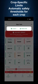
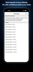
Localized wind data at altitude provides safety
- Comprehensive weather data including wind speed at altitude provides essential safety for drone flight planning
- Occasional login failures and loading errors prevent users from accessing weather data after recent updates


Analysis in progress

Offline forecast caching ensures utility in remote rural environments.
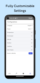
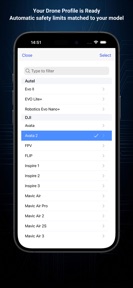
- Equipment-specific presets for 18 drone models create high switching costs.
Distributed across 10 markets, strongest in Europe.
Based on 3 of 4 apps with localized market data, more coverage rolling in as scans complete · last scanned .
Americas (3)
- United States3 / 3
- Brazil1 / 3
- Mexico1 / 3
Europe (6)
- Germany2 / 3
- Italy2 / 3
- Netherlands2 / 3
- France1 / 3
- Portugal1 / 3
›+1 more europe market
- Spain1 / 3
Asia-Pacific (1)
- Japan2 / 3
Core markets (3/3 apps)
User Sentiment
How do users feel about their apps?
1
Positive apps
0
Neutral / mixed
0
Negative apps
85/100
Avg sentiment score
Rivals
Who does Renan Rafael Bertoldo compete with?
The rivals identified
Nemeses(1)

Both applications target drone pilots requiring environmental data for flight planning, creating direct competition for the same user base.
Contenders(5)


Both applications serve drone pilots by providing environmental data for flight planning, creating direct competition for the same user base.


Both applications target drone pilots with pre-flight safety tools, creating direct competition for users seeking weather and environmental data for flight planning.


Both applications target the same UAV pilot demographic for flight planning, creating direct competition for users seeking environmental and regulatory data.


Both applications target UAV operators with weather and GPS signal stability data, creating direct competition for flight planning utility.


Both applications target UAV pilots with environmental data for flight planning, creating direct competition for the same user base seeking mission safety tools.
Same space(19)


AuroraMe provides the same geomagnetic and sky-condition data as DroneWeather, specifically for users planning outdoor photography missions.


Aurora Forecast provides the same geomagnetic monitoring as DroneWeather, focusing on aurora visibility for global users.


Weatherzone provides the same localized forecasting as DroneWeather but adds professional climate pattern analysis.


ForeFlight is an aviation-grade navigation tool that provides the same weather visualization as DroneWeather but for manned aircraft.


UAV Forecast is a direct competitor to DroneWeather, providing the same altitude-specific wind and GPS data for drone pilots.


Weather ۬ provides the same real-time atmospheric data and radar tracking as DroneWeather for general flight planning.


My Aurora Forecast shares the niche, specialized utility focus of DroneWeather by providing geomagnetic data essential for drone flight stability.


NOAA Weather Radar Live Map provides the same radar and barometer data as DroneWeather for real-time flight safety.


Weatherly offers standard weather forecasting and current condition monitoring similar to the basic utility of DroneWeather.


Mountain-Forecast.com serves the same high-altitude, safety-conscious audience as DroneWeather but focuses on mountain terrain.


Weather Live° targets the same commuter and outdoor planner audience as DroneWeather but focuses on visual widget-based clarity.


NOAA Radar & Weather Forecast provides the same real-time radar and meteorological data as DroneWeather for general flight planning.


This app provides generic weather forecasting that overlaps with the standard meteorological data found in DroneWeather.


Ventusky provides the high-resolution, multi-model visualization that advanced drone pilots require for complex flight planning.


WeatherBug provides the same hyper-local weather data as DroneWeather but utilizes a proprietary hardware network for higher accuracy.


Weawow appeals to the same enthusiast demographic as DroneWeather by offering a clean, ad-free interface for comparing weather data sources.


Windfinder shares the high-precision wind data requirement of DroneWeather, serving the same outdoor sports and aviation-adjacent user base.


Windy.app provides the same wind and wave data as DroneWeather, serving the same outdoor sports and aviation-adjacent audience.


Windy.com serves the same professional aviation audience as DroneWeather but provides significantly deeper meteorological data through multi-model comparison.
New entrants(1)


Weather & Rain Radar Forecast provides the same real-time radar and forecasting as DroneWeather for general planning.
