



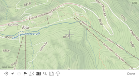


Theodolite is a professional-grade navigation and AR viewfinder that integrates a compass, inclinometer, rangefinder, and GPS into a single tool. Originally released in 2009, it enables users to capture geo-overlay photos and movies with embedded metadata for field documentation. It is widely utilized by professionals for land measurement, surveying, and tactical navigation.
Overview · Full Intel report in progress
Product velocity
Unknown
Daily rank 🇺🇸
#21
▼6Navigation · paid
Sentiment
4.7
899 reviews
Nemesis

Avenza Maps: Offline Mapping
The App DNA
What makes this app unique?
For Surveyors, geologists, engineers, first responders, and outdoor professionals requiring precise field data collection.
What does it look like?
Key features
Displays geographical data, angle markings, and project notes directly over the camera viewfinder.
Combines a compass, two-axis inclinometer, rangefinder, GPS, and navigation calculator in one interface.
Records photos and movies with 2X-8X zoom while embedding geographical and project metadata into the file.
How much does it cost?
Velocity
Who built it?
Craig Hunter
9 apps tracked · Navigation
 Pro Altimeter - Barometric+GPS
 Pro Altimeter for Watch
 Theodolite for Watch
 Nav Camera
 Pro Compass for Watch
 Pro Compass
 Theodolite HD
 Wx for iPhone
User Sentiment
What do users think recently?
How are ratings & reviews evolving?
Not enough recent reviews to extract reliable themes yet.
Read the full review analysisCompetition
Competitive landscape for Theodolite
How's the Navigation market?
The rivals identified
By Avenza Systems Inc.
Both apps target professional field workers in surveying and forestry who require high-precision navigation and data collection tools while operating in remote environments without cellular connectivity.
- Theodolite provides integrated AR data overlays for direct field measurements, whereas Avenza relies on external map file imports.
- Avenza operates a freemium model with subscription-gated custom imports, while Theodolite maintains a single paid price point for all features.
- Avenza offers a commercial map store for professional-grade assets, while Theodolite focuses on native sensor-based data capture.


Unlock the head-to-head verdict: where this rival wins, and where it loses.
Access the full report for freeThe Analyst's Read
Key takeaways for Theodolite
Where is it heading?
Bottom line
Theodolite is a long-standing, specialized utility designed for high-precision field data collection and augmented reality navigation.
Report last updated