
Authai Yaprasat
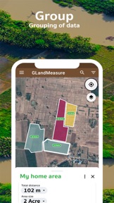
 GLand: GPS Field Area Measure


Publisher DNA
What defines Authai Yaprasat?
AI intelligence is not yet available for Authai Yaprasat. The portfolio data below is up to date.
Portfolio
What does Authai Yaprasat ship?
Apps
1 app analysed
GPS-based area calculation provides a low-barrier entry for casual property owners
- Accurate GPS land measurement tools provide reliable data for professional surveyors and real estate agents
- Inability to share measurement files between different mobile devices hinders collaborative field work for teams
Distributed across 10 markets, strongest in Asia-Pacific.
Based on 1 of 1 app with localized market data · last scanned .
Americas (3)
- Brazil1 / 1
- Mexico1 / 1
- United States1 / 1
Europe (3)
- Germany1 / 1
- Portugal1 / 1
- Spain1 / 1
Asia-Pacific (4)
- India1 / 1
- Indonesia1 / 1
- South Korea1 / 1
- Vietnam1 / 1
Core markets (1/1 apps)
User Sentiment
How do users feel about their apps?
1
Positive apps
0
Neutral / mixed
0
Negative apps
85/100
Avg sentiment score
Rivals
Who does Authai Yaprasat compete with?
The rivals identified
Nemeses(1)

Both apps target outdoor users requiring location data, but GLand focuses on professional land surveying and area calculation while the rival focuses on coordinate identification.
Same space(20)


Provides truck-specific navigation, serving as a professional routing tool for the source app's logistics-focused users.


Provides high-frequency location data for specialized hardware, serving as an advanced utility for the source app's power users.


Focuses on voice-guided navigation, providing a general-purpose routing tool for the source app's users.


Offers specialized vehicle-dimension routing, serving as a safety-focused navigation tool for the source app's mobile users.


Serves the same mobile-first navigation user base but focuses on cycling-specific infrastructure.


Offers satellite-based location exploration that complements the source app's land-mapping features.


Offers navigation and speed camera alerts, serving as a safety-focused routing tool for the source app's users.


Targets backcountry users who require land-ownership data, overlapping with the source app's land-surveying audience.


Provides general routing for daily travel, acting as a secondary navigation tool for the source app's user base.


Offers speed and distance tracking, serving as a utility tool for the source app's mobile users.


Offers topographic mapping for outdoor activities, serving as a specialized navigation tool for the source app's field users.


Offers parcel-level data that serves as a professional alternative to the source app's manual measurement tools.


Provides professional-grade parcel data that complements the source app's field-measurement capabilities.


Provides general-purpose navigation that complements the specialized land-surveying tasks of the source app.


Provides general navigation and routing, acting as a secondary tool for the source app's users.


Provides real-time speed monitoring, acting as a simple utility for the source app's mobile users.


Provides satellite-based navigation and exploration, serving as a visual tool for the source app's users.


Offers professional-grade truck navigation, providing a specialized routing tool for the source app's large-vehicle users.


Targets recreational users requiring precise navigation data, similar to the source app's field-surveying utility.


Direct competitor in geospatial measurement, providing similar area and distance calculation via GPS markers.
