


Gerry Shaw
For niche professionals and hobbyists, including birders, outdoor adventurers, and medical students seeking ad-free, offline-capable tools.
 Birds Near Me


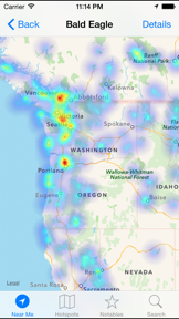


Snapshot
Who is Gerry Shaw?
Developing privacy-focused, ad-free utility tools for specialized professional and hobbyist niches.
Target audience


Portfolio
Free 3Last updated

Birds Near Me
v1.5
7.8y ago
Publisher DNA
What defines Gerry Shaw?
Publisher DNA
Primary focus
Privacy-centric utility and reference tools
Scale
indie
Target audience
Niche professionals and hobbyists, including birders, outdoor adventurers, and medical students seeking ad-free, offline-capable tools.
Signature Patterns
- •Strict adherence to privacy-first models with no ads or tracking
- •Focus on offline-capable utilities for specialized professional or hobbyist use cases
- •Minimalist UI/UX prioritizing functional utility over social or gamified elements
- •Niche category diversification including Medical, Navigation, and Developer Tools
Portfolio momentum
The publisher has released 0 updates in the last 6 months and 3 out of 4 apps are currently classified as abandoned.
Portfolio
What does Gerry Shaw ship?
Apps
4 apps analysed


Single-market publisher, every app ships only to United States.
Based on 1 of 4 apps with localized market data, more coverage rolling in as scans complete · last scanned .
Americas (1)
- United States1 / 1
Core markets (1/1 apps)
Rivals
Who does Gerry Shaw compete with?
The rivals identified
Nemeses(2)

Both apps target outdoor enthusiasts and professionals requiring offline GPS navigation, with Avenza Maps competing directly for the same user base through its offline-first architecture.


Both apps target individuals seeking emergency response training, with AED Sim focusing on specific CPR simulation and First Aid Made Simple offering broader scenario-based emergency practice.
Contenders(11)


Both apps target iOS users requiring navigation and location data, though Land Nav focuses on offline topographic utility while iMaps+ relies on Google Maps data for urban transit and commercial search.


Relief Maps competes with Land Nav by offering overlapping offline 3D topographic mapping and GPX route planning for mountain-focused outdoor activities.


Both apps target outdoor enthusiasts and field professionals requiring offline-capable GPS navigation and waypoint logging for remote environments.


Both apps compete for users requiring navigation tools on iOS, with overlapping utility in route planning and location tracking for outdoor and travel contexts.


Both apps target the medical education and emergency response training market, competing for the limited time and attention of students and healthcare professionals.


onX Backcountry competes directly with Land Nav's offline mapping capabilities for outdoor navigation.


Both applications target outdoor enthusiasts with privacy-focused, offline-capable navigation tools that remove the need for constant cellular connectivity.


Both apps compete for navigation users, with Land Nav serving outdoor enthusiasts and Game Maps IRL targeting commuters through visual gamification.


Both apps target outdoor enthusiasts requiring offline navigation and coordinate tracking, creating direct competition for users seeking reliable backcountry tools.


Both apps target outdoor navigation with offline GPS capabilities, creating direct competition for users seeking reliable wayfinding in remote areas without cellular service.


PatrolNav competes with Land Nav by offering offline-first navigation utility, though it pivots toward law enforcement-specific location data like highway mile markers and squadmate tracking.
Same space(35)


Focuses exclusively on metronome training for CPR, providing a simplified version of the timing features in AED Sim.


Argo Navigation provides marine-specific mapping that serves as a specialized alternative to Land Nav's land-based tools.


BaseMap targets the same outdoor enthusiast audience as Land Nav by focusing on land-ownership data.


CalTopo provides professional-grade backcountry mapping tools that overlap with Land Nav's core navigation suite.


Functions as a remote-controlled patient monitor for simulation, pairing with the training scenarios found in AED Sim.


Uses video to demonstrate AED operation, serving as an informational tool for bystanders and professionals.


Integrates with physical hardware to provide diagnostic data during exams, complementing training tools.


Hunting Points offers similar field navigation and land-boundary tracking as Land Nav for rural users.


Provides metronome cues and event logging for emergency responders, overlapping with the timing features of AED Sim.


Provides a high-volume library of clinical scenarios for medical professionals to practice decision-making.


Garmin Explore acts as a hardware-linked companion that competes with Land Nav's offline navigation utility.


Topo Maps+ provides professional-grade topographic analysis that serves as a high-end alternative to Land Nav.


GOHUNT serves a specific hunting demographic that requires the same land-boundary data Land Nav provides.


Detector Maps provides geological mapping for prospectors, serving a niche similar to Land Nav's professional tools.

known for MapXplorer: Map Radar Navigate
MapXplorer acts as a general-purpose navigation utility that overlaps with Land Nav's mapping functionality.


Manages AED program compliance and inspections, serving the administrative side of the AED ecosystem.


Simulates ultrasound protocols for medical professionals, expanding the simulation scope beyond basic life support.


Acts as a simple metronome for bystander CPR, targeting the general public rather than the professional training audience.


Debriefs CPR performance using data from external hardware, providing a high-fidelity feedback loop for training.


Supplies vetted resuscitation protocols for bedside use, targeting the same emergency response professionals.


Focuses on certification exam preparation, targeting students and professionals seeking to pass life support tests.


Locates physical AEDs using open-source data, providing a utility that complements the training provided by AED Sim.


Provides quick access to ILCOR algorithms for emergency professionals, acting as a reference rather than a simulator.


Tractor GPS provides field navigation for agriculture, mirroring Land Nav's focus on precise offline tracking.


Supports emergency professionals with precise medication dosing, acting as a field reference for the same clinical audience.


Serves the same clinical audience but focuses on automated ECG interpretation rather than CPR training.


Offers gamified clinical education across 20+ specialties, targeting the same simulation-focused user base.


Spartan Forge targets serious hunters with advanced mapping technology similar to Land Nav's professional tools.


Provides video demonstrations for emergency procedures, serving as a visual training aid for the same user base.


TruckMap provides commercial-grade routing that serves as a specialized alternative to Land Nav's general outdoor focus.


Track N Trail offers specialized game recovery tools that complement the mapping features found in Land Nav.


Trucker Guide offers specialized navigation for CDL holders, contrasting with Land Nav's recreational outdoor utility.


Hammer provides truck-specific routing that serves as a commercial alternative to Land Nav's outdoor navigation.


Provides CPR guidance specifically for veterinary professionals, applying the same simulation logic to a different species.


Wavve Boating offers marine navigation with custom charts, serving as a specialized peer to Land Nav.
New entrants(3)


Logs and tracks CPR performance for EMS professionals, providing analytics for training improvement.


EarthScope provides general location tools that overlap with Land Nav's basic navigation and mapping features.


RouteXL provides vehicle-specific routing that contrasts with Land Nav's general-purpose outdoor navigation.
The Analyst's Read
The bottom line on Gerry Shaw
Bottom line
Gerry Shaw is a specialized indie developer with a clear commitment to privacy-centric utility, though the portfolio currently shows signs of stagnation. Their positioning serves as a case study in high-utility, low-maintenance niche tools that prioritize user trust over aggressive monetization.
Frequently asked questions
How many apps does Gerry Shaw publish?
What kind of apps does Gerry Shaw make?
What is Gerry Shaw's top app?
In how many countries are Gerry Shaw's apps available?
What fed this analysis
- Apps analyzed:
- 4
- With full intel:
- 0
- With overview:
- 4
- Website scraped:
- yes
- Social presence:
- no