


Tirin
For general mobile users seeking specific, task-oriented tools for weather tracking, travel planning, and personal productivity.
 Barometer & Altimeter Pro


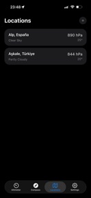

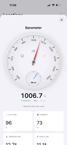


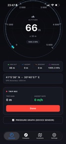


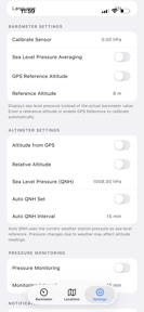








Snapshot
Who is Tirin?
Providing utility-focused mobile tools for daily life, ranging from environmental monitoring to personal organization.
Target audience


Portfolio
Free 31Last updated

Barometer & Altimeter Pro
v3.0.0
3mo ago
Publisher DNA
What defines Tirin?
Publisher DNA
Primary focus
Utility and lifestyle mobile applications
Scale
indie
Target audience
General mobile users seeking specific, task-oriented tools for weather tracking, travel planning, and personal productivity.
Signature Patterns
- •Consistent free-to-use pricing model across all top titles.
- •Focus on single-purpose utility tools rather than complex feature sets.
- •High frequency of updates to maintain app relevance in store search.
- •Visual-first design approach, such as retro LCD interfaces or 3D simulations.
Portfolio momentum
Released 44 updates across 10 apps in the last 6 months, indicating a highly active development cycle.
Portfolio
What does Tirin ship?
Apps
31 apps analysed


Analysis in progress


Analysis in progress
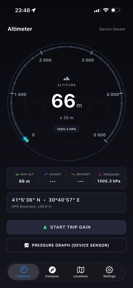
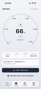
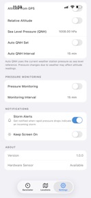
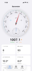
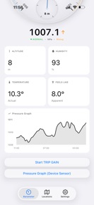
Transform your device into a powerful offline barometer and altimeter.

Analysis in progress
Distributed across 12 markets, strongest in Europe.
Based on 5 of 31 apps with localized market data, more coverage rolling in as scans complete · last scanned .
Americas (3)
- United States5 / 5
- Brazil2 / 5
- Mexico2 / 5
Europe (7)
- France2 / 5
- Germany2 / 5
- Italy2 / 5
- Netherlands2 / 5
- Portugal2 / 5
›+2 more europe markets
- Spain2 / 5
- Sweden2 / 5
Asia-Pacific (2)
- Japan2 / 5
- South Korea2 / 5
Core markets (5/5 apps)
Rivals
Who does Tirin compete with?
The rivals identified
Nemeses(1)

Both apps target outdoor planners needing localized weather data, but Weather Live° captures a general audience while Anemometer: Wind Speed Tracker focuses on activity-specific safety for drone pilots and sailors.
Contenders(9)


Both apps target drone pilots requiring wind data for flight safety, but UAV Forecast captures the professional segment through altitude-specific weather and regulatory alerts. Anemometer: Wind Speed Tracker competes by offering a free, accessible alternative to the subscription-gated utility of the rival.


Both apps target outdoor enthusiasts requiring localized wind data for activity planning, creating direct competition for the same user base.


Both apps target outdoor enthusiasts requiring environmental monitoring, though Anemometer focuses on localized wind safety while Zoom Earth provides broad satellite-based situational awareness.


Both apps compete for the same outdoor planning audience by providing location-based weather data, though they prioritize different data types: wind safety versus radar visualization.


Both apps compete for outdoor enthusiasts planning activities based on localized weather conditions, creating direct overlap in utility for users requiring wind and meteorological data.


Both apps target outdoor enthusiasts who require precise wind and weather data for activity planning. Ventusky competes by offering professional-grade meteorological visualization that overlaps with the wind tracking utility of Anemometer.


Both apps target outdoor enthusiasts requiring localized wind data, creating direct competition for users seeking activity-specific weather planning.


Both apps target outdoor enthusiasts requiring localized wind data, creating direct competition for users planning nautical or wind-dependent activities.


Both apps target outdoor enthusiasts and professionals who require precise wind data for activity planning. Windy.com competes by offering professional-grade multi-model visualization that overlaps with the core utility of Anemometer.
Same space(20)


AccuWeather provides hyperlocal data that complements Anemometer's wind tracking by offering minute-by-minute precipitation insights.


Weather Plus provides offline-capable weather tracking, offering a utility-focused alternative to Anemometer's real-time wind data.


Drone Map & UAV Forecast provides airspace and weather data for drone pilots, overlapping with the safety-focused utility of Anemometer.


Weather NOW provides visual 3D Earth data that serves as a high-fidelity companion to Anemometer's wind tracking.


WeatherPro provides graphical environmental metrics that complement the wind-specific data provided by Anemometer.


NOAA Live Weather Radar provides severe weather alerts that act as a safety utility for users who rely on Anemometer for wind data.


Drone App provides altitude-specific wind data, making it a direct technical competitor to Anemometer for drone-focused users.


Storm Tracker focuses on severe weather monitoring, providing a safety-critical layer for users who also track wind conditions via Anemometer.


NOAA: Weather Radar & Forecast provides government-sourced severe weather alerts, serving as a safety-critical companion to Anemometer.


Weatherly provides generalized weather forecasting that acts as a broad-scope companion to Anemometer's specialized wind speed focus.


meteoblue provides high-precision meteorological data for professional environments, overlapping with Anemometer's target audience of outdoor professionals.


RainViewer provides professional-grade radar data that serves as a technical supplement to Anemometer's wind-specific tracking.


Drone UAV Fly Forecast provides a good-to-fly threshold for drone pilots, serving as a direct alternative to Anemometer's safety indicators.


Dronecast serves the same drone-pilot audience as Anemometer by providing wind and gust speeds at various altitudes.


Storm Radar serves the same high-intent weather tracking audience as Anemometer but focuses on large-scale storm intelligence rather than localized wind metrics.


Aurora Forecast targets the same niche outdoor enthusiast demographic as Anemometer but focuses on space weather rather than terrestrial wind.


Weather forecast & NOAA Radar provides granular hourly data that complements Anemometer's wind-specific focus for daily planning.


weather 24 provides a general 16-day forecast that serves as a broad-market alternative to Anemometer's specialized wind tracking.


Weather & Radar offers specialized modules for winter sports and coastal conditions, directly appealing to the same active user base as Anemometer.


Wisuki integrates community session logging with wind and wave data, providing a social layer to the technical wind tracking found in Anemometer.
New entrants(2)


Weather & Rain Radar Forecast provides interactive maps for wind and temperature, acting as a broad-scope alternative to Anemometer.


Weather Live Radar provides detailed environmental metrics that complement the wind-specific tracking found in Anemometer.
The Analyst's Read
The bottom line on Tirin
Bottom line
Tirin is an aggressive, high-velocity publisher currently using a portfolio of simple utilities to maintain store presence while pivoting toward a community-based social platform. Their success depends on their ability to convert these utility-app users into members of their new interest-based digital communities.
Frequently asked questions
How many apps does Tirin publish?
What kind of apps does Tirin make?
What is Tirin's top app?
In how many countries are Tirin's apps available?
What fed this analysis
- Apps analyzed:
- 10
- With full intel:
- 0
- With overview:
- 10
- Website scraped:
- yes
- Social presence:
- no
