
Report updated Jun 24, 2026

Harz is an established travel app that is free with in-app purchases. With a 5.0/5 rating from 2 reviews, it shows polarized user reception.

What is Harz?

Harz is a regional travel and navigation app for hikers and mountain bikers in the Harz mountains, available on iOS and Android.

Users hire Harz for specialized, curated access to local trail networks and stamping points that generic global platforms lack, reducing the effort required to plan regional excursions.

Current Momentum

v4.0 · 11mo ago

Maintenance
  • Ships technical bug fixes only.
  • Last major update occurred 2022.

Active Nemesis

AllTrails: Hike, Bike & Run

AllTrails: Hike, Bike & Run

By AllTrails

Other Rivals

komoot - hike, bike & run
Wikiloc - Trails of the World
bergfex: Hiking & Tracking
Mapy.com: Offline maps & GPS
Recreation.gov
National Park Service

7-Day Rank Pulse 🇺🇸

Travel

No ranking data

Rating Pulse 🇺🇸

What makes this app unique?

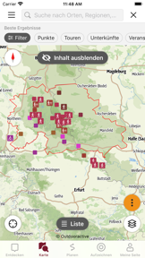
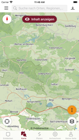
What Does It Look Like?

What Are The Key Features?

Regional Content DatabaseDifferentiator

Access to curated local routes and stamping points for the Harzer Wandernadel.

Offline Map StorageDifferentiator

Download map data for use without cellular connectivity.

Voice NavigationStandard

Turn-by-turn audio guidance for hiking and cycling.

How much does it cost?

Freemium
  • Free tier with basic maps and tour suggestions
  • Outdooractive Pro subscription for offline maps and ad-free experience

Gates offline utility and specialized map layers behind a Pro subscription to monetize high-intent outdoor users.

Who Built It?

Outdooractive AG app icon 1
Outdooractive AG app icon 2
Outdooractive AG app icon 3
Outdooractive AG app icon 4

Outdooractive AG

(87.4K)

Providing outdoor enthusiasts and professional guides with high-precision navigation, route planning, and verified trail data for global exploration.

Portfolio

13

Apps

Free 12
Travel42%
Navigation17%

What other apps does Outdooractive AG make?

Outdooractive

Outdooractive

Travel·4.5(72.2K)
View Intel →
World Heritage in the Harz

World Heritage in the Harz

App
Club Vosgien – Hike & Bike

Club Vosgien – Hike & Bike

App
Drauradweg

Drauradweg

App
Amazon of Europe Bike Trail

Amazon of Europe Bike Trail

App
Delius Klasing: Rad Touren

Delius Klasing: Rad Touren

App

Explore the full Outdooractive AG report

Portfolio breakdown, audience, momentum, and every app published by Outdooractive AG.

Go deeper

What is the competitive landscape for Harz?

How's The Travel Market?

How does it evolve in the Travel market?

Harz occupies a niche regional position in the Travel category, relying on curated local content rather than the global scale of competitors like AllTrails. The lack of recent updates and low review volume on current platforms signals a maintenance-mode posture that limits growth against active, community-driven rivals.

Rank progression

1 active ranking tracked, 30-day window

The rivals identified

Nemeses(1)

With over 1 million reviews and a high-velocity release cadence, AllTrails dominates the global outdoor navigation market with a massive user-generated content flywheel.

Differentiators

  • Massive community-driven trail database provides real-time condition updates that local-focused apps cannot match.
  • Aggressive release cycle of 21 updates in six months ensures rapid feature iteration and bug squashing.
  • Freemium model with a robust subscription tier locks users into a comprehensive cross-platform ecosystem.

Head to head

The target app must double down on its regional authority and specialized local content to defend against AllTrails' superior global scale and community engagement.

Contenders(3)

bergfex: Hiking & Tracking icon

bergfex GmbH

4.1(11.4K)

A direct regional competitor with deep roots in the Alpine and German-speaking outdoor market.

Differentiators

  • Deep integration with regional tourism data provides highly accurate information on mountain huts and lift status.
  • Specialized focus on winter sports and ski touring provides a seasonal advantage over general hiking apps.
Wikiloc - Trails of the World icon

Wikiloc Outdoor SL

4.5(147.9K)

Wikiloc serves as a major repository for user-uploaded GPS tracks, competing directly on trail variety.

Differentiators

  • Unrivaled volume of user-uploaded GPS tracks provides granular coverage for niche and off-the-beaten-path routes.
  • Live tracking feature allows friends and family to monitor progress, enhancing safety for solo adventurers.
komoot - hike, bike & run icon

komoot GmbH

3.8(377.1K)

A primary competitor in the European market, komoot excels at sport-specific routing and community-driven discovery.

Differentiators

  • Advanced sport-specific routing algorithms differentiate between road cycling, mountain biking, and hiking requirements.
  • Strong focus on community-curated 'Highlights' allows users to discover hidden gems through social validation.

Same space(1)

Mapy.com: Offline maps & GPS icon

Seznam.cz a.s.

4.1(249.6K)

A powerful navigation-first tool that excels in offline map rendering and detailed topographical data.

Differentiators

  • Superior offline map rendering engine allows for high-detail navigation without any cellular data connection.
  • Extensive database of points of interest specifically tailored for European outdoor exploration and tourism.

New entrants(2)

National Park Service icon

National Park Service

4.9(95.9K)

An emerging threat that leverages official authority to provide high-trust, curated content for major outdoor destinations.

Differentiators

  • Curated, high-quality content directly from park rangers provides a level of trust and accuracy.
  • Focus on accessibility and educational content differentiates it from purely utility-driven navigation tools.
Recreation.gov icon

Booz Allen Hamilton Inc.

4.9(341.9K)

Rapidly expanding its footprint with frequent updates, this app bridges the gap between navigation and government-backed facility booking.

Differentiators

  • Direct integration with government booking systems allows users to reserve campsites and permits within the app.
  • Official status provides exclusive access to real-time park alerts and facility status updates.

Compare Harz against every rival

All rivals in one side-by-side table: identity, store metrics, ratings & sentiment, and strategic intel, plus a head-to-head page for each.

Go deeper

The outtake for Harz

Strengths to defend, gaps to attack

Core Strengths

  • Regional partnerships establish category authority for Harz-specific tourism
  • Apple Health integration anchors user fitness history within the app
  • Offline storage provides utility in remote mountain regions

Critical Frictions

  • Zero Android rating count suggests poor visibility
  • Three-year gap since last major iOS update
  • Reliance on static content limits long-term engagement

Growth Levers

  • Integrate real-time trail condition reporting
  • Expand B2B partnerships to include local accommodation booking
  • Leverage regional tourism data for seasonal event alerts

Market Threats

  • AllTrails' rapid release cycle erodes static app utility
  • Global competitors' social features siphon user-generated content
  • Lack of updates risks platform-level deprecation

What are the next best moves?

highInvest

Audit Android acquisition funnel because zero ratings suggest a broken install-to-review path → increase user visibility

Android platform shows zero rating count despite long-term availability.

Trade-off: Pause the planned UI refresh for the tour planner — acquisition health is the primary survival metric.

mediumPivot

Ship real-time trail status alerts because static data is the #1 vulnerability against global competitors → improve retention

Competitors like AllTrails use community data to provide real-time updates.

Trade-off: Deprioritize the Apple Health sync maintenance — real-time data is a higher-value differentiator.

A counter-intuitive read

The app's lack of social features is not a weakness but a deliberate B2B moat that allows the Harzer Tourismusverband to maintain total control over regional information accuracy.

Feature Gaps vs Competitors

  • Real-time trail condition updates (available in AllTrails but missing here)
  • Community-curated highlights (available in komoot but missing here)
  • Live tracking for safety (available in Wikiloc but missing here)

Key Takeaways

Harz holds regional authority through curated local content but bleeds relevance due to a stagnant release cadence, so the PM must prioritize real-time trail data to defend against global competitors.

Where Is It Heading?

Declining

The outdoor navigation market is consolidating around global, community-driven platforms that prioritize rapid feature iteration and real-time social validation. Harz remains exposed to this trend: its static regional focus cannot compete with the utility of live trail data, so the PM must pivot to real-time updates or risk total obsolescence.

The three-year update gap on iOS signals a shift toward maintenance mode, which accelerates user churn to more active, feature-rich global alternatives.

Zero Android rating count indicates a failed acquisition funnel, which prevents the app from building the necessary user base to sustain long-term development.

Disclosure: Independent intel to help mobile builders succeed.

AI-powered analysis with editorial review, built from publicly available sources. Marlvel.ai is not affiliated with, endorsed by, or sponsored by Harz, its developer, the app publisher, Apple, or Google Play. All trademarks, logos, and screenshots referenced remain the property of their respective owners.

What's new

The app shifted to a freemium pricing model and formalized its regional-niche strategy to counter competitive pressure from global outdoor platforms.

shifted

Freemium Model Adoption

shifted

Defensive Regional Positioning

improved

Feature Repositioning

Cite this report

Marlvel.ai. “Harz Intelligence Report.” Updated Jun 24, 2026. https://marlvel.ai/apps/harz

Agent Markdown (.md)See methodologyContact support

Data licensed under CC-BY-NC 4.0