
Chaviro Software
For travelers, hikers, and urban explorers requiring offline orientation or specialized location tracking in major European cities.
 Direction Compass With Maps





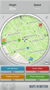






Snapshot
Who is Chaviro Software?
Providing specialized navigation tools and offline city guides for travelers and outdoor enthusiasts.
Target audience


Portfolio
Free 2Last updated

Direction Compass With Maps
v2.3.1
1.1y ago
Publisher DNA
What defines Chaviro Software?
Publisher DNA
Primary focus
Navigation utilities and offline travel maps
Scale
indie
Target audience
Travelers, hikers, and urban explorers requiring offline orientation or specialized location tracking in major European cities.
Signature Patterns
- •Focus on offline-first functionality for travel and navigation to avoid roaming fees.
- •Hybrid monetization model utilizing both free-to-use utilities and one-time paid city guides.
- •Integration of high-density point-of-interest databases (22,000+ locations) within specialized travel apps.
- •Minimal release activity and long-term maintenance of a single high-performing flagship.
Portfolio momentum
The publisher is currently in a maintenance phase, with zero new releases in the last six months and only one of five apps receiving recent updates.
Portfolio
What does Chaviro Software ship?
Apps
7 apps analysed

Clue combination visualization provides a visual aid that simplifies arithmetic.
- Automatic assumption deletion lowers the entry barrier for complex logic grids.

Analysis in progress

- Offline-first architecture eliminates roaming fee dependency for international travelers
- Navigation failures following the latest update prevent users from accessing core application functionality

Distributed across 11 markets, strongest in Europe.
Based on 4 of 7 apps with localized market data, more coverage rolling in as scans complete · last scanned .
Americas (3)
- Mexico4 / 4
- United States4 / 4
- Brazil1 / 4
Europe (6)
- France4 / 4
- Germany4 / 4
- Spain4 / 4
- Italy1 / 4
- Netherlands1 / 4
›+1 more europe market
- Portugal1 / 4
Asia-Pacific (2)
- Japan1 / 4
- South Korea1 / 4
Core markets (4/4 apps)
User Sentiment
How do users feel about their apps?
0
Positive apps
0
Neutral / mixed
1
Negative apps
10/100
Avg sentiment score
Rivals
Who does Chaviro Software compete with?
The rivals identified
Nemeses(2)

Citymapper is the dominant market leader for London transit navigation, leveraging massive real-time data integration and a high-frequency release cadence that dwarfs niche offline map competitors.


Both apps target commuters and travelers with navigation and location tracking, creating direct competition for users seeking reliable directional assistance.
Contenders(8)


A legacy navigation player that maintains a broad feature set, including turn-by-turn directions and local search, directly challenging the target's utility.


Adjacent navigation utility that solves the problem of precise location identification using a unique addressing system.


Both apps target outdoor and urban navigation, competing for the same user base by offering free, location-based guidance tools.


Avenza is the primary competitor in the offline-first mapping space, serving users who require high-fidelity map data without cellular connectivity.


Both apps target outdoor enthusiasts and commuters with navigation tools, creating direct competition within the utility-based navigation segment.


Both applications target outdoor enthusiasts and travelers requiring navigation tools, with both providing free, map-based orientation and location tracking functionality.


Both applications target travelers seeking location-based navigation, though they differ by prioritizing real-time orientation versus photo-based coordinate extraction.


As the official government transit app, it holds a unique competitive advantage through direct access to authoritative infrastructure data.
Same space(19)


Find My Car provides parking retrieval using augmented reality, simplifying vehicle location in large areas.


Find My Parked Car provides parking location management, acting as a specialized utility for urban drivers.


Altimeter GPS with barometer provides sensor-based altitude tracking for remote environments, focusing on offline data collection.


iMapp provides safety-focused tracking for families, using geofencing and speed monitoring to differentiate from standard navigation.


bergfex provides Alpine-specific trail planning, serving outdoor enthusiasts who require region-specific topographic data.


Bikemap provides cycling-specific routing, addressing terrain suitability and bike paths that general mapping tools often ignore.


Compass∞ integrates environmental data into a compass interface, serving as a multi-tool for outdoor enthusiasts.


Compass ⊘ provides a digital compass with an aesthetic focus, serving users who prefer a rustic design for everyday use.


GPS Tracks provides waypoint logging for field professionals, offering more technical precision than standard consumer navigation apps.


Altimeter provides barometer-based elevation tracking, serving as a safety utility for wilderness navigation.


C-MAP provides specialized marine navigation, serving boaters who need bathymetry data beyond standard terrestrial mapping.


OS Maps provides trail discovery and planning for outdoor enthusiasts, focusing on community-rated routes.


Sun Seeker provides solar tracking for professional site scouting, serving a niche audience that requires precise celestial data.


Topo GPS offers detailed topographic maps for outdoor activities, serving as a dedicated device replacement for hikers and cyclists.


Sygic offers professional-grade offline navigation for drivers, targeting users who require reliability in low-connectivity environments.


Gaia GPS targets professional backcountry navigation, providing high-fidelity GIS tools that exceed the capabilities of basic directional apps.


Transit provides urban mobility navigation through crowdsourced data, appealing to users who prioritize public transport over general orientation.


Real-time GPS Location Sharing focuses on personal safety and coordination, acting as a social utility rather than a navigation tool.


Adjacent navigation app focused on outdoor trails rather than urban city navigation.
New entrants(3)

known for MapXplorer: Map Radar Navigate
A recent entrant in the navigation space with a high release cadence, signaling an aggressive attempt to capture market share.


SpeedTrace provides a glanceable speedometer and trip recorder, serving as a specialized utility for monitoring travel metrics.


EarthScope provides live earth views and location scouting, acting as a visual navigation aid.
The Analyst's Read
The bottom line on Chaviro Software
Bottom line
Chaviro Software is a specialized indie publisher whose market presence is defined by a single high-performing navigation utility. Their shift away from paid city guides toward a free, high-scale tool suggests a focus on utility-driven user acquisition over the premium travel content market.
Frequently asked questions
How many apps does Chaviro Software publish?
What kind of apps does Chaviro Software make?
What is Chaviro Software's top app?
In how many countries are Chaviro Software's apps available?
What fed this analysis
- Apps analyzed:
- 5
- With full intel:
- 0
- With overview:
- 5
- Website scraped:
- yes
- Social presence:
- no