


East Studios Oy
For outdoor enthusiasts, hikers, and backcountry travelers who require reliable, offline-capable GPS navigation in remote areas.
 Russian Topo Maps Pro


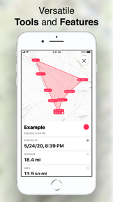


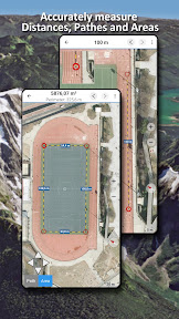


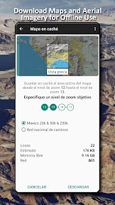


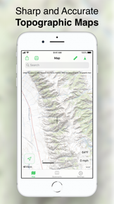


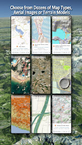


Snapshot
Who is East Studios Oy?
Providing offline-first topographic navigation for outdoor enthusiasts and backcountry travelers worldwide. Enabling reliable GPS tracking in remote regions without mobile network coverage.
Target audience


Portfolio
Free 8Last updated

Russian Topo Maps Pro
v7.8.8 free
7mo ago
Publisher DNA
What defines East Studios Oy?
Publisher DNA
Primary focus
Outdoor navigation and topographic mapping tools
Scale
indie
Target audience
Outdoor enthusiasts, hikers, and backcountry travelers who require reliable, offline-capable GPS navigation in remote areas.
Signature Patterns
- •Focus on offline-first GPS navigation and route recording
- •Integration of specialized regional topographic and nautical map layers
- •Support for external map formats including GeoPDF and WMS
- •Monetization strategy split between paid pro versions and free, ad-supported tools
Portfolio momentum
Released 12 updates across 10 apps in the last 6 months, indicating a highly active development cycle across the entire portfolio.
Portfolio
What does East Studios Oy ship?
Apps
11 apps analysed


Offroad & Outdoor Navigation. Multiple Maps: Topo, Aerials, Nautical Charts, etc


Distributed across 11 markets, strongest in Asia-Pacific.
Based on 1 of 11 apps with localized market data, more coverage rolling in as scans complete · last scanned .
Americas (2)
- Canada1 / 1
- United States1 / 1
Europe (4)
- Germany1 / 1
- Sweden1 / 1
- Turkey1 / 1
- United Kingdom1 / 1
Asia-Pacific (5)
- Australia1 / 1
- India1 / 1
- Indonesia1 / 1
- Singapore1 / 1
- Vietnam1 / 1
Core markets (1/1 apps)
Rivals
Who does East Studios Oy compete with?
The rivals identified
Nemeses(2)

Both apps target outdoor professionals and remote travelers requiring offline navigation, with Avenza Maps currently capturing the professional segment through a dedicated map store and custom import workflows.


Both applications occupy the GPS navigation category, forcing a choice between specialized offline topographic exploration and real-time urban traffic management.
Contenders(16)


onX Backcountry focuses on the same backcountry audience as AtloMaps but adds specialized terrain safety features.


Both platforms target outdoor enthusiasts requiring offline navigation in remote areas, creating direct competition for users seeking reliable geographic data without cellular connectivity.


Both apps target outdoor enthusiasts requiring offline navigation in remote regions, creating direct competition for the same user base.


Both apps target outdoor enthusiasts and professionals requiring offline navigation in remote regions, creating direct competition for the same user base.


Both apps target outdoor navigation with free, offline-capable tools, creating direct competition for users seeking reliable wayfinding without cellular connectivity.


Both platforms target outdoor enthusiasts by providing offline navigation tools and free access to geographic data. They compete directly for users requiring map access in remote regions without cellular connectivity.


Both apps target outdoor enthusiasts and travelers requiring offline navigation, with AtloMaps focusing on professional-grade topographic data while MAPS.ME prioritizes broad consumer utility.


Both apps target outdoor enthusiasts requiring offline navigation and route tracking, creating direct competition for users who prioritize reliable mapping in remote areas.


Both apps target outdoor explorers and commuters with navigation and offline map capabilities, creating direct competition for users seeking reliable route tracking and location data.


Both platforms provide offline map downloads, creating direct competition for users requiring navigation in areas with limited connectivity.


Both apps target navigation, but AtloMaps focuses on offline remote exploration while MapQuest targets North American commuters.


Both applications target outdoor navigation, with RockHoundR specializing in geological prospecting while Topo Maps serves general hiking and nautical navigation.


Both platforms target users requiring offline navigation, with Sygic competing for the same outdoor-focused audience through specialized motorbike routing and offline 3D map capabilities.


Both apps target outdoor navigation with offline GPS capabilities, creating direct competition for users seeking reliable route tracking in remote areas.


Both applications target outdoor navigation, specifically overlapping in nautical charting and GPS tracking capabilities for recreational users.


Both apps provide mapping and navigation services, but they serve distinct use cases: AtloMaps targets remote outdoor exploration, while Neshan focuses on urban traffic management and ride-hailing utility.
Same space(36)


GPS Navigation: Live Earth Map offers general-purpose navigation and satellite views for users needing standard routing.


BaseMap offers land ownership layers for hunters, providing a specific data set that complements the general topographic data in Topo Maps.


Bikemap provides bicycle-specific routing, addressing the need for cycle-path data that Topo Maps does not prioritize.


CalTopo is a professional-grade backcountry tool, offering advanced terrain analysis that serves the same outdoor audience as Topo Maps.


Topo Maps US serves the same US-based outdoor market as AtloMaps with a focus on USGS data.


Yandex Maps provides urban navigation and local service integration, contrasting with the remote-focused utility of AtloMaps.


TopoRec offers a specialized viewer for historical and modern map data, complementing AtloMaps' current-terrain focus.


Hunting Points provides land ownership data for hunters, functioning as a specialized field utility alongside Topo Maps.


Fottur targets the same outdoor navigation segment but relies on a subscription-only model.


Navionics Boating focuses on marine navigation, providing specialized bathymetric charts that Topo Maps lacks for water-based activities.


Aqua Map Boating provides nautical charts for mariners, serving as a specialized alternative to the general-purpose navigation in Topo Maps.


Topo Maps+ overlaps with the core topographic utility of AtloMaps for backcountry exploration.


GOHUNT targets the hunting segment, providing specialized unit profiles and tag draw data that Topo Maps lacks.


Detector Maps provides geological data for prospectors, offering a professional-grade research tool for remote exploration.

known for MapXplorer: Map Radar Navigate
MapXplorer provides driver-focused navigation and safety alerts, serving a different use case than the outdoor-centric Topo Maps.


Footpath Route Planner offers a manual tracing interface for route planning, serving the same outdoor activity market as Topo Maps.


4WD Maps focuses on the Australian off-road market, providing a specialized alternative to AtloMaps.


Optiway focuses on delivery logistics, providing route optimization that serves a professional workflow distinct from the recreational use of Topo Maps.


OpenMaps combines outdoor and marine navigation, providing a broader utility set than AtloMaps.


Iphigénie offers a wide range of international topographic maps, serving as a comprehensive alternative for global outdoor navigation.


PathAway provides a similar outdoor navigation toolset with a focus on professional surveying and tracking.


onWater targets anglers with fishing-specific intelligence, providing a niche data layer for the same outdoor market as Topo Maps.


onX Offroad shares the remote navigation focus of AtloMaps but adds professional safety coordination for backcountry users.


Tractor GPS provides agricultural field guidance, serving farmers who need coverage tracking rather than the topographic data found in Topo Maps.


Trailforks offers a community-sourced trail database, serving the same mountain biking and hiking audience as Topo Maps.


Treeline Maps targets the North American hiking market with specialized topographic data, similar to AtloMaps.


GPS Map Camera & Navigation adds a photography-centric layer to navigation, useful for documenting remote terrain.


Radarbot complements AtloMaps by providing real-time traffic and speed camera alerts for drivers.


Topo GPS provides a direct alternative for topographic mapping with a focus on specific country-level data.


Game Maps IRL targets commuters with stylized aesthetics, offering a visual alternative to the utilitarian topographic focus of Topo Maps.


GPS Navigation Maps Directions offers general-purpose navigation tools for users needing basic routing alongside specialized maps.


TruckMap serves commercial drivers requiring specialized routing, contrasting with the recreational focus of Topo Maps.


Hammer provides truck-specific navigation, serving a professional niche that requires more rigid vehicle-dimension constraints than Topo Maps.


Cyclers serves a specialized subset of the outdoor market by focusing on bike-specific route planning.


HiiKER competes for the same outdoor enthusiast demographic by offering professional-grade topographic map integrations.


what3words provides precise location identification, serving as a utility for navigation that Topo Maps users might use for meeting points.
New entrants(2)


EarthScope provides general location tools and live earth views, acting as a broad navigation companion to Topo Maps.


Live Earth Camera provides global mapping and flight tracking, serving as a general-purpose navigation tool alongside Topo Maps.
The Analyst's Read
The bottom line on East Studios Oy
Bottom line
East Studios Oy is a disciplined niche publisher that has successfully scaled a modular navigation framework across multiple international markets. Their ability to maintain high user ratings while managing a diverse, region-specific portfolio suggests strong product-market fit among serious outdoor users.
Frequently asked questions
How many apps does East Studios Oy publish?
What kind of apps does East Studios Oy make?
What is East Studios Oy's top app?
In how many countries are East Studios Oy's apps available?
What fed this analysis
- Apps analyzed:
- 10
- With full intel:
- 0
- With overview:
- 10
- Website scraped:
- yes
- Social presence:
- no
