


Marco Palaferri
For sailors, fishermen, and outdoor adventurers like hikers and cyclists who require reliable navigation in remote, offline environments.
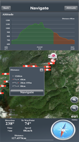
 Marine Navigation Lite




Snapshot
Who is Marco Palaferri?
Providing offline GPS navigation tools for maritime and outdoor enthusiasts. Enabling reliable location tracking without reliance on cellular data.
Target audience


Portfolio
Free 3Last updated

Marine Navigation Lite
v15.1.2
10mo ago
Publisher DNA
What defines Marco Palaferri?
Publisher DNA
Primary focus
Offline GPS navigation and maritime charting
Scale
indie
Target audience
Sailors, fishermen, and outdoor adventurers like hikers and cyclists who require reliable navigation in remote, offline environments.
Signature Patterns
- •Strict focus on offline-first GPS functionality
- •Proprietary S57 engine implementation for maritime data
- •Hybrid monetization combining one-time purchases with optional subscriptions
- •Cross-platform utility for both maritime and terrestrial navigation
Portfolio momentum
Released 7 updates across 4 apps in the last 6 months, indicating consistent maintenance and feature iteration.
Portfolio
What does Marco Palaferri ship?
Apps
4 apps analysed


Single-market publisher, every app ships only to United States.
Based on 1 of 4 apps with localized market data, more coverage rolling in as scans complete · last scanned .
Americas (1)
- United States1 / 1
Core markets (1/1 apps)
Rivals
Who does Marco Palaferri compete with?
The rivals identified
Nemeses(2)


Both apps target the same maritime navigation audience, but Marine Navigation functions as a standalone GPS chartplotter while ActiveCaptain serves as a hardware-dependent companion for Garmin users.


Both apps target outdoor enthusiasts requiring GPS navigation and route recording, with Wikiloc's massive community-verified database directly challenging TrekkingPoint's utility-focused model.
Contenders(19)


Focuses on trail discovery and navigation for outdoor enthusiasts, providing a community-driven alternative to the source app's chart-focused approach.


Targets the same privacy-conscious user base as the source app, but utilizes OpenStreetMap data for broader land-based navigation.


Addresses the professional-grade mapping needs of outdoor enthusiasts, overlapping with the source app's requirement for reliable offline tools.


Both applications target the same maritime navigation audience, creating direct competition for boaters seeking GPS charting and trip planning tools.


Both apps target outdoor enthusiasts requiring offline navigation, with Avenza Maps capturing the professional segment while TrekkingPoint offers a dedicated, paid utility for route management.


Both apps target outdoor enthusiasts requiring GPS tracking and route planning, competing directly for users who need reliable navigation tools for hiking and cycling.


Both apps target maritime navigators with GPS charting tools, creating direct competition for the same recreational and professional user base.


Both apps target outdoor enthusiasts requiring offline navigation and route planning, creating direct competition for users seeking reliable trail and road management tools.


Both apps target maritime navigators requiring offline nautical charts, creating direct competition for users seeking reliable GPS-based navigation tools.


Both apps target outdoor enthusiasts requiring route planning and navigation for hiking and cycling, creating direct competition for the same user base.


Both apps target the same recreational maritime audience with offline charting capabilities, forcing a choice between Marine Navigation's one-time purchase model and C-MAP's subscription-gated bathymetry.


Both apps target the same maritime navigation audience, competing directly for sailors and fishermen seeking mobile GPS and charting solutions.


Both apps target coastal sailors and fishermen with offline-first navigation tools, creating direct competition for users seeking reliable maritime charting and voyage planning.


Uses LiDAR-based 3D terrain data to provide safety-critical backcountry navigation for outdoor enthusiasts.


Both apps target sailors and fishermen with GPS charting, but Orca forces hardware integration while Marine Navigation focuses on standalone offline privacy.


Both apps target hikers and cyclists with offline navigation and route recording features, creating direct competition for outdoor activity tracking.


Both apps target the same maritime navigation segment, competing for users seeking digital charting tools on mobile platforms.


Both apps provide offline GPS navigation for outdoor activities, creating direct competition for users seeking reliable navigation in remote areas without cellular service.


Both apps target maritime navigation, but Wavve Boating captures recreational boaters with personalized charts while Marine Navigation focuses on serious sailors requiring offline privacy.
Same space(24)


Offers multi-modal speed monitoring that serves boaters alongside drivers, providing a high-utility dashboard for travel metrics.

known for MapXplorer: Map Radar Navigate
Serves as a general-purpose navigation aid for commuters, contrasting with the specialized maritime focus of the source app.


Enables precise agricultural field guidance by allowing farmers to align equipment using AB lines.


Combines nationwide land ownership data with specialized hunting layers for remote environment navigation.


Offers global offline map packs that remove the connectivity dependency required by standard navigation apps.


Shares the source app's focus on offline reliability for field professionals, though it targets land-based outdoor activities.


Gamifies outdoor movement through a global network of community-hidden containers that creates high switching costs.


Provides access to over 80 base maps and overlays for specialized topographic navigation.


Supports military-grade coordinate systems for tactical operators requiring precise field navigation.


Provides hardware-level control for boat equipment, serving as a functional extension to the navigation and safety tools used by sailors.


Maintains a large database of over 780,000 trails that provides condition reports for mountain bikers.


Directly complements the source app by providing real-time AIS vessel tracking, a feature relevant to maritime users.


Provides topographic mapping for outdoor professionals, serving as a direct alternative for users requiring offline GPS device functionality.


Targets professional operators with dimension-aware routing, mirroring the safety-critical requirements of maritime navigation.


Partners with municipal cycling campaigns to provide infrastructure-specific routing for urban commuters.


Targets professional operators with dimension-aware routing, mirroring the safety-critical requirements of maritime navigation.


Offers specialized routing for large vehicles, providing a similar utility to maritime navigation by focusing on safety and regulatory compliance.


Acts as a specialized reference tool for maritime professionals, supporting the same user base that relies on the source app's S57 engine.


Uses machine vision technology to highlight blood trails for game recovery in hunting scenarios.


Provides vehicle-specific routing logic, a professional-grade feature that mirrors the technical precision required by maritime navigators.


Aggregates community-driven parking data to assist professional truck drivers with OTR logistics.


Integrates professional-grade topographic maps for multi-day route planning in mountain environments.


Facilitates route planning across 300,000 community-sourced paths for cyclists and motorbikers.


Provides multilingual offline navigation support for international hikers.
New entrants(4)


Targets professional drivers with dimension-aware routing, providing a similar safety-first utility to the source app's navigation focus.


Bridges the gap between Google Maps and dedicated GPS devices by converting links to GPX files.


Automates voyage logging for sailors, providing a data-collection utility that complements the source app's navigation focus.


Stores activity data locally to provide a privacy-focused logging tool for hikers.
The Analyst's Read
The bottom line on Marco Palaferri
Bottom line
The publisher has successfully carved out a technical niche by focusing on offline-first navigation, a critical requirement for their specific maritime and outdoor user base. Their ability to maintain a consistent update cadence suggests a stable, long-term commitment to this specialized category.
Frequently asked questions
How many apps does Marco Palaferri publish?
What kind of apps does Marco Palaferri make?
What is Marco Palaferri's top app?
In how many countries are Marco Palaferri's apps available?
What fed this analysis
- Apps analyzed:
- 4
- With full intel:
- 0
- With overview:
- 4
- Website scraped:
- yes
- Social presence:
- no
