


Aleksandr Alekseev
For enthusiast drone pilots, sports fans, and mobile users seeking network connectivity optimization.
 Live Football TV. Soccer Score






Snapshot
Who is Aleksandr Alekseev?
Providing utility-focused mobile tools for drone pilots, sports fans, and network users. Simplifying complex data access for niche mobile audiences.
Target audience


Portfolio
Free 25Last updated

Live Football TV. Soccer Score
v3.3.0
6mo ago
Publisher DNA
What defines Aleksandr Alekseev?
Publisher DNA
Primary focus
Utility and information-based mobile tools
Scale
indie
Target audience
Enthusiast drone pilots, sports fans, and mobile users seeking network connectivity optimization.
Signature Patterns
- •Focus on high-utility, data-driven mobile tools.
- •Monetization mix of free-to-access content and freemium utility models.
- •High-frequency update cadence across all active titles.
- •Targeting specific technical or interest-based user segments.
Portfolio momentum
Released 26 updates across 3 apps in the last 6 months, with all titles receiving updates within the last 30 days.
Portfolio
What does Aleksandr Alekseev ship?
Apps
25 apps analysed

Analysis in progress

Analysis in progress

Cellular network cell phone signal booster: 3G 4G 5G LTE signal strength data


Offline local multiplayer removes connectivity dependencies.
- Multi-rule support across five international variants broadens the addressable market.

- Direct user appreciation for the application functionality expressed through positive feedback
Distributed across 20 markets, strongest in Europe.
Based on 8 of 25 apps with localized market data, more coverage rolling in as scans complete · last scanned .
Americas (4)
- United States8 / 8
- Mexico3 / 8
- Brazil2 / 8
- Canada1 / 8
Europe (9)
- France3 / 8
- Germany2 / 8
- Italy2 / 8
- Netherlands2 / 8
- Portugal2 / 8
›+4 more europe markets
- Spain2 / 8
- Sweden1 / 8
- Turkey1 / 8
- United Kingdom1 / 8
Asia-Pacific (7)
- Japan2 / 8
- South Korea2 / 8
- Australia1 / 8
- India1 / 8
- Indonesia1 / 8
›+2 more asia-pacific markets
- Singapore1 / 8
- Vietnam1 / 8
Core markets (8/8 apps)
User Sentiment
How do users feel about their apps?
1
Positive apps
0
Neutral / mixed
1
Negative apps
58/100
Avg sentiment score
Unlock the app dragging this portfolio down.
Access the full report for freeRivals
Who does Aleksandr Alekseev compete with?
The rivals identified
Nemeses(4)


Both apps target drone pilots with low-altitude weather data, but the rival's free, ad-free model directly undermines the subscription-gated safety features of Drone App: Forecast for UAV.


Both apps target football fans with free, real-time match updates and news, creating direct competition for daily active usage among mobile sports enthusiasts.


Skywall competes directly for the same user base seeking high-quality aesthetic personalization, leveraging a more robust content library and frequent engagement features.


Both apps target outdoor users requiring hyper-local weather data for activity planning, creating direct competition for the user's pre-flight or pre-commute decision-making window.
Contenders(23)


Both apps provide local weather data, but Drone Forecast targets UAV pilots with airspace safety tools while the rival serves general weather tracking needs.


Both apps compete for the same football audience by offering identical free live streaming and match tracking services.


WinSpirit targets the same mobile personalization market with a simplified interface that directly challenges the target's ease-of-use value proposition.


Both apps target football fans with real-time match updates and league coverage, competing for the same mobile screen time during matchdays.


Both apps target drone pilots with weather and airspace safety data, creating direct competition for the same flight-planning use case.


Both apps provide weather forecasting services to users planning outdoor activities, creating a direct overlap in the utility segment for environmental data.


Both apps target football fans with free, ad-supported sports content, creating direct competition for user attention in the sports utility category.

known for Christmas Backgrounds and Holiday Wallpapers - Festive Motifs
This app captures seasonal traffic from the same user base looking for thematic device personalization.


Both apps target football fans with free, ad-supported mobile access to match data and league updates. They compete directly for the same user base seeking real-time soccer information on mobile devices.


Both applications target users requiring environmental situational awareness, with Drone Forecast focusing on UAV flight safety and Zoom Earth providing broader weather and storm tracking capabilities.


Both apps compete for users requiring weather data, but Drone Forecast provides specialized UAV flight safety metrics while the rival focuses on general meteorological alerts.


Both apps target football fans with free, ad-supported live score and match tracking services. They compete for the same user base looking for real-time match updates and league coverage on mobile devices.


Both apps target football fans with free, real-time match information and score updates, creating direct competition for daily active users.


It targets the same demographic interested in home decor and visual inspiration, acting as a secondary source for aesthetic imagery.


Both apps compete for the same football fan base by offering free, ad-supported mobile access to match data and updates. They overlap directly in the market for real-time soccer tracking and league coverage.


Both apps target users requiring wind speed and direction data for outdoor activities, creating direct competition for the same user base despite the rival's focus on marine data.


Both apps target football fans seeking match updates and coverage, competing for the same mobile user base interested in real-time soccer data.


Both apps target football fans seeking real-time match updates and scores, creating direct competition for daily active usage among sports enthusiasts.


Both apps target aviation professionals and pilots, with Ventusky providing high-precision meteorological data that overlaps with the pre-flight planning requirements of Drone Forecast users.


Both apps target football fans with free, real-time match updates and statistics, creating direct competition for daily user engagement.


Both apps target outdoor enthusiasts requiring precise weather data for safety, creating a direct overlap for drone pilots who prioritize wind conditions for flight stability.


Windy.com serves the same aviation-focused audience but provides significantly deeper meteorological data visualization that acts as a professional alternative to the source app.


Both apps provide weather data, which is a critical component for drone pilots, though the rival lacks the specialized aviation-specific No Fly Zone mapping.
Same space(98)


Live World Map provides visual exploration of global locations, aiding users in identifying terrain affecting signal reception.


This app serves as a direct utility alternative for drone pilots, focusing on the same core safety indicators and airspace mapping.


Provides professional-grade radar and aviation data layers that serve as a high-utility secondary tool for professional drone pilots.


Windygo provides a privacy-focused alternative for the same audience, emphasizing simplicity and specific metrics like the Kp Index.


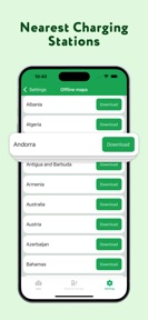
This utility provides visual tower distribution and maintains an offline database for use in areas without active connectivity.


This app competes for the same aesthetic-conscious audience by offering virtual reality tools for home personalization.


This mapping utility displays nearby cell towers and provides filtering options based on network generation.


This mapping application displays cellular towers and provides detailed metadata like CID and MCC for network analysis.


This high-volume utility provides device scanning and signal optimization, serving as a diagnostic alternative for home network users.


Number Locator provides caller identification, which overlaps with the user's focus on mobile network utility.


Weather4Fly targets the same drone-pilot audience by focusing on hardware-specific safety assessments rather than generic weather data.


Operates as a primary hub for global soccer fans, focusing on transfer market data and match statistics.


Phone Location Tracker offers family safety tracking, complementing the signal finder's focus on connectivity in remote areas.


This app functions as a community-driven flight planning tool that overlaps with the source app's airspace and weather-check utility.


While functionally different, it occupies the same 'House & Home' category space, competing for user attention within the home-improvement ecosystem.


It competes for the same 'Home' category users by offering advanced customization and integration features for smart home environments.


This mapping tool utilizes FCC Broadband Data Collection records combined with crowdsourced data to show network coverage.


This mapping tool creates a proprietary data advantage by aggregating crowdsourced speed tests through automated recurring checks.


AURA provides a similar drone-weather utility but differentiates through a focus on accessibility for beginners and ad-free monetization.


This diagnostic tool provides signal strength in dBm and device hardware specifications to help users identify connectivity issues.


Offers real-time rain tracking for outdoor planning, though lacks the specific airspace restrictions required for drone flight.


Designed for fans prioritizing speed in real-time score updates.


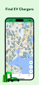
Zunder targets the same mobile-dependent audience by providing infrastructure for electric vehicle charging.


Phone Tracker Live Locator enables location monitoring for family safety, serving as a utility for mobile users.


Drone Spot focuses on the community and location-discovery aspect of drone flying, complementing the source app's safety-first utility.


GPS Tracker focuses on safety and location history for users tracking movement in areas with variable coverage.


This mapping utility calculates distance and bearing to towers and includes a terrain-aware viewshed for coverage analysis.


Offers general weather planning for outdoor activities, though it lacks the specific regulatory airspace maps needed for drone flight.


Provides storm tracking and hurricane alerts useful for general safety, but lacks the UAV-specific airspace data.


Serves the same global soccer fan base by providing deep match-day statistics and analytics that complement basic score tracking.


UAV Forecast is a direct competitor that shares the same drone-safety niche but utilizes a more aggressive subscription-only monetization model.


Street View Map offers visual exploration and navigation, assisting users in scouting terrain for signal optimization.


Serves American football fans with dedicated live streaming and game coverage.


This utility maps cellular towers and requires a premium subscription to access advanced filtering and detailed tower information.


Helps fans track matches and league details in a single mobile interface.


GPS Satellite View provides visual navigation and traffic data for users in poor coverage areas.


Earth Map offers global visualization, aiding users in scouting locations for potential network signal availability.


Provides geomagnetic data that helps drone pilots plan for potential GPS interference during solar events.


Offers general environmental data and radar tracking for outdoor planning, lacking specific drone airspace regulatory tools.


DroneWX provides a similar combination of weather forecasting and airspace mapping, targeting the same professional and hobbyist drone pilot base.


Offers a platform for viewing live matches and results on mobile devices.


Provides general weather and radar tracking for outdoor planning, though it lacks the specific airspace regulatory maps for drones.


Offers standard weather insights for travel planning, though it lacks the specialized safety data required for drone flight.


Serves a broad sports fan base with real-time data and fixtures across multiple sports.


This network utility provides interactive maps and speed testing to help users understand cellular network infrastructure.


Targets bettors and fans requiring rapid score updates and broadcast information.


This specialized tool generates professional PDF reports on carrier density and tower proximity for network installers.


Focuses on the U.S. market for soccer fans following domestic and international leagues.


Offers a comprehensive scoreboard and news feed for football fans.


Provides high-precision weather data that helps pilots assess flight conditions with professional-grade accuracy.


This app provides a similar drone-specific weather and airspace utility, positioning itself as a professional tool for mission-critical data.


GPS Route Planner combines navigation with safety alerts, assisting users traveling to remote areas for network access.


This utility maps 5G, 4G, and 3G towers and includes speed testing to help users solve connection issues.


Provides match tracking and statistics for football fans, though currently in a maintenance-dormant state.


This mapping tool provides global cellular infrastructure data to help users troubleshoot signal reception and compare carrier density.


This tool serves as an alternative for users seeking internet connection diagnostics and speed testing capabilities.


Omnee competes for the same home-focused user attention by providing high-utility tools like AI assistants and maintenance support.


Acts as a global soccer hub for fans seeking real-time scores and live match streaming.


AirMap provides a similar flight-planning interface that combines weather data with regulatory airspace monitoring for drone pilots.


Dronecast offers a similar suite of pre-flight safety checks and wind data, positioning itself as a direct utility alternative.


This direct competitor utilizes a database of 69 million towers to assist users with signal troubleshooting and network optimization.


Offers general weather planning for travel, lacking the specific regulatory airspace maps needed for drone flight.


GPS Map Camera adds geographic context to photos, serving users who document network coverage.


DroneWeather provides a free, utility-focused alternative that prioritizes GPS signal stability and geomagnetic activity for drone performance.


UAV Mission Control provides an identical utility-focused verdict system for drone pilots, competing directly for the pre-flight planning workflow.


Acts as a companion for tracking football scores and upcoming match schedules.


GPS Navigation provides routing and speed monitoring, a standard companion for users navigating to better signal areas.


Drone Pilot Helper serves the same pre-flight safety niche by providing a clear verdict based on customizable hardware limits.


Live Satellite Earth Map provides immersive 3D satellite maps for visualizing terrain for signal assessment.


Targets the same sports enthusiast demographic with real-time data and player-level analytics.


GPS Satellite Earth Map facilitates navigation using satellite maps to find reliable network coverage.


Targets fans looking for live streaming of major international football leagues.


This utility provides global tower data and includes an augmented reality view for precise tower alignment.


Live Earth Map provides satellite-based visual exploration, helping users identify terrain features impacting signal propagation.


Functions as an official companion app for the specific Premier League audience.


Map Drive serves drivers needing road safety alerts, complementing the signal finder's utility for mobile connectivity.


Phone Tracker & GPS Locator provides real-time location sharing, essential for users traveling in areas with limited coverage.


Provides a centralized hub for match analytics and live scores for football fans.


Provides a mobile companion for live scores and match highlights.


This utility competes for the same user base by offering speed tests and signal history tracking for internet diagnostics.


Live Earth Map combines navigation with satellite imagery, helping users plan routes to better signal areas.


This mapping utility uses sector grouping technology to identify the physical location of towers rather than just signal coverage areas.


Ventusky targets the same professional user base by offering a more advanced, 3D-interactive visualization layer for meteorological data.


Provides broad weather coverage for general planning, though lacks specialized aviation or UAV-specific airspace data.


Acts as a general weather utility for outdoor hobbyists, lacking the specific regulatory map overlays needed for UAV operations.


Provides general weather planning for outdoor activities, lacking the specific regulatory airspace maps needed for drone flight.


Provides hyper-local weather data from personal stations, which can assist pilots in assessing localized conditions beyond general forecasts.


Provides lightning tracking that serves as a critical safety layer for outdoor drone pilots, despite the intrusive ad-load.


WindAlert provides a specialized wind-monitoring utility that competes for the same user attention by leveraging a proprietary hardware network.


Serves as a secondary weather source for drone pilots who need to compare multiple forecast providers to mitigate prediction uncertainty.


Provides general weather planning for outdoor activities, lacking the regulatory airspace maps essential for drone pilots.


Provides a broadcast schedule for fans to plan their viewing across multiple sports.


Provides general weather planning for outdoor activities, lacking the specific regulatory airspace maps needed for drone flight.


Captures the same football fan base by gamifying interaction to increase session frequency.


This focused utility uses the OpenCelliD database to visualize cellular infrastructure and carrier coverage across the United States.


GPS Tracking combines caller identification with location tracking, serving as a connectivity utility for mobile users.


This app offers a similar pre-flight planning workflow, focusing on wind trends and airspace safety for drone operators.


Drone Weather provides a similar pre-flight planning tool that combines airspace awareness with wind analysis for drone pilots.
New entrants(10)


Uses a card-based design to provide scores and fixtures for football fans.


Can I Fly provides a simplified, utility-focused interface for drone pilots to assess flight safety based on real-time weather.


This newcomer targets a specific niche within the personalization market, potentially siphoning off users looking for faith-based content.


Provides general weather planning for outdoor activities, lacking the specific regulatory airspace maps needed for drone flight.


A new entrant that directly challenges the target's core value proposition by offering higher resolution 4K content.


Flyby focuses on the same pre-flight decision-making process by consolidating multiple signals into a single flight-readiness score.


Offers a convenient place for fans to access football information and match standings.


EarthVista offers visual exploration through live camera feeds, helping users scout locations for network connectivity.


This mapping tool provides access to 159,000 FCC antenna records with smart clustering for fast browsing and offline use.


This diagnostic tool combines tower radar with signal strength monitoring and speed tests for remote workers and travelers.
The Analyst's Read
The bottom line on Aleksandr Alekseev
Bottom line
The publisher demonstrates strong product-market fit within fragmented utility niches, maintaining high engagement through consistent updates. Their ability to sustain a 4.44 weighted rating across diverse categories suggests a disciplined approach to functional app development.
Frequently asked questions
How many apps does Aleksandr Alekseev publish?
What kind of apps does Aleksandr Alekseev make?
What is Aleksandr Alekseev's top app?
In how many countries are Aleksandr Alekseev's apps available?
What fed this analysis
- Apps analyzed:
- 3
- With full intel:
- 0
- With overview:
- 3
- Website scraped:
- yes
- Social presence:
- no