Martijn de Meulder
For maritime professionals, recreational boaters, and amateur astronomers requiring precise, localized data for the Netherlands and North Sea regions.
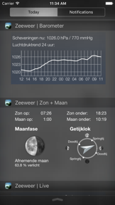
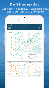
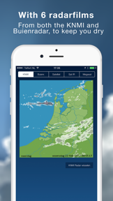
 Sea Weather - Maritime app
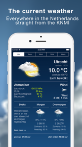

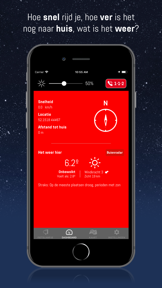


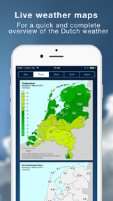











Snapshot
Who is Martijn de Meulder?
Providing maritime professionals and outdoor enthusiasts with real-time meteorological and hydrological data. Aggregating official government sensor networks for precise coastal and inland navigation.
Target audience


Portfolio
Free 5Last updated

Sea Weather - Maritime app
v5.8
1.2y ago
Publisher DNA
What defines Martijn de Meulder?
Publisher DNA
Primary focus
Maritime weather and navigation utilities
Scale
indie
Target audience
Maritime professionals, recreational boaters, and amateur astronomers requiring precise, localized data for the Netherlands and North Sea regions.
Signature Patterns
- •Direct integration with official Dutch government monitoring networks (KNMI, Rijkswaterstaat).
- •Focus on high-precision data for maritime and outdoor navigation.
- •Monetization mix of free, freemium, and paid models.
- •Cross-platform support including iPhone, iPad, and Apple Watch.
Portfolio momentum
Released 5 updates across the portfolio in the last 6 months with consistent maintenance of core maritime and weather titles.
Portfolio
What does Martijn de Meulder ship?
Apps
10 apps analysed


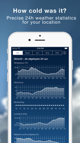
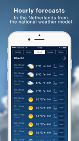
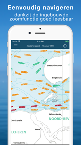
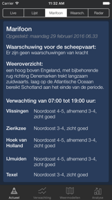
The current weather and wave data, at sea and along the Dutch coast.



Rivals
Who does Martijn de Meulder compete with?
The rivals identified
Nemeses(1)

Both applications target outdoor professionals and enthusiasts requiring high-precision meteorological data, creating direct competition for users prioritizing forecast accuracy for navigation and planning.
Contenders(10)


Both applications serve as official, government-sourced meteorological data providers for specific geographic regions, targeting users who require authoritative weather information for outdoor activities.


Both applications target outdoor users requiring location-specific weather data, though they serve distinct needs: professional maritime navigation versus immediate precipitation tracking for general outdoor activities.


Both applications provide environmental monitoring, though Sea Weather targets professional maritime navigation while Weather & Radar Forecast serves general daily planning needs.


Both applications provide official meteorological data for specific geographic regions, competing for users who require reliable weather forecasts for navigation or planning.


Clime competes for the same outdoor enthusiast audience by providing real-time radar and safety alerts, though it lacks the specialized maritime-specific hydrological data found in Sea Weather.


Both applications target maritime professionals and water sports enthusiasts by providing real-time wind, wave, and meteorological data for navigation. They compete directly for the same user base by offering specialized marine condition tracking.


Both apps provide weather data to users, but they diverge on utility: Sea Weather serves professional maritime navigation, while Weather forecast targets general consumer planning.


Both applications compete for users seeking weather data, though they serve distinct segments: maritime professionals versus general commuters. They overlap in the broader weather utility category, forcing a choice between specialized regional accuracy and general-purpose radar tools.


Both apps compete for users requiring weather data for outdoor planning, though they serve distinct segments ranging from maritime professionals to general consumers.


Weather & Radar competes for the same coastal-focused audience by offering specialized modules for beach-goers and coastal conditions, despite its generalist positioning as a radar-centric utility.
Same space(37)


Meteored integrates official National Weather Service data to provide alerts that supplement maritime safety checks for users.


This app offers extended 16-day forecasts and air quality monitoring that provides supplemental planning data for maritime users.


MyRadar provides aviation-grade radar and hyper-local alerts that maritime users rely on for storm avoidance and real-time safety.


Specialized navigation tool that addresses the need for bike-specific routing and path terrain suitability.


Navigation utility providing real-time speed and trip monitoring for drivers and boaters.


Specialized navigation tool that captures the same recreational transit audience through scenic routing algorithms.


Outdoor navigation tool that provides offline mapping and waypoint logging for remote field work.


Navigation and safety tool that provides crash detection for motorcyclists.


WeatherPro offers animated satellite imagery and environmental metrics that assist maritime users in planning outdoor activities.


Dominant marine navigation platform that competes for the same professional and recreational boating user base.


Direct marine navigation competitor providing official nautical charts and community-driven data overlays.

known for MapXplorer: Map Radar Navigate
General-purpose navigation tool that competes for the user's attention on the same device during transit.


This platform consolidates marine weather and solunar data for the same sailing and fishing audience, using a vast station database to provide localized coastal conditions.


This app tracks geomagnetic activity for a specialized audience that overlaps with maritime travelers operating in northern latitudes.


Marine Weather Forecast Pro synthesizes NASA datasets and NOAA buoy data to provide professional-grade maritime navigation tools.


Weatherly provides general outlooks that serve as a basic reference for maritime users planning long-term trips.


This app delivers official UK-specific warnings that provide safety context for maritime users in British waters.


Marine navigation platform providing bathymetry data that serves as a specialized fishing utility.


Handheld marine navigation tool that provides worldwide chart coverage and real-time data integration.


Zoom Earth provides historical satellite archives that allow maritime users to analyze past weather patterns for route planning.


Professional-grade marine navigation tool that provides high-resolution bathymetry for coastal sailors.


Marine navigation platform that integrates proprietary hardware with a mobile interface for boat control.


Privacy-focused navigation tool that serves as a zero-tracking alternative for outdoor exploration.


This radar-centric tool provides immediate visual situational awareness for maritime users tracking severe weather systems.


PredictWind aggregates proprietary models to support the same route planning and safety needs as Sea Weather.


Marine navigation tool that provides automated route planning based on environmental variables like depth.


Professional navigation tool that provides dimension-aware routing for large vehicles.


Professional navigation tool that provides dimension-aware routing for large vehicles.


Navigation tool that provides truck-optimized routing and a freight marketplace for professional drivers.


This app provides general weather forecasting that serves as a high-frequency utility for outdoor enthusiasts, though it lacks the specialized maritime focus of Sea Weather.


Community-driven navigation platform that provides real-time infrastructure data for professional drivers.


Ventusky offers professional-grade meteorological tools and multi-model visualization that serve as a secondary analysis resource for maritime professionals.


Marine navigation tool that provides customized GPS and tide predictions for recreational boaters.


Provides outdoor navigation utility that captures the same user segment interested in route planning and GPS tracking.


Windfinder uses a proprietary network of weather stations to provide the precise wind and wave data required by the same kitesurfing and sailing demographic.


WindHub targets the same sailing and angling audience by providing specialized nautical chart overlays and a directory for marina contact information.


Windy.com aggregates global models and a vast webcam network to provide professional-grade data for maritime navigation.
The Analyst's Read
The bottom line on Martijn de Meulder
Bottom line
This publisher maintains a strong, defensible position by serving as a trusted conduit for official Dutch maritime and meteorological data. Their portfolio shows a disciplined focus on utility-driven tools that solve specific, high-stakes information needs for regional users.
Frequently asked questions
How many apps does Martijn de Meulder publish?
What kind of apps does Martijn de Meulder make?
What is Martijn de Meulder's top app?
What fed this analysis
- Apps analyzed:
- 10
- With full intel:
- 0
- With overview:
- 10
- Website scraped:
- yes
- Social presence:
- no