


Shingle Oy
For outdoor enthusiasts, hikers, and property owners who require high-accuracy, offline-capable topographic maps for remote Nordic regions.
 Topo maps - Finland


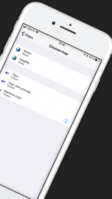


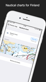
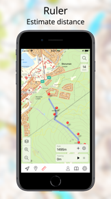

Snapshot
Who is Shingle Oy?
Providing specialized offline topographic mapping tools for outdoor navigation in Finland, Sweden, and Norway. Built for hikers and travelers requiring reliable location data in remote areas.
Target audience


Portfolio
Last updated

Topo maps - Finland
v3.7.2
1.2y ago
Publisher DNA
What defines Shingle Oy?
Publisher DNA
Primary focus
Navigation tools for outdoor enthusiasts
Scale
indie
Target audience
Outdoor enthusiasts, hikers, and property owners who require high-accuracy, offline-capable topographic maps for remote Nordic regions.
Origin
Shingle is a two-person development team based in Kiiminki, Finland.
Signature Patterns
- •Strict focus on offline-first topographic navigation
- •Integration of official government land survey data
- •Paid-upfront pricing model across all titles
- •Core feature set includes GPX management and route tracking
Portfolio momentum
Released 3 updates across 3 apps in the last 6 months, indicating a steady maintenance cycle for their core navigation tools.
Company profile
medium confidence- Headquarters
- Kiiminki, Finland
- Employees
- 1-10
Portfolio
What does Shingle Oy ship?
Apps
3 apps analysed


Tightly focused on 2 markets (Sweden, United States).
Based on 1 of 3 apps with localized market data, more coverage rolling in as scans complete · last scanned .
Americas (1)
- United States1 / 1
Europe (1)
- Sweden1 / 1
Core markets (1/1 apps)
Rivals
Who does Shingle Oy compete with?
The rivals identified
Nemeses(2)

It provides topographic maps for outdoor activities, serving as a direct functional alternative to the source app.


Both apps target outdoor enthusiasts requiring offline topographic navigation, creating direct competition for users seeking reliable trail mapping in remote areas.
Contenders(13)


Both apps target outdoor enthusiasts requiring offline navigation, with Avenza Maps competing for the same user base by offering broader professional-grade tools and custom map imports.


Both apps target outdoor enthusiasts requiring offline navigation and route management, creating direct competition for users seeking reliable mapping in remote areas.


Both apps target outdoor navigation with offline capabilities, creating direct competition for users seeking reliable GPS tools in remote areas.


It provides backcountry navigation tools, serving as a direct alternative for users requiring topographic data and terrain analysis.


Both applications target outdoor enthusiasts requiring offline navigation, creating direct competition for users seeking reliable mapping in remote areas.


Both apps target outdoor enthusiasts requiring offline topographic mapping and route management, creating direct competition for users seeking reliable navigation in wilderness areas.


Both apps target outdoor enthusiasts with topographic navigation and route tracking, competing for the same user base of hikers and travelers.


Iphigénie competes by offering Kartverket map data for Norway within a broader, free-to-access multi-country mapping library that targets the same outdoor navigation audience.


Both apps target outdoor enthusiasts requiring GPX route management and offline navigation, creating direct competition for users seeking wilderness navigation tools.


Both applications target outdoor enthusiasts requiring offline navigation and GPX management for hiking and cycling activities. They compete directly for users seeking reliable trail data in wilderness environments.


Both apps target outdoor enthusiasts with offline mapping and route management tools, creating direct competition for users seeking navigation utilities in remote areas.


Both applications target outdoor enthusiasts by providing official, region-specific topographic data for offline navigation and route management. They compete for the same user base of hikers and property owners requiring reliable mapping in remote areas.


Both apps target outdoor enthusiasts requiring offline navigation, creating direct competition for users seeking reliable mapping in remote areas.
Same space(20)


It provides marine-specific navigation charts that serve as a specialized alternative to the terrestrial topographic data of the source app.


It acts as a specialized marine navigation tool for boaters, contrasting with the terrestrial topographic focus of the source app.

known for MapXplorer: Map Radar Navigate
It acts as a general-purpose navigation alternative for users requiring real-time traffic alerts rather than static topographic data.


It offers a flexible route-planning interface that snaps paths to trails, complementing the source app's static topographic data.


It provides a privacy-focused navigation alternative to the source app's topographic data.


It provides marine-specific bathymetry that serves as a specialized alternative to the terrestrial focus of the source app.


It offers proprietary land ownership data that serves as a specialized alternative to the source app's general topographic maps.


It provides a massive database of trails for mountain biking and skiing, serving as a specialized activity-focused alternative to the source app.


It provides dimension-aware navigation for large vehicles, which is irrelevant to the source app's hiker-focused topographic data.


It provides real-time traffic and navigation for drivers, contrasting with the offline topographic focus of the source app.


It provides specialized routing for cyclists that ignores the general topographic focus of the source app.


It provides real-time speed and trip monitoring, serving as a utility for drivers and cyclists rather than topographic navigation.


calimoto focuses on motorcycle-specific navigation, serving a distinct activity segment within the broader navigation market.


It provides multi-modal urban navigation and local search, which contrasts with the source app's focus on outdoor topographic navigation.


It provides specialized geological data for prospectors, contrasting with the general topographic focus of the source app.


It provides fishing-specific intelligence and property boundaries, serving as a specialized alternative for anglers.


It provides agricultural field guidance, serving as a specialized tool for farmers rather than general topographic navigation.


Game Maps IRL targets commuters with gamified navigation visuals, contrasting with the source app's focus on functional topographic data.


It provides dimension-aware navigation for large vehicles, which is irrelevant to the source app's hiker-focused topographic data.


what3words provides precise location identification for logistics and emergency services, acting as a utility layer for the navigation space.
The Analyst's Read
The bottom line on Shingle Oy
Bottom line
Users report: Shingle Oy is a focused, utility-driven developer that successfully monetizes regional topographic data through a simple, paid-app strategy. Their commitment to high-quality, government-sourced data provides a durable moat in the niche outdoor navigation market.
Frequently asked questions
How many apps does Shingle Oy publish?
What kind of apps does Shingle Oy make?
What is Shingle Oy's top app?
In how many countries are Shingle Oy's apps available?
What fed this analysis
- Apps analyzed:
- 3
- With full intel:
- 0
- With overview:
- 3
- Website scraped:
- yes
- Social presence:
- no