

Giacomo Gabriele
For maritime professionals, navigators, and students requiring precise, offline-capable navigational calculations.
 Radar Plotting
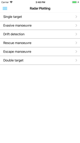


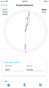
Snapshot
Who is Giacomo Gabriele?
Providing maritime professionals and students with specialized offline tools for complex navigational and radar plotting calculations.
Target audience


Portfolio
Free 2Last updated

Radar Plotting
vVARY
1.9y ago
Publisher DNA
What defines Giacomo Gabriele?
Publisher DNA
Primary focus
Specialized maritime navigation tools
Scale
indie
Target audience
Maritime professionals, navigators, and students requiring precise, offline-capable navigational calculations.
Origin
Developed to provide navigation solving calculators for students, teachers, and officers.
Signature Patterns
- •Strict focus on offline-first functionality for maritime environments
- •Specialized utility tools targeting the Navigation category exclusively
- •Monetization via a free-to-use model for core navigational features
- •Visual aids including charts, maps, and interactive radar sheets
Portfolio momentum
Released 5 updates across 2 apps in the last 6 months, with the most recent update occurring 6 days ago.
Portfolio
What does Giacomo Gabriele ship?
Apps
2 apps analysed

The most complete application that solves the navigation calculations


Rivals
Who does Giacomo Gabriele compete with?
The rivals identified
Nemeses(1)


Tides Planner competes for the same maritime audience by offering specialized tide forecasting and offline data access, directly overlapping with the tidal analysis utility in Nautical Calculator Pro.
Contenders(4)


Both applications target maritime professionals and recreational sailors with free navigation and calculation tools, creating direct competition for the same user base.


Both apps target maritime professionals and offshore sailors, creating a functional overlap in passage planning and operational safety. Nautical Calculator Pro provides general navigation math, while Galvanic Fatigue Calculator focuses on crew-specific fatigue management.


Both applications serve maritime navigators, but they diverge in utility: Nautical Calculator Pro provides general computational tools, while Circle Of Position Navigation focuses on celestial sun-based positioning.


CVoyager complements general navigation tools by providing specialized algorithmic route optimization for professional maritime use.
Same space(33)

Orca targets the same maritime audience but shifts the value proposition from standalone calculation to hardware-integrated boat control.


NOAA Nautical Charts & Maps provides offline chart access for the same maritime audience as Radar Plotting.


Navigation Marine provides basic tracking utilities that serve as a lightweight alternative to the source app's complex calculations.


Marine Navigation - Canada provides regional navigation aids for the same maritime user base.


SkyDemon provides flight-specific navigation that mirrors the tactical decision-support role of Radar Plotting.


This utility focuses on the specific celestial sight reduction workflow, acting as a technical companion for professional mariners.


This app provides a specialized celestial navigation subset, serving as a digital reference tool for traditional maritime methods.


Great Lakes HD Nautical Charts provides a specialized chart-plotting tool for the same maritime navigation market.


Navionics serves the same maritime audience but shifts the focus from manual radar plotting to automated chart-based navigation.


mKart provides a 3D navigation environment that serves the same safety-focused maritime audience.


Footpath serves the broader outdoor navigation market, overlapping with the planning needs of Radar Plotting users.


iSailGPS NZ provides specialized nautical chart navigation for the same maritime audience as Radar Plotting.


This app provides a specialized digital compass tool that serves as a simple navigation aid for the source app's users.


Nautical Charts & Maps offers a budget-friendly alternative for coastal navigation, appealing to the same recreational user base.


This app functions as a chartplotter, providing a visual navigation layer that sits alongside the source app's computational tools.


Maritime Master - Radar is a direct educational peer that replicates the radar plotting workflows used in training.


PRO CHARTS targets the same recreational boating market with a focus on route management and navigation.


This toolkit provides a general-purpose maritime calculation suite that directly mirrors the core functionality of the source app.


C-MAP targets the same recreational boating segment with high-resolution bathymetry that serves as a specialized fishing utility.


Nav Tools provides a high-frequency sensor-fused telemetry dashboard that complements the source app's static calculation tools.


iNavX provides a similar mobile-first navigation tool for sailors, overlapping with the technical needs of Radar Plotting users.


This app isolates a specific wind calculation utility, providing a specialized tool for sailors within the broader navigation space.


Celestial Navigation 360 focuses on specialized celestial workflows, providing a visual and camera-based alternative to the source app.


Binnacle provides a bridge-instrument suite that targets the same professional maritime demographic as the source app.


TZ iBoat offers professional-grade navigation tools that appeal to the same coastal sailors who use Radar Plotting for training.


This tool provides a visual celestial reference that complements the raw calculation features of the source app.


Savvy Navvy provides an all-in-one navigation interface that competes for the same recreational boater attention as Radar Plotting.


This app serves as an offline-first alternative for celestial computations, removing the dependency on external connectivity.


Sextant provides a mobile-based celestial navigation solution that replaces manual paper-based sight reduction workflows.


This preview app offers a broad suite of maneuvering and navigation utilities that overlap with the source app's core functions.


This toolkit provides a comprehensive offline reference for celestial navigation, serving as a specialized data source for mariners.


Wavve Boating offers a community-driven navigation experience for the same recreational boating audience.


Marine Radar functions as a hardware-linked display for radar images, directly complementing the radar plotting discipline.
New entrants(4)


Maritrack provides vessel tracking that serves the same maritime situational awareness needs as Radar Plotting.


Intercept Radar provides aviation tracking that mirrors the radar-based situational awareness of Radar Plotting.


This app provides a specific coordinate conversion utility that serves as a quick reference tool for the source app's users.


Rhumb provides a global chart interface that complements the source app's navigation calculations with visual passage planning.
The Analyst's Read
The bottom line on Giacomo Gabriele
Bottom line
Giacomo Gabriele is a focused indie developer providing essential, high-utility tools for a specific professional niche. The strong rating for the Radar Plotting app indicates a successful translation of complex maritime procedures into a mobile UX.
Frequently asked questions
How many apps does Giacomo Gabriele publish?
What kind of apps does Giacomo Gabriele make?
What is Giacomo Gabriele's top app?
What fed this analysis
- Apps analyzed:
- 2
- With full intel:
- 0
- With overview:
- 2
- Website scraped:
- yes
- Social presence:
- yes