


Flytomap
For professional and recreational boaters, anglers, and outdoor enthusiasts requiring reliable offline cartography and tidal data.
 Real Tides & Currents Graph HD


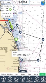


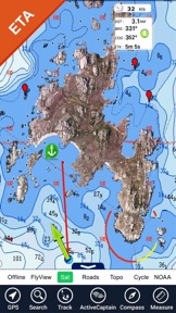


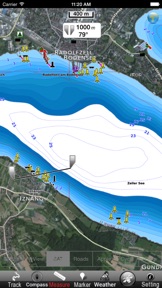

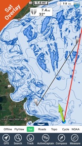


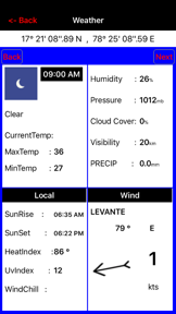

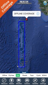


Snapshot
Who is Flytomap?
Providing specialized offline GPS cartography and maritime data for outdoor enthusiasts and professional navigators.
Target audience


Portfolio
Free 4Last updated

Real Tides & Currents Graph HD
v3.5.13
1.2y ago
Publisher DNA
What defines Flytomap?
Publisher DNA
Primary focus
Specialized maritime and outdoor navigation tools
Scale
indie
Target audience
Professional and recreational boaters, anglers, and outdoor enthusiasts requiring reliable offline cartography and tidal data.
Origin
Founded by GIS experts and software developers to bring professional-grade mapping to the mobile market.
Signature Patterns
- •Strict focus on offline-first functionality for remote environments
- •Monetization via upfront paid app model rather than subscriptions or ads
- •Integration of professional maritime data sources including NOAA and USGS
- •Cross-device compatibility focused on high-resolution tablet (HD) interfaces
Portfolio momentum
Maintained a steady development cadence with 3 updates across 5 apps in the last 6 months, including a major release within the last 30 days.
Company profile
medium confidence- Founded
- 2009
Portfolio
What does Flytomap ship?
Apps
16 apps analysed

Analysis in progress

Analysis in progress


Analysis in progress
Distributed across 20 markets, strongest in Europe.
Based on 5 of 16 apps with localized market data, more coverage rolling in as scans complete · last scanned .
Americas (4)
- United States5 / 5
- Mexico3 / 5
- Brazil2 / 5
- Canada2 / 5
Europe (9)
- France3 / 5
- Germany3 / 5
- Italy3 / 5
- Spain3 / 5
- Sweden3 / 5
›+4 more europe markets
- Netherlands2 / 5
- Portugal2 / 5
- Turkey2 / 5
- United Kingdom2 / 5
Asia-Pacific (7)
- Australia2 / 5
- India2 / 5
- Indonesia2 / 5
- Japan2 / 5
- Singapore2 / 5
›+2 more asia-pacific markets
- South Korea2 / 5
- Vietnam2 / 5
Core markets (5/5 apps)
Rivals
Who does Flytomap compete with?
The rivals identified
Nemeses(2)

Both applications target the same marine navigation audience, competing directly for users requiring reliable charts for cruising and sailing.


Both applications target the same outdoor sports demographic, including sailors and surfers, by providing wind forecasting and real-time weather observations.
Contenders(12)


Both applications target the same recreational boating market, competing directly for users through GPS-based route planning and nautical chart access.


Both applications target marine navigators with offline nautical charts and community-sourced maritime intelligence, creating direct competition for the same user base.


Both apps target recreational boaters requiring offline marine navigation, competing for the same user base through shared reliance on regional nautical chart data.


Both applications target recreational boaters with offline marine charting and NOAA data, competing directly on price and utility for coastal navigation.


Both apps target boaters requiring offline navigation, creating direct competition for users seeking reliable maritime charting tools.


PRO CHARTS competes by offering a freemium model for global NOAA nautical charts, directly challenging the paid Mediterranean-specific utility of Mediterranean Sea GPS Charts.


Both applications target recreational boaters with offline marine navigation and chart-based routing, creating direct competition for users seeking reliable maritime positioning.


Both apps target recreational boaters requiring marine navigation, with iNavX competing for the same user base by offering broader chart provider support and integrated weather forecasting.


Both applications target the same coastal and marine navigation audience by providing offline chart access and community-sourced maritime data for voyage planning.


Both applications target the same marine navigation audience, with Mediterranean Sea GPS Charts providing a standalone offline utility while Orca attempts to capture the same segment through hardware-integrated navigation.


Both applications target the same outdoor enthusiast demographic, including sailors and kitesurfers, by providing wind and weather forecasting tools for activity planning.


Both applications target outdoor enthusiasts like boaters and paragliders by providing wind and weather data, creating direct competition for the same user base.
Same space(26)


Provides a general-purpose alternative for mobile and wearable users needing real-time monitoring and offline access.


This marine navigation app focuses on social connectivity and trip planning for recreational boaters.


It provides professional-grade offline mapping for field work, competing for the same offline-first user base as marine chart apps.


This app provides offline tracking and waypoint logging for remote field work, similar to the offline utility of marine charts.

known for MapXplorer: Map Radar Navigate
This app provides general road navigation rather than the marine-specific charting required for Mediterranean boaters.


This tool focuses on route planning for land-based activities, offering a different utility than marine-specific GPS charts.


Offers a visual-first approach to weather tracking, appealing to users who prefer aesthetic cityscapes over raw data.


Acts as a regional utility for users in Portugal, contrasting with the global focus of the source app.


This tool provides a wide range of topographic maps for outdoor activities, offering an alternative for land-based navigation.


Focuses on coastal and marine conditions, overlapping with the nautical interests of the source app's audience.


This app provides multi-modal navigation using OpenStreetMap data, serving as a general-purpose alternative to specialized marine tools.


This app provides proprietary land ownership data for hunters, serving as a specialized GIS tool for land-based navigation.


This app provides trail-based navigation for hikers and cyclists, serving as a land-based alternative for outdoor exploration.


It offers a privacy-focused alternative for offline navigation that lacks the specialized marine charts needed for sea travel.


It serves as a general-purpose topographic mapping tool that can be used for sailing, overlapping with the marine navigation category.


This is a direct marine competitor that integrates environmental variables like tides and weather into route planning.


This app targets professional drivers with dimension-aware routing, occupying a similar niche for specialized vehicle navigation.


This app targets professional drivers with dimension-aware routing, occupying a similar niche for specialized vehicle navigation.


This app offers truck-specific navigation, serving as a specialized alternative for professional vehicle routing.


This app provides real-time traffic and lane guidance for road travel, lacking the specialized marine charts needed for sea navigation.


This tool serves outdoor enthusiasts with professional GIS tools, though it lacks the nautical-specific data found in marine apps.


This platform provides community-driven data for truck drivers, competing for professional attention in the navigation space.


Targets the same professional and outdoor athlete demographic with high-precision, multi-model data layers.


This is a direct marine competitor that allows users to customize charts based on specific boat drafts.


Provides a general-purpose, free alternative for global weather monitoring, contrasting with the source app's specialized wind focus.


Serves as a broad-market alternative for users seeking hyper-local data from a network of 250,000 personal weather stations.
New entrants(1)


Provides a broad-spectrum environmental monitoring tool that includes marine and geological data alongside standard weather forecasts.
The Analyst's Read
The bottom line on Flytomap
Bottom line
Flytomap is a disciplined, technical publisher that has successfully defended a maritime niche through specialized data integration and offline reliability. Their commitment to a paid-upfront model suggests a loyal, professional user base that prioritizes utility over free-to-play accessibility.
Frequently asked questions
How many apps does Flytomap publish?
What kind of apps does Flytomap make?
What is Flytomap's top app?
In how many countries are Flytomap's apps available?
What fed this analysis
- Apps analyzed:
- 5
- With full intel:
- 0
- With overview:
- 5
- Website scraped:
- yes
- Social presence:
- yes
